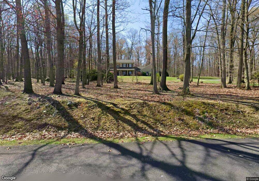
480 Ginger Pat Dr East Earl, PA 17519
Estimated Value: $448,000 - $682,000
--
Bed
3
Baths
2,488
Sq Ft
$225/Sq Ft
Est. Value
About This Home
This home is located at 480 Ginger Pat Dr, East Earl, PA 17519 and is currently estimated at $560,553, approximately $225 per square foot. 480 Ginger Pat Dr is a home located in Lancaster County with nearby schools including Garden Spot Middle School, Garden Spot Senior High School, and Conestoga Parochial School.
Ownership History
Date
Name
Owned For
Owner Type
Purchase Details
Closed on
Nov 25, 1998
Sold by
Calik Richard J and Calik Sherrl A
Bought by
Leaman Cory L and Leaman Mary A
Current Estimated Value
Home Financials for this Owner
Home Financials are based on the most recent Mortgage that was taken out on this home.
Original Mortgage
$174,400
Outstanding Balance
$39,786
Interest Rate
6.83%
Estimated Equity
$520,767
Create a Home Valuation Report for This Property
The Home Valuation Report is an in-depth analysis detailing your home's value as well as a comparison with similar homes in the area
Home Values in the Area
Average Home Value in this Area
Purchase History
| Date | Buyer | Sale Price | Title Company |
|---|---|---|---|
| Leaman Cory L | $218,000 | Lawyers Title Insurance Corp |
Source: Public Records
Mortgage History
| Date | Status | Borrower | Loan Amount |
|---|---|---|---|
| Open | Leaman Cory L | $174,400 |
Source: Public Records
Tax History Compared to Growth
Tax History
| Year | Tax Paid | Tax Assessment Tax Assessment Total Assessment is a certain percentage of the fair market value that is determined by local assessors to be the total taxable value of land and additions on the property. | Land | Improvement |
|---|---|---|---|---|
| 2025 | $5,503 | $307,300 | $95,800 | $211,500 |
| 2024 | $5,503 | $307,300 | $95,800 | $211,500 |
| 2023 | $5,424 | $307,300 | $95,800 | $211,500 |
| 2022 | $5,366 | $307,300 | $95,800 | $211,500 |
| 2021 | $5,280 | $307,300 | $95,800 | $211,500 |
| 2020 | $5,280 | $307,300 | $95,800 | $211,500 |
| 2019 | $5,223 | $307,300 | $95,800 | $211,500 |
| 2018 | $7,484 | $307,300 | $95,800 | $211,500 |
| 2017 | $4,867 | $233,700 | $62,300 | $171,400 |
| 2016 | $4,867 | $233,700 | $62,300 | $171,400 |
| 2015 | $1,352 | $233,700 | $62,300 | $171,400 |
| 2014 | $3,304 | $233,700 | $62,300 | $171,400 |
Source: Public Records
Map
Nearby Homes
- 5490 Division Hwy
- 5235 Honeysuckle Ln
- 600 Meetinghouse Rd
- 210 Musser Rd
- 1258 Main St
- 529 Ranck Rd Unit 1
- 529 Ranck Rd Unit 2
- 529 Ranck Rd Unit 3
- 529 Ranck Rd Unit 4
- 529 Ranck Rd Unit 5
- 529 Ranck Rd Unit 9
- 529 Ranck Rd Unit 6
- 529 Ranck Rd Unit 8
- 529 Ranck Rd Unit 10
- 13 Amber Cir
- 5892 Meadville Rd
- 1022 Elwood St
- 259 Hill Rd
- 490 Red Hill Rd
- 607 Buchland Rd
- 479 Ginger Pat Dr
- 474 Ginger Pat Dr
- 475 Ginger Pat Dr
- 486 Ginger Pat Dr
- 470 Ginger Pat Dr
- 471 Ginger Pat Dr
- 1336 Briertown Rd
- 1334 Briertown Rd
- 1368 Briertown Rd
- 1326 Briertown Rd
- 1338 Briertown Rd
- 1382 Briertown Rd
- 0 Briertown Rd
- 1344 Briertown Rd
- 5 Briertown Rd
- 18 Briertown Rd
- 1327 Briertown Rd
- 1321 Briertown Rd
- 1354 Briertown Rd
- 1402 Briertown Rd