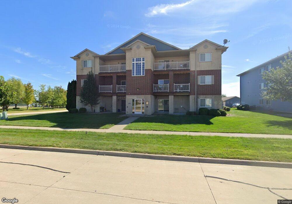
480 N Madison Ave Unit 5 North Liberty, IA 52317
Estimated Value: $159,000 - $202,000
2
Beds
2
Baths
1,020
Sq Ft
$174/Sq Ft
Est. Value
About This Home
This home is located at 480 N Madison Ave Unit 5, North Liberty, IA 52317 and is currently estimated at $177,254, approximately $173 per square foot. 480 N Madison Ave Unit 5 is a home located in Johnson County with nearby schools including Clear Creek Amana High School, Montessori Children's Garden, and Heritage Christian School.
Ownership History
Date
Name
Owned For
Owner Type
Purchase Details
Closed on
Jul 20, 2007
Sold by
Prime Ventures Construction Inc
Bought by
The Watts Group Lc
Current Estimated Value
Home Financials for this Owner
Home Financials are based on the most recent Mortgage that was taken out on this home.
Original Mortgage
$81,175
Outstanding Balance
$51,343
Interest Rate
6.73%
Mortgage Type
Purchase Money Mortgage
Estimated Equity
$125,911
Create a Home Valuation Report for This Property
The Home Valuation Report is an in-depth analysis detailing your home's value as well as a comparison with similar homes in the area
Home Values in the Area
Average Home Value in this Area
Purchase History
| Date | Buyer | Sale Price | Title Company |
|---|---|---|---|
| The Watts Group Lc | $95,500 | None Available |
Source: Public Records
Mortgage History
| Date | Status | Borrower | Loan Amount |
|---|---|---|---|
| Open | The Watts Group Lc | $81,175 |
Source: Public Records
Tax History Compared to Growth
Tax History
| Year | Tax Paid | Tax Assessment Tax Assessment Total Assessment is a certain percentage of the fair market value that is determined by local assessors to be the total taxable value of land and additions on the property. | Land | Improvement |
|---|---|---|---|---|
| 2025 | $2,586 | $168,100 | $30,000 | $138,100 |
| 2024 | $2,482 | $146,700 | $30,000 | $116,700 |
| 2023 | $2,324 | $146,700 | $30,000 | $116,700 |
| 2022 | $2,290 | $117,200 | $11,000 | $106,200 |
| 2021 | $2,286 | $117,200 | $11,000 | $106,200 |
| 2020 | $2,286 | $111,300 | $11,000 | $100,300 |
| 2019 | $2,140 | $111,300 | $11,000 | $100,300 |
| 2018 | $2,094 | $105,400 | $11,000 | $94,400 |
| 2017 | $2,062 | $105,400 | $11,000 | $94,400 |
| 2016 | $2,006 | $100,100 | $11,000 | $89,100 |
| 2015 | $2,006 | $100,100 | $11,000 | $89,100 |
| 2014 | $1,812 | $108,200 | $11,000 | $97,200 |
Source: Public Records
Map
Nearby Homes
- 275 Madison Ave
- 175 Madison Ave
- 450 Penn Ct Unit 8
- 470 Penn Ct Unit 8
- 2385 Foundry Ln
- 2355 Foundry Ln
- 2325 Foundry Ln
- 505 Penn Ct Unit 11
- 505 Penn Ct Unit 1
- 113 Alydar Dr Unit P113
- 2310 Landon Rd
- 105 N Park Ridge Rd
- 212 Watercress Rd Unit A
- 2330 Landon Rd
- 2335 Landon Rd
- 2350 Landon Rd
- 300 Herky St
- 2380 Landon Rd
- 170 S Park Ridge Rd
- 414 Churchill Dr
- 480 N Madison Ave Unit 12
- 480 N Madison Ave Unit 11
- 480 N Madison Ave Unit 10
- 480 N Madison Ave Unit 9
- 480 N Madison Ave Unit 8
- 480 N Madison Ave Unit 7
- 480 N Madison Ave Unit 6
- 480 N Madison Ave Unit 4
- 480 N Madison Ave Unit 3
- 480 N Madison Ave Unit 2
- 480 N Madison Ave Unit 1
- 480 N Madison Ave
- 480 Madison Ave #3
- 480 Madison Ave #3 Unit 3
- 440 Madison Avenue #12
- 440 N Madison Ave Unit 12
- 440 N Madison Ave Unit 11
- 440 N Madison Ave Unit 10
- 440 N Madison Ave Unit 9
- 440 N Madison Ave Unit 8