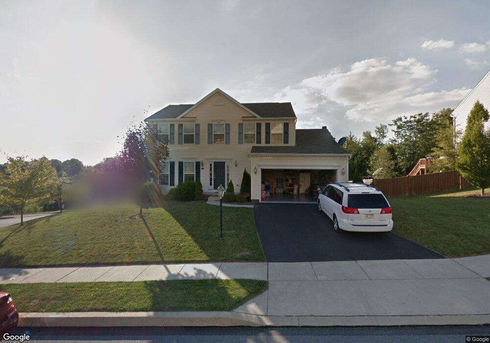
480 Pulaski Place Dallastown, PA 17313
Estimated Value: $347,000 - $420,000
4
Beds
4
Baths
2,587
Sq Ft
$148/Sq Ft
Est. Value
About This Home
This home is located at 480 Pulaski Place, Dallastown, PA 17313 and is currently estimated at $382,024, approximately $147 per square foot. 480 Pulaski Place is a home located in York County with nearby schools including York Township Elementary School, Dallastown Area Middle School, and Dallastown Area High School.
Ownership History
Date
Name
Owned For
Owner Type
Purchase Details
Closed on
Jul 21, 2020
Sold by
Oakjones Donald E
Bought by
Oakjones Donald E
Current Estimated Value
Purchase Details
Closed on
Nov 4, 2005
Sold by
Southern Heights Tract Inc
Bought by
Oakjones Donald E and Oakjones Lisa M
Home Financials for this Owner
Home Financials are based on the most recent Mortgage that was taken out on this home.
Original Mortgage
$245,580
Interest Rate
5.87%
Mortgage Type
Purchase Money Mortgage
Create a Home Valuation Report for This Property
The Home Valuation Report is an in-depth analysis detailing your home's value as well as a comparison with similar homes in the area
Home Values in the Area
Average Home Value in this Area
Purchase History
| Date | Buyer | Sale Price | Title Company |
|---|---|---|---|
| Oakjones Donald E | -- | None Available | |
| Oakjones Donald E | $306,976 | Residential Title & Escrow C |
Source: Public Records
Mortgage History
| Date | Status | Borrower | Loan Amount |
|---|---|---|---|
| Open | Oakjones Donald E | $30,697 | |
| Previous Owner | Oakjones Donald E | $245,580 |
Source: Public Records
Tax History Compared to Growth
Tax History
| Year | Tax Paid | Tax Assessment Tax Assessment Total Assessment is a certain percentage of the fair market value that is determined by local assessors to be the total taxable value of land and additions on the property. | Land | Improvement |
|---|---|---|---|---|
| 2025 | $7,220 | $210,340 | $31,020 | $179,320 |
| 2024 | $7,115 | $210,340 | $31,020 | $179,320 |
| 2023 | $7,115 | $210,340 | $31,020 | $179,320 |
| 2022 | $6,882 | $210,340 | $31,020 | $179,320 |
| 2021 | $6,556 | $210,340 | $31,020 | $179,320 |
| 2020 | $6,556 | $210,340 | $31,020 | $179,320 |
| 2019 | $6,535 | $210,340 | $31,020 | $179,320 |
| 2018 | $6,491 | $210,340 | $31,020 | $179,320 |
| 2017 | $6,232 | $210,340 | $31,020 | $179,320 |
| 2016 | $0 | $210,340 | $31,020 | $179,320 |
| 2015 | -- | $210,340 | $31,020 | $179,320 |
| 2014 | -- | $210,340 | $31,020 | $179,320 |
Source: Public Records
Map
Nearby Homes
- 79 S Franklin St
- 0 Lot 15 Gary Dr
- 53 S Franklin St
- 263 W Main St
- 18 E Howard St
- 2981 Sunset Dr
- 2960 Starfire Dr
- 680 Hampstead Ct
- 117 S Park St
- 430 E Maple St
- 55 Belmar Dr
- 197 S Main St
- 705 Summit Dr
- 1 N Duke St
- 2900 Ironstone Hill Rd
- 74 S Main St
- 195 Coventry Rd
- 141 W Water St
- 630 Woodland Ave
- 114 Heather Glen Dr
- 476 Pulaski Place
- 400 Pulaski Place
- 415 Pulaski Place Unit 22
- 415 Pulaski Place
- 485 Pulaski Place
- 408 Pulaski Place
- 345 Pulaski Place
- 412 & 408 Pulaski Place
- 472 Pulaski Place
- 360 Pulaski Place
- 412 & 408 Pulaski Place
- 308 Franklin Square Dr
- 416 Pulaski Place
- 300 Franklin Square Dr
- 425 Pulaski Place
- 412 Pulaski Place
- 475 Pulaski Place
- 468 Pulaski Place Unit 18
- 468 Pulaski Place
- 330 Pulaski Place