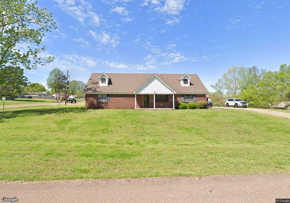
480 Pwr Loop Munford, TN 38058
Estimated Value: $268,475 - $306,000
Studio
3
Baths
1,838
Sq Ft
$156/Sq Ft
Est. Value
About This Home
This home is located at 480 Pwr Loop, Munford, TN 38058 and is currently estimated at $286,869, approximately $156 per square foot. 480 Pwr Loop is a home located in Tipton County with nearby schools including Drummonds Elementary School, Munford Middle School, and Munford High School.
Ownership History
Date
Name
Owned For
Owner Type
Purchase Details
Closed on
Jul 2, 2003
Sold by
Roseborough Warren A
Bought by
Roseborough Warren A
Current Estimated Value
Home Financials for this Owner
Home Financials are based on the most recent Mortgage that was taken out on this home.
Original Mortgage
$100,000
Outstanding Balance
$52,190
Interest Rate
8.75%
Estimated Equity
$234,679
Purchase Details
Closed on
Jul 29, 1994
Purchase Details
Closed on
Feb 25, 1988
Bought by
Reed Paul Wayne
Create a Home Valuation Report for This Property
The Home Valuation Report is an in-depth analysis detailing your home's value as well as a comparison with similar homes in the area
Home Values in the Area
Average Home Value in this Area
Purchase History
| Date | Buyer | Sale Price | Title Company |
|---|---|---|---|
| Roseborough Warren A | -- | -- | |
| -- | $71,100 | -- | |
| -- | -- | -- | |
| Reed Paul Wayne | -- | -- |
Source: Public Records
Mortgage History
| Date | Status | Borrower | Loan Amount |
|---|---|---|---|
| Open | Reed Paul Wayne | $100,000 |
Source: Public Records
Tax History
| Year | Tax Paid | Tax Assessment Tax Assessment Total Assessment is a certain percentage of the fair market value that is determined by local assessors to be the total taxable value of land and additions on the property. | Land | Improvement |
|---|---|---|---|---|
| 2025 | $1,019 | $66,975 | $9,750 | $57,225 |
| 2024 | $1,019 | $66,975 | $9,750 | $57,225 |
| 2023 | $1,019 | $66,975 | $9,750 | $57,225 |
| 2022 | $958 | $46,950 | $7,175 | $39,775 |
| 2021 | $958 | $46,950 | $7,175 | $39,775 |
| 2020 | $957 | $46,950 | $7,175 | $39,775 |
| 2019 | $805 | $33,275 | $4,250 | $29,025 |
| 2018 | $805 | $33,275 | $4,250 | $29,025 |
| 2017 | $799 | $33,000 | $4,250 | $28,750 |
| 2016 | $799 | $33,000 | $4,250 | $28,750 |
| 2015 | $798 | $33,000 | $4,250 | $28,750 |
| 2014 | $798 | $33,004 | $0 | $0 |
Source: Public Records
Map
Nearby Homes
- 155 Pwr Loop
- 544 Rachel Shankle Dr
- 447 Abbey Rd Unit D
- 447 Abbey Rd Unit A
- 0 Appleberry Rd
- 52 Green Meadows Blvd
- 21 Rose Bush St
- Beckett Plan at The Villages of Green Meadows
- Bennett Plan at The Villages of Green Meadows
- Cooper Plan at The Villages of Green Meadows
- Carver Plan at The Villages of Green Meadows
- Miller Plan at The Villages of Green Meadows
- Spencer Plan at The Villages of Green Meadows
- Nelson Plan at The Villages of Green Meadows
- Isabel Plan at The Villages of Green Meadows
- Aspen Plan at The Villages of Green Meadows
- Carson Plan at The Villages of Green Meadows
- Arbor Plan at The Villages of Green Meadows
- 53 Rose Bush St
- 47 Rose Bush St
- 264 Dessie Re Dr
- 246 Dessie Re Dr
- 520 Pwr Loop
- 517 Pwr Loop
- 517 P W R Loop
- 271 da Wyatt Rae
- 460 Pwr Loop
- 535 Pwr Loop
- 467 Pwr Loop
- 226 Dessie Re Dr
- 251 da Wyatt Rae
- 247 Dessie Re Dr
- 447 Pwr Loop
- 555 Pwr Loop
- 231 da Wyatt Rae
- 208 Dessie Re Dr
- 229 Dessie Re Dr
- 429 P W R Loop Rd
- 575 Pwr Loop
- 211 da Wyatt Rae