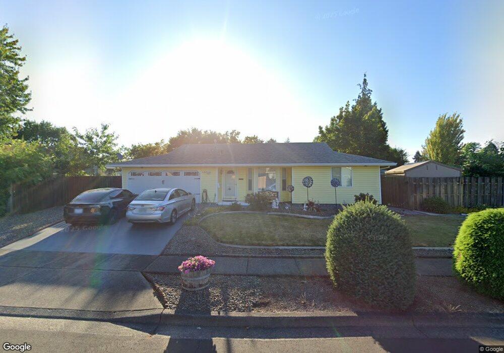
480 S 6th Ave Cornelius, OR 97113
Estimated Value: $438,000 - $451,000
Studio
2
Baths
1,294
Sq Ft
$344/Sq Ft
Est. Value
About This Home
This home is located at 480 S 6th Ave, Cornelius, OR 97113 and is currently estimated at $444,609, approximately $343 per square foot. 480 S 6th Ave is a home located in Washington County with nearby schools including Echo Shaw Elementary School, Neil Armstrong Middle School, and Tom McCall Upper Elementary School.
Ownership History
Date
Name
Owned For
Owner Type
Purchase Details
Closed on
Sep 17, 2025
Sold by
Loy Patricia Joann and Hahmeyer Robert William
Bought by
Serafin Daniel and Serafin Rachel
Current Estimated Value
Home Financials for this Owner
Home Financials are based on the most recent Mortgage that was taken out on this home.
Original Mortgage
$412,087
Outstanding Balance
$411,351
Interest Rate
6.58%
Mortgage Type
FHA
Estimated Equity
$33,258
Purchase Details
Closed on
May 30, 2017
Sold by
Lucore Patricia Rose
Bought by
Loy Patricia Joann and Hahmeyer Robert William
Purchase Details
Closed on
Jun 5, 1996
Sold by
Keller Gregory S and Keller Diana L
Bought by
Lucore Patricia R
Home Financials for this Owner
Home Financials are based on the most recent Mortgage that was taken out on this home.
Original Mortgage
$52,000
Interest Rate
7.96%
Create a Home Valuation Report for This Property
The Home Valuation Report is an in-depth analysis detailing your home's value as well as a comparison with similar homes in the area
Purchase History
| Date | Buyer | Sale Price | Title Company |
|---|---|---|---|
| Serafin Daniel | $445,000 | Wfg Title | |
| Loy Patricia Joann | -- | Wfg Title | |
| Loy Patricia Joann | -- | None Available | |
| Lucore Patricia R | $122,000 | First American Title Ins Co |
Source: Public Records
Mortgage History
| Date | Status | Borrower | Loan Amount |
|---|---|---|---|
| Open | Serafin Daniel | $412,087 | |
| Previous Owner | Lucore Patricia R | $52,000 |
Source: Public Records
Tax History
| Year | Tax Paid | Tax Assessment Tax Assessment Total Assessment is a certain percentage of the fair market value that is determined by local assessors to be the total taxable value of land and additions on the property. | Land | Improvement |
|---|---|---|---|---|
| 2026 | $3,862 | $222,310 | -- | -- |
| 2025 | $3,862 | $215,840 | -- | -- |
| 2024 | $3,527 | $209,560 | -- | -- |
| 2023 | $3,527 | $203,460 | $0 | $0 |
| 2022 | $3,125 | $203,460 | $0 | $0 |
| 2021 | $3,088 | $191,790 | $0 | $0 |
| 2020 | $3,077 | $186,210 | $0 | $0 |
| 2019 | $3,010 | $180,790 | $0 | $0 |
| 2018 | $2,917 | $175,530 | $0 | $0 |
| 2017 | $2,826 | $170,420 | $0 | $0 |
| 2016 | $2,747 | $165,460 | $0 | $0 |
| 2015 | $2,585 | $160,650 | $0 | $0 |
| 2014 | $2,496 | $155,980 | $0 | $0 |
Source: Public Records
Map
Nearby Homes
- 332 S Tarrybrook Dr
- 253 S Tarrybrook Cir
- 1100 S Ivy St
- 961 S 4th Ave
- 904 S Magnolia St
- 1509 Centennial Cir
- 1504 Frontier Cir
- 4403 Wagon Wheel Cir
- 1506 Pioneer Cir
- 1402 Pioneer Way
- 369 S 16th Ave
- 4303 Settlers Loop
- 1701 S Alpine St
- 420 N 13th Ave
- 302 S 19th Ave
- 570 N 10th Ave Unit 75
- 570 N 10th Ave Unit 2
- 570 N 10th Ave Unit 6
- 570 N 10th Ave Unit 80
- 570 N 10th Ave Unit 10