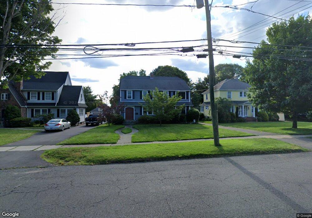
480 Wolcott Hill Rd Wethersfield, CT 06109
Estimated Value: $500,282 - $553,000
3
Beds
2
Baths
2,160
Sq Ft
$246/Sq Ft
Est. Value
About This Home
This home is located at 480 Wolcott Hill Rd, Wethersfield, CT 06109 and is currently estimated at $532,071, approximately $246 per square foot. 480 Wolcott Hill Rd is a home located in Hartford County with nearby schools including Charles Wright School, Silas Deane Middle School, and Wethersfield High School.
Ownership History
Date
Name
Owned For
Owner Type
Purchase Details
Closed on
Jun 20, 2005
Sold by
Turner Douglas M and Turner Nancy B
Bought by
Cox Stephen and Hedlund Jennifer
Current Estimated Value
Home Financials for this Owner
Home Financials are based on the most recent Mortgage that was taken out on this home.
Original Mortgage
$268,000
Outstanding Balance
$140,092
Interest Rate
5.78%
Estimated Equity
$391,979
Purchase Details
Closed on
Aug 25, 2003
Sold by
Maloy Ann M
Bought by
Turner Douglas M and Turner Nancy B
Home Financials for this Owner
Home Financials are based on the most recent Mortgage that was taken out on this home.
Original Mortgage
$304,000
Interest Rate
5.52%
Create a Home Valuation Report for This Property
The Home Valuation Report is an in-depth analysis detailing your home's value as well as a comparison with similar homes in the area
Home Values in the Area
Average Home Value in this Area
Purchase History
| Date | Buyer | Sale Price | Title Company |
|---|---|---|---|
| Cox Stephen | $335,000 | -- | |
| Turner Douglas M | $330,000 | -- |
Source: Public Records
Mortgage History
| Date | Status | Borrower | Loan Amount |
|---|---|---|---|
| Closed | Turner Douglas M | $132,000 | |
| Open | Turner Douglas M | $268,000 | |
| Previous Owner | Turner Douglas M | $304,000 | |
| Previous Owner | Turner Douglas M | $5,764 |
Source: Public Records
Tax History
| Year | Tax Paid | Tax Assessment Tax Assessment Total Assessment is a certain percentage of the fair market value that is determined by local assessors to be the total taxable value of land and additions on the property. | Land | Improvement |
|---|---|---|---|---|
| 2025 | $11,990 | $290,880 | $95,680 | $195,200 |
| 2024 | $7,908 | $182,960 | $65,100 | $117,860 |
| 2023 | $7,644 | $182,960 | $65,100 | $117,860 |
| 2022 | $7,516 | $182,960 | $65,100 | $117,860 |
| 2021 | $7,441 | $182,960 | $65,100 | $117,860 |
| 2020 | $7,445 | $182,960 | $65,100 | $117,860 |
| 2019 | $7,454 | $182,960 | $65,100 | $117,860 |
| 2018 | $7,418 | $181,900 | $62,500 | $119,400 |
| 2017 | $7,234 | $181,900 | $62,500 | $119,400 |
| 2016 | $7,010 | $181,900 | $62,500 | $119,400 |
| 2015 | $6,947 | $181,900 | $62,500 | $119,400 |
| 2014 | $6,683 | $181,900 | $62,500 | $119,400 |
Source: Public Records
Map
Nearby Homes
- 31 Somerset St
- 35 Stillwold Dr
- 131 Coleman Rd
- 43 Edward St
- 158 Dix Rd
- 147 Spring St
- 146 Dudley Rd
- 750 Wolcott Hill Rd
- 23 Hillcrest Ave
- 99 Maple St
- 1 Fernwood St
- 192 Wolcott Hill Rd
- 38 Wheeler Rd
- 124 Midwell Rd
- 250 Edward St
- 63 Wells Farm Dr
- 55 Rutledge Rd
- 317-319 Garden St
- 144 Brown St
- 31 Ox Yoke Dr
- 484 Wolcott Hill Rd
- 476 Wolcott Hill Rd
- 492 Wolcott Hill Rd
- 472 Wolcott Hill Rd
- 11 Belcher Rd
- 496 Wolcott Hill Rd
- 15 Belcher Rd
- 21 Belcher Rd
- 500 Wolcott Hill Rd
- 31 Belcher Rd
- 10 Belcher Rd
- 464 Wolcott Hill Rd
- 504 Wolcott Hill Rd
- 14 Belcher Rd
- 18 Belcher Rd
- 151 Wells Rd
- 35 Belcher Rd
- 155 Wells Rd
- 22 Belcher Rd
- 145 Wells Rd
Your Personal Tour Guide
Ask me questions while you tour the home.