Estimated Value: $389,034 - $488,000
4
Beds
2
Baths
2,535
Sq Ft
$165/Sq Ft
Est. Value
About This Home
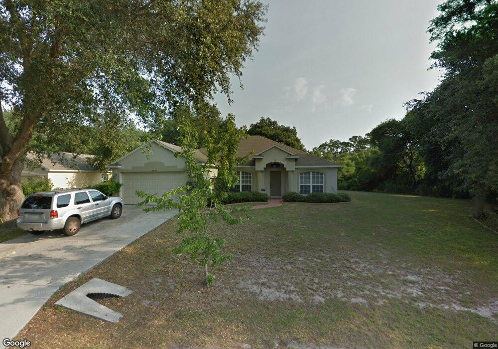
This home is located at 4800 Fresno St, Cocoa, FL 32927 and is currently estimated at $419,509, approximately $165 per square foot. 4800 Fresno St is a home located in Brevard County with nearby schools including Atlantis Elementary School, Space Coast Junior/Senior High School, and Sculptor Charter School.
Ownership History
Date
Name
Owned For
Owner Type
Purchase Details
Closed on
Apr 9, 2019
Sold by
Davis Nadeira
Bought by
Davis Peter and Davis Dominique
Current Estimated Value
Purchase Details
Closed on
Mar 22, 2004
Sold by
Lleva E V
Bought by
Davis Peter
Home Financials for this Owner
Home Financials are based on the most recent Mortgage that was taken out on this home.
Original Mortgage
$113,750
Outstanding Balance
$51,106
Interest Rate
5.12%
Estimated Equity
$368,403
Purchase Details
Closed on
Sep 11, 2003
Sold by
Lleva E V
Bought by
Mercedes Homes Inc
Create a Home Valuation Report for This Property
The Home Valuation Report is an in-depth analysis detailing your home's value as well as a comparison with similar homes in the area
Home Values in the Area
Average Home Value in this Area
Purchase History
| Date | Buyer | Sale Price | Title Company |
|---|---|---|---|
| Davis Peter | -- | Attorney | |
| Davis Peter | $185,000 | The Title Station Inc | |
| Lleva E V | $142,300 | B D R Title | |
| Mercedes Homes Inc | -- | B-D-R Title |
Source: Public Records
Mortgage History
| Date | Status | Borrower | Loan Amount |
|---|---|---|---|
| Open | Lleva E V | $113,750 | |
| Open | Davis Peter | $166,300 |
Source: Public Records
Tax History
| Year | Tax Paid | Tax Assessment Tax Assessment Total Assessment is a certain percentage of the fair market value that is determined by local assessors to be the total taxable value of land and additions on the property. | Land | Improvement |
|---|---|---|---|---|
| 2025 | $2,797 | $216,040 | -- | -- |
| 2024 | $2,750 | $209,960 | -- | -- |
| 2023 | $2,750 | $203,850 | $0 | $0 |
| 2022 | $2,632 | $197,920 | $0 | $0 |
| 2021 | $2,685 | $192,160 | $0 | $0 |
| 2020 | $2,975 | $215,070 | $0 | $0 |
| 2019 | $2,927 | $210,240 | $35,000 | $175,240 |
| 2018 | $3,404 | $198,230 | $27,000 | $171,230 |
| 2017 | $1,787 | $125,010 | $0 | $0 |
| 2016 | $3,001 | $164,180 | $18,000 | $146,180 |
| 2015 | $2,870 | $138,340 | $15,000 | $123,340 |
| 2014 | $2,635 | $125,770 | $11,000 | $114,770 |
Source: Public Records
Map
Nearby Homes
- 4824 Curtis Blvd
- 4760 Ivan St
- 6990 Camden Ave
- 6820 Caliph Ave
- 4625 Curtis Blvd
- 7155 Export Ave
- 4790 Greenhill St
- 5080 Mayflower St
- 7245 Grissom Pkwy
- 4852 Alfred St
- 5200 Frisco St
- 6620 Grissom Pkwy
- 0000 Unknown St
- 5155 Mayflower St
- 6947 Carlowe Ave
- 5165 Patricia St
- 5095 Hogan Place
- 7160 Carlowe Ave
- 7275 Durban Ave
- 4688 Fairsun St
- 4720 Fresno St
- 4810 Fresno St
- 4815 Fresno St
- 4820 Curtis Blvd
- 4825 Fresno St
- 4800 Curtis Blvd
- 4825 Curtis Blvd
- 4830 Fresno St
- 4835 Fresno St
- 6796 Opal Ave
- 6888 Dodge Rd
- 4821 Falcon Blvd
- 4790 Curtis
- 4835 Curtis Blvd
- 4843 Falcon Blvd
- 6880 Dodge Rd
- 4839 Fresno St
- 4895 Doreen Rd
- 4885 Doreen Rd
- 0000 Fresno St
Your Personal Tour Guide
Ask me questions while you tour the home.