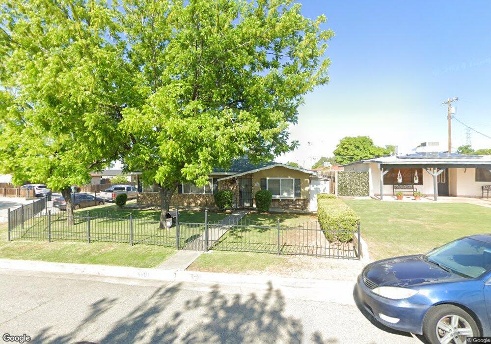
4801 Birdie Ln Bakersfield, CA 93308
Highland Knolls NeighborhoodEstimated Value: $307,183 - $338,000
3
Beds
2
Baths
1,454
Sq Ft
$223/Sq Ft
Est. Value
About This Home
This home is located at 4801 Birdie Ln, Bakersfield, CA 93308 and is currently estimated at $323,796, approximately $222 per square foot. 4801 Birdie Ln is a home located in Kern County with nearby schools including Highland Elementary School, Standard Middle School, and North High School.
Ownership History
Date
Name
Owned For
Owner Type
Purchase Details
Closed on
Nov 20, 2023
Sold by
Hanson Chrystle
Bought by
Chrystle Lynnette Hanson Living Trust and Hanson
Current Estimated Value
Purchase Details
Closed on
Feb 25, 2009
Sold by
Fdic
Bought by
Hanson Chrystle
Home Financials for this Owner
Home Financials are based on the most recent Mortgage that was taken out on this home.
Original Mortgage
$112,917
Interest Rate
5.03%
Mortgage Type
FHA
Purchase Details
Closed on
Nov 26, 2008
Sold by
Kelly Laura L
Bought by
Indymac Bank Fsb
Purchase Details
Closed on
May 11, 2006
Sold by
Trimble Hayes R and Trimble Goldie G
Bought by
Kelly Laura L
Home Financials for this Owner
Home Financials are based on the most recent Mortgage that was taken out on this home.
Original Mortgage
$220,000
Interest Rate
7.12%
Mortgage Type
Purchase Money Mortgage
Create a Home Valuation Report for This Property
The Home Valuation Report is an in-depth analysis detailing your home's value as well as a comparison with similar homes in the area
Home Values in the Area
Average Home Value in this Area
Purchase History
| Date | Buyer | Sale Price | Title Company |
|---|---|---|---|
| Chrystle Lynnette Hanson Living Trust | -- | None Listed On Document | |
| Hanson Chrystle | $115,000 | Chicago Title Company | |
| Indymac Bank Fsb | $114,061 | Accommodation | |
| Kelly Laura L | $275,000 | Ticor Title Company Of Ca |
Source: Public Records
Mortgage History
| Date | Status | Borrower | Loan Amount |
|---|---|---|---|
| Previous Owner | Hanson Chrystle | $112,917 | |
| Previous Owner | Kelly Laura L | $220,000 |
Source: Public Records
Tax History Compared to Growth
Tax History
| Year | Tax Paid | Tax Assessment Tax Assessment Total Assessment is a certain percentage of the fair market value that is determined by local assessors to be the total taxable value of land and additions on the property. | Land | Improvement |
|---|---|---|---|---|
| 2025 | $2,759 | $148,074 | $32,183 | $115,891 |
| 2024 | $2,667 | $145,171 | $31,552 | $113,619 |
| 2023 | $2,667 | $142,326 | $30,934 | $111,392 |
| 2022 | $2,584 | $139,536 | $30,328 | $109,208 |
| 2021 | $2,493 | $136,801 | $29,734 | $107,067 |
| 2020 | $2,400 | $135,400 | $29,430 | $105,970 |
| 2019 | $2,284 | $135,400 | $29,430 | $105,970 |
| 2018 | $2,200 | $130,144 | $28,288 | $101,856 |
| 2017 | $2,184 | $127,593 | $27,734 | $99,859 |
| 2016 | $2,018 | $125,092 | $27,191 | $97,901 |
| 2015 | $1,988 | $123,214 | $26,783 | $96,431 |
| 2014 | $1,925 | $120,802 | $26,259 | $94,543 |
Source: Public Records
Map
Nearby Homes
- 80 Eagle Ln
- 99 Serve Ln
- 4000 N Chester Ave Unit 18
- 4871 Birdie Ln
- 43 Divot Ln
- 214 Par Ln
- 7 Tee Ln
- 4824 Greenview Ln
- 4873 Putter Ln
- 4884 Greenview Ln
- 325 Terriwood Ave
- 5050 N Hills Dr
- 4607 Skye Dr
- 406 Mckelvey Ave
- 4407 Glencannon St
- 348 Petrol Rd
- 348 Petrol Rd Unit 366
- 348 Petrol Rd Unit 394
- 3724 Rock Meadow Ct
- 394 Petrol Rd
- 4811 Birdie Ln
- 300 Countryside Dr
- 4825 Birdie Ln
- 4812 Putter Ln
- 4800 Birdie Ln
- 325 Countryside Dr
- 337 Countryside Dr
- 313 Countryside Dr
- 349 Countryside Dr
- 4839 Birdie Ln
- 4824 Putter Ln
- 301 Countryside Dr
- 4812 Birdie Ln
- 412 Countryside Dr
- 401 Countryside Dr
- 79 Eagle Ln
- 4824 Birdie Ln
- 4855 Birdie Ln
- 4836 Putter Ln
- 249 Countryside Dr