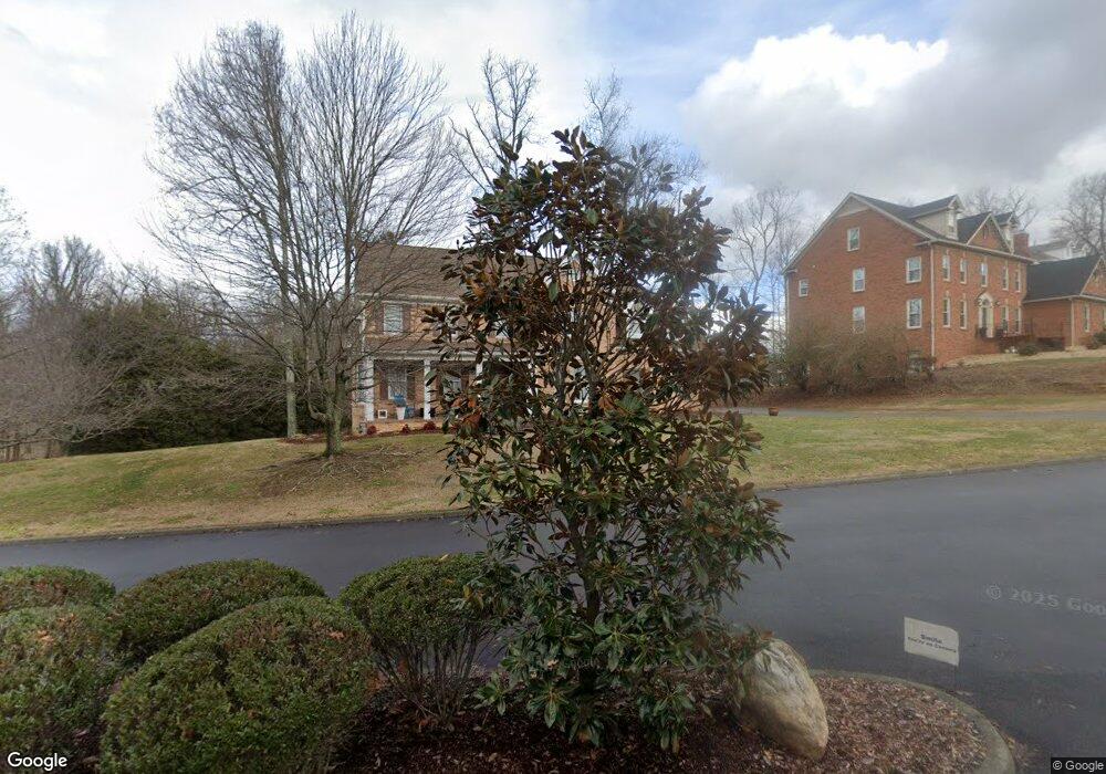
4801 Preston Park Dr Kingsport, TN 37664
Estimated Value: $623,605 - $714,000
4
Beds
4
Baths
2,702
Sq Ft
$247/Sq Ft
Est. Value
About This Home
This home is located at 4801 Preston Park Dr, Kingsport, TN 37664 and is currently estimated at $666,151, approximately $246 per square foot. 4801 Preston Park Dr is a home located in Sullivan County with nearby schools including Thomas Jefferson Elementary School, Ross N. Robinson Middle School, and Dobyns-Bennett High School.
Ownership History
Date
Name
Owned For
Owner Type
Purchase Details
Closed on
Jun 8, 2009
Sold by
Mcqueeney Patrick S
Bought by
Mize Jennifer Fletcher
Current Estimated Value
Purchase Details
Closed on
May 30, 2006
Sold by
Mcatee Wayne D
Bought by
Mcqueeney Patrick S
Purchase Details
Closed on
Mar 28, 2005
Sold by
Guest Charles E
Bought by
Mcatee Wayne D
Home Financials for this Owner
Home Financials are based on the most recent Mortgage that was taken out on this home.
Original Mortgage
$2,328
Interest Rate
5.62%
Purchase Details
Closed on
Jun 8, 1995
Create a Home Valuation Report for This Property
The Home Valuation Report is an in-depth analysis detailing your home's value as well as a comparison with similar homes in the area
Home Values in the Area
Average Home Value in this Area
Purchase History
| Date | Buyer | Sale Price | Title Company |
|---|---|---|---|
| Mize Jennifer Fletcher | $305,000 | -- | |
| Mcqueeney Patrick S | $317,000 | -- | |
| Mcatee Wayne D | $291,000 | -- | |
| -- | $55,000 | -- |
Source: Public Records
Mortgage History
| Date | Status | Borrower | Loan Amount |
|---|---|---|---|
| Previous Owner | -- | $2,328 | |
| Previous Owner | -- | $43,650 |
Source: Public Records
Tax History Compared to Growth
Tax History
| Year | Tax Paid | Tax Assessment Tax Assessment Total Assessment is a certain percentage of the fair market value that is determined by local assessors to be the total taxable value of land and additions on the property. | Land | Improvement |
|---|---|---|---|---|
| 2024 | -- | $103,875 | $25,925 | $77,950 |
| 2023 | $4,575 | $103,875 | $25,925 | $77,950 |
| 2022 | $4,499 | $102,150 | $25,925 | $76,225 |
| 2021 | $4,376 | $102,150 | $25,925 | $76,225 |
| 2020 | $2,197 | $102,150 | $25,925 | $76,225 |
| 2019 | $3,962 | $85,500 | $15,000 | $70,500 |
| 2018 | $3,869 | $85,500 | $15,000 | $70,500 |
| 2017 | $3,869 | $85,500 | $15,000 | $70,500 |
| 2016 | $3,732 | $80,325 | $15,000 | $65,325 |
| 2014 | $3,514 | $80,323 | $0 | $0 |
Source: Public Records
Map
Nearby Homes
- 4401 Beechcliff Dr
- 4416 Beechcliff Dr
- 4589 Old Stage Rd
- 4509 Old Stage Rd
- 4609 Old Stage Rd
- 4617 Old Stage Rd
- 4513 Stagecoach Rd
- Lot 6 Briarwood Rd
- 4407 Mitchell Rd
- 4524 Glenbrook Dr
- TBD Chestnut Ridge Rd
- 4528 Glenbrook Dr
- 4736 Sterling Ln
- 4527 Harbor Dr
- Tbd Silver Ct
- 2653 Suffolk St
- Tbd E Stone Dr
- 3130 E Stone Dr
- 112 Shuler Dr
- 105 Lemay Dr
- 4805 Preston Park Dr
- 4804 Preston Park Dr
- 4802 Preston Park Dr
- 4809 Preston Park Dr
- 4806 Preston Park Dr
- 5009 Orebank Rd
- 4810 Preston Park Dr
- 4906 Quincy Ct
- 4814 Preston Park Dr
- 4817 Preston Park Dr
- LOTS Quincy Ct
- 0 Quincy Ct
- 34 Quincy Ct
- 35 Quincy Ct
- LAND- Quincy Ct
- 4809 Yale Square
- 4913 Quincy Ct
- 4820 Preston Park Dr
- 4820 Preston Park Dr Unit KING
- 4906 Yale Square