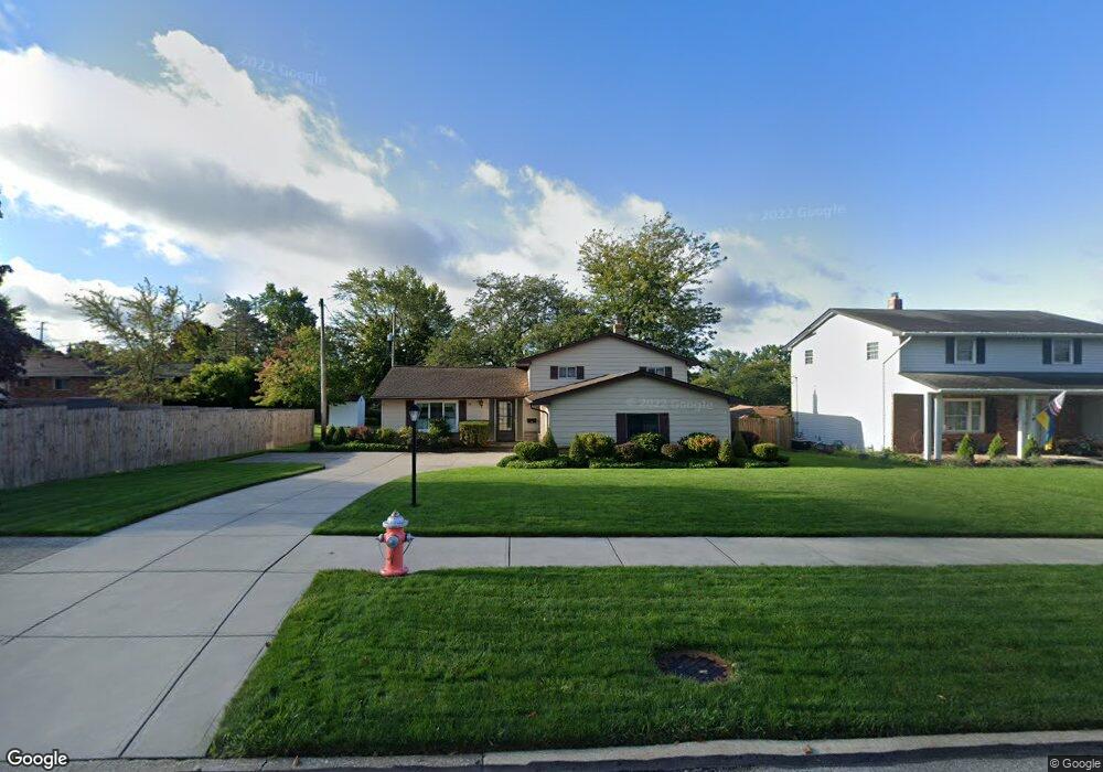
4801 Sandy Hook Dr Cleveland, OH 44134
Estimated Value: $278,176 - $331,000
3
Beds
2
Baths
2,000
Sq Ft
$151/Sq Ft
Est. Value
About This Home
This home is located at 4801 Sandy Hook Dr, Cleveland, OH 44134 and is currently estimated at $301,794, approximately $150 per square foot. 4801 Sandy Hook Dr is a home located in Cuyahoga County with nearby schools including Green Valley Elementary School, Normandy High School, and Hillside Middle School.
Ownership History
Date
Name
Owned For
Owner Type
Purchase Details
Closed on
Dec 6, 1991
Sold by
Salamon Wayne R and Salamon Elaine T
Bought by
Salamon Wayne R
Current Estimated Value
Purchase Details
Closed on
Mar 19, 1985
Sold by
Salamon Wayne R
Bought by
Salamon Wayne R and Salamon Elaine T
Purchase Details
Closed on
Jan 12, 1977
Bought by
Salamon Wayne R
Purchase Details
Closed on
Jan 6, 1977
Sold by
Bores Kenneth E and M J
Bought by
Allied Mortgages Inc
Purchase Details
Closed on
Jan 1, 1975
Bought by
Bores Kenneth E and M J
Create a Home Valuation Report for This Property
The Home Valuation Report is an in-depth analysis detailing your home's value as well as a comparison with similar homes in the area
Home Values in the Area
Average Home Value in this Area
Purchase History
| Date | Buyer | Sale Price | Title Company |
|---|---|---|---|
| Salamon Wayne R | -- | -- | |
| Salamon Wayne R | -- | -- | |
| Salamon Wayne R | $56,000 | -- | |
| Allied Mortgages Inc | $55,500 | -- | |
| Bores Kenneth E | -- | -- |
Source: Public Records
Tax History
| Year | Tax Paid | Tax Assessment Tax Assessment Total Assessment is a certain percentage of the fair market value that is determined by local assessors to be the total taxable value of land and additions on the property. | Land | Improvement |
|---|---|---|---|---|
| 2025 | $4,647 | $81,655 | $16,765 | $64,890 |
| 2024 | $4,939 | $81,655 | $16,765 | $64,890 |
| 2023 | $4,465 | $63,710 | $12,360 | $51,350 |
| 2022 | $4,425 | $63,700 | $12,360 | $51,350 |
| 2021 | $4,555 | $63,700 | $12,360 | $51,350 |
| 2020 | $4,040 | $49,770 | $9,660 | $40,110 |
| 2019 | $3,886 | $142,200 | $27,600 | $114,600 |
| 2018 | $3,732 | $49,770 | $9,660 | $40,110 |
| 2017 | $3,726 | $44,210 | $8,050 | $36,160 |
| 2016 | $3,703 | $44,210 | $8,050 | $36,160 |
| 2015 | $3,646 | $44,210 | $8,050 | $36,160 |
| 2014 | $3,646 | $45,580 | $8,300 | $37,280 |
Source: Public Records
Map
Nearby Homes
- 4418 Stary Dr
- 6140 Kelley Ln
- 4790 W Sprague Rd
- 7770 Arbor Way Unit O36
- 7790 Arbor Way Unit M31
- 8137 State Rd
- 7791 Ridge Rd
- L 8E S South Pointe Ln
- 2915 Friar Dr
- 7663 Lime Ln
- 5810 Ely Vista Dr
- 7791 Hoertz Rd
- 8428 Ridge Rd
- 8267 Pinehurst Dr
- 7550 Daytona Dr
- 6924 Day Dr
- 7206 Meadow Ln
- 8201 Royalview Dr
- 8320 Craigleigh Dr
- 2465 Dentzler Rd
- 4831 Sandy Hook Dr
- 7580 State Rd
- 7590 State Rd
- 4861 Sandy Hook Dr
- 4800 Woodbury Hills Dr
- 7600 State Rd
- 4820 Woodbury Hills Dr
- 7561 Vista Dr
- 4900 Woodbury Hills Dr
- 4901 Sandy Hook Dr
- 4780 Woodbury Hills Dr
- 7550 State Rd
- 4920 Woodbury Hills Dr
- 7551 Vista Dr
- 4949 Sandy Hook Dr
- 4940 Woodbury Hills Dr
- 4811 Woodbury Hills Dr
- 7581 State Rd
- 7541 Vista Dr
- 7571 State Rd
Your Personal Tour Guide
Ask me questions while you tour the home.