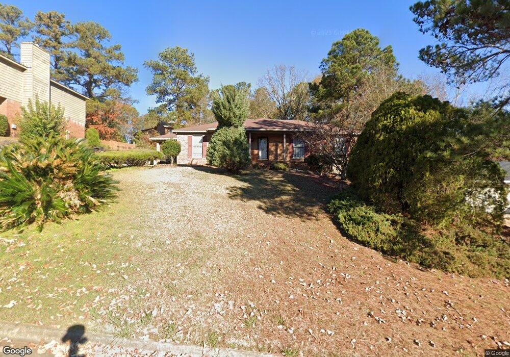
4801 Velpoe Dr Columbus, GA 31907
Eastern Columbus NeighborhoodEstimated Value: $165,000 - $196,538
3
Beds
2
Baths
1,552
Sq Ft
$116/Sq Ft
Est. Value
About This Home
This home is located at 4801 Velpoe Dr, Columbus, GA 31907 and is currently estimated at $179,885, approximately $115 per square foot. 4801 Velpoe Dr is a home located in Muscogee County with nearby schools including St. Mary's Road Magnet Academy, Rothschild Leadership Academy, and Spencer High School.
Ownership History
Date
Name
Owned For
Owner Type
Purchase Details
Closed on
Dec 29, 2014
Sold by
Hsbc Bank Usa Natoinal Ass
Bought by
Mathis Christopher
Current Estimated Value
Home Financials for this Owner
Home Financials are based on the most recent Mortgage that was taken out on this home.
Original Mortgage
$69,182
Outstanding Balance
$54,063
Interest Rate
4.4%
Mortgage Type
FHA
Estimated Equity
$125,822
Purchase Details
Closed on
Dec 3, 2013
Sold by
Marshall John H
Bought by
Hsbc Bank Usa Natoinal Associa
Create a Home Valuation Report for This Property
The Home Valuation Report is an in-depth analysis detailing your home's value as well as a comparison with similar homes in the area
Home Values in the Area
Average Home Value in this Area
Purchase History
| Date | Buyer | Sale Price | Title Company |
|---|---|---|---|
| Mathis Christopher | $70,900 | -- | |
| Hsbc Bank Usa Natoinal Associa | $63,750 | -- |
Source: Public Records
Mortgage History
| Date | Status | Borrower | Loan Amount |
|---|---|---|---|
| Open | Mathis Christopher | $69,182 |
Source: Public Records
Tax History Compared to Growth
Tax History
| Year | Tax Paid | Tax Assessment Tax Assessment Total Assessment is a certain percentage of the fair market value that is determined by local assessors to be the total taxable value of land and additions on the property. | Land | Improvement |
|---|---|---|---|---|
| 2025 | $1,910 | $61,984 | $11,500 | $50,484 |
| 2024 | $1,909 | $61,984 | $11,500 | $50,484 |
| 2023 | $2,442 | $61,984 | $11,500 | $50,484 |
| 2022 | $618 | $47,536 | $11,500 | $36,036 |
| 2021 | $611 | $40,944 | $11,500 | $29,444 |
| 2020 | $611 | $40,944 | $11,500 | $29,444 |
| 2019 | $615 | $40,944 | $11,500 | $29,444 |
| 2018 | $615 | $40,944 | $11,500 | $29,444 |
| 2017 | $619 | $40,944 | $11,500 | $29,444 |
| 2016 | $622 | $33,656 | $4,760 | $28,896 |
| 2015 | $624 | $28,360 | $4,760 | $23,600 |
| 2014 | $2,274 | $55,000 | $4,760 | $50,240 |
| 2013 | -- | $55,000 | $4,760 | $50,240 |
Source: Public Records
Map
Nearby Homes
- 4718 Velpoe Dr
- 811 Pheasant Loop
- 1025 Belmar St
- 4422 Debolt Ct
- 4408 Ridgefield Dr
- 1225 Rowell St
- 4939 Aaron Dr
- 4201 Valley Crest Dr
- 849 Bunker Hill Rd
- 4581 Dawn Ct
- 4965 Brightstar Ln
- 5219 Argonne Dr
- 1425 Staunton Dr
- 59 Apollo Dr
- 1210 Bunker Hill Rd
- 780 Honey Do Ct
- 4930 Capricorn Ct
- 5336 Gettysburg Way
- 4437 St Marys Rd
- 1238 Brandywine Dr
- 4743 Velpoe Dr
- 4807 Velpoe Dr
- 4714 Topi Ct
- 4735 Velpoe Dr
- 4802 Velpoe Dr
- 4710 Topi Ct
- 4810 Velpoe Dr
- 4715 Topi Ct
- 839 Quail Creek Dr
- 833 Quail Creek Dr
- 4744 Velpoe Dr
- 4816 Velpoe Dr
- 4727 Velpoe Dr
- 4823 Velpoe Dr
- 4702 Topi Ct
- 827 Quail Creek Dr
- 4824 Velpoe Dr
- 4730 Velpoe Dr
- 4713 Topi Ct
- 821 Quail Creek Dr