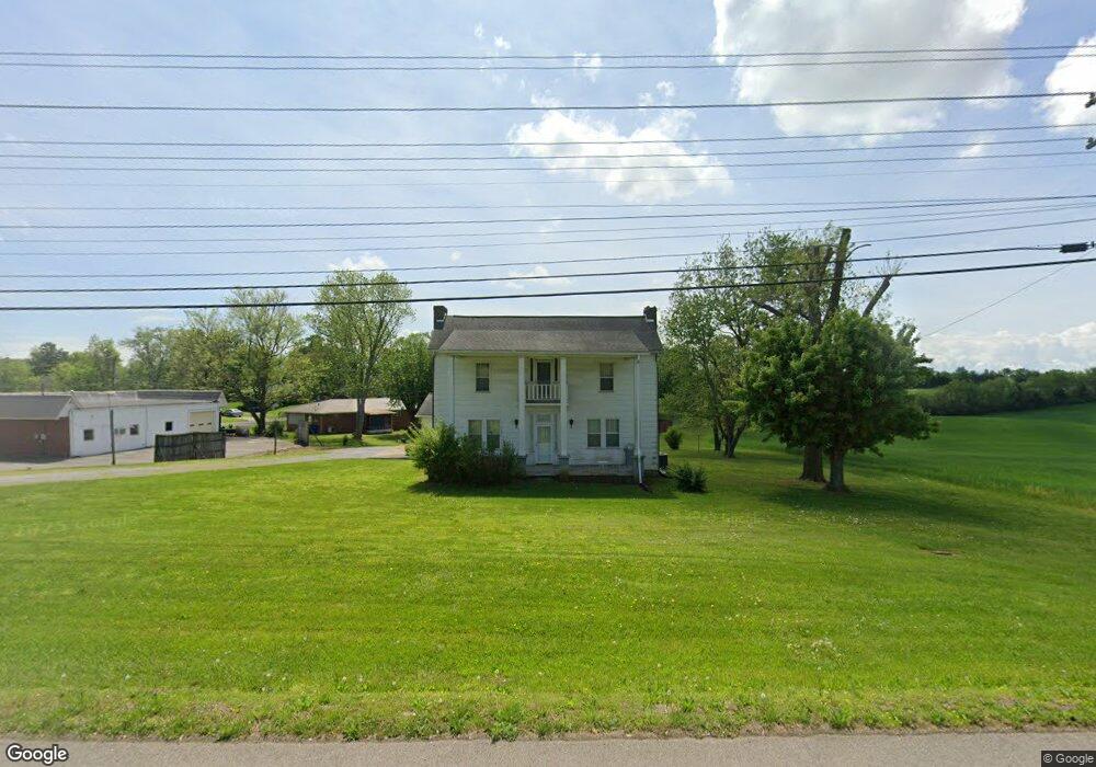
4801 W Andrew Johnson Hwy Morristown, TN 37814
Estimated Value: $288,000 - $608,000
--
Bed
1
Bath
2,580
Sq Ft
$169/Sq Ft
Est. Value
About This Home
This home is located at 4801 W Andrew Johnson Hwy, Morristown, TN 37814 and is currently estimated at $435,894, approximately $168 per square foot. 4801 W Andrew Johnson Hwy is a home located in Hamblen County with nearby schools including Manley Elementary School, West View Middle School, and Morristown West High School.
Ownership History
Date
Name
Owned For
Owner Type
Purchase Details
Closed on
Dec 10, 2020
Sold by
Mcclanahan Sally Robertson and Robertson Trent Deborah
Bought by
Robertson Linda Lee
Current Estimated Value
Purchase Details
Closed on
Sep 8, 1999
Sold by
Kanipe Scott
Bought by
Jeffrey Heath
Purchase Details
Closed on
May 25, 1999
Sold by
Bohlerber Kenneth
Bought by
Scott Kanipe
Home Financials for this Owner
Home Financials are based on the most recent Mortgage that was taken out on this home.
Original Mortgage
$125,500
Interest Rate
6.9%
Purchase Details
Closed on
Apr 30, 1998
Sold by
Bratt Timothy
Bought by
Bohlerber Kenneth
Purchase Details
Closed on
Jan 20, 1998
Sold by
Ruby Robertson
Bought by
Bratt Timothy
Purchase Details
Closed on
Dec 22, 1997
Sold by
Ruby Robertson
Bought by
Knight Billy
Purchase Details
Closed on
Oct 12, 1964
Bought by
Robertson Ruby
Create a Home Valuation Report for This Property
The Home Valuation Report is an in-depth analysis detailing your home's value as well as a comparison with similar homes in the area
Home Values in the Area
Average Home Value in this Area
Purchase History
| Date | Buyer | Sale Price | Title Company |
|---|---|---|---|
| Robertson Linda Lee | -- | None Available | |
| Jeffrey Heath | $136,567 | -- | |
| Scott Kanipe | $156,900 | -- | |
| Bohlerber Kenneth | $176,000 | -- | |
| Bratt Timothy | $87,500 | -- | |
| Knight Billy | $125,000 | -- | |
| Robertson Ruby | -- | -- |
Source: Public Records
Mortgage History
| Date | Status | Borrower | Loan Amount |
|---|---|---|---|
| Previous Owner | Robertson Ruby | $125,500 |
Source: Public Records
Tax History Compared to Growth
Tax History
| Year | Tax Paid | Tax Assessment Tax Assessment Total Assessment is a certain percentage of the fair market value that is determined by local assessors to be the total taxable value of land and additions on the property. | Land | Improvement |
|---|---|---|---|---|
| 2024 | $1,215 | $69,025 | $32,200 | $36,825 |
| 2023 | $1,215 | $69,025 | $0 | $0 |
| 2022 | $2,181 | $69,025 | $32,200 | $36,825 |
| 2021 | $2,181 | $69,025 | $32,200 | $36,825 |
| 2020 | $2,178 | $69,025 | $32,200 | $36,825 |
| 2019 | $1,278 | $37,600 | $32,200 | $5,400 |
| 2018 | $1,184 | $37,600 | $32,200 | $5,400 |
| 2017 | $1,165 | $37,600 | $32,200 | $5,400 |
| 2016 | $1,113 | $37,600 | $32,200 | $5,400 |
| 2015 | $1,036 | $37,600 | $32,200 | $5,400 |
| 2014 | -- | $37,600 | $32,200 | $5,400 |
| 2013 | -- | $48,050 | $0 | $0 |
Source: Public Records
Map
Nearby Homes
- 4848 W Andrew Johnson Hwy
- 615 Benjamin Blvd
- 500 Hampton Blvd W
- 621 Benjamin Blvd
- 523 Hampton Blvd W
- 407 Cummings Ct
- 403 Cummings Ct
- 715* Benjamin Blvd
- 5130 Old Highway 11e
- 994 Pinewood Cir
- 665 Pinewood Cir
- 640 Pinewood Cir
- 5203 Cub Cir
- 623 Landen Cir
- 4537 Horseshoe Trail
- 5041 Lost Creek Dr
- 5045 Lost Creek Dr
- 5044 Lost Creek Dr
- 5049 Lost Creek Dr
- 5048 Lost Creek Dr
- 4797 W Andrew Johnson Hwy
- 281 Suburban Dr
- 271 Suburban Dr
- 4701 W Andrew Johnson Hwy
- Lot #1 W Andrew Johnson Hwy
- Lot #30 W Andrew Johnson Hwy
- 7425 W Andrew Johnson Hwy
- 261 Suburban Dr
- 280 Suburban Dr
- 270 Suburban Dr
- 251 Suburban Dr
- 260 Suburban Dr
- 4836 W Andrew Johnson Hwy
- 250 Suburban Dr
- 4780 W Andrew Johnson Hwy
- 241 Suburban Dr
- 240 Suburban Dr
- 231 Suburban Dr
- 230 Suburban Dr
- 221 Suburban Dr