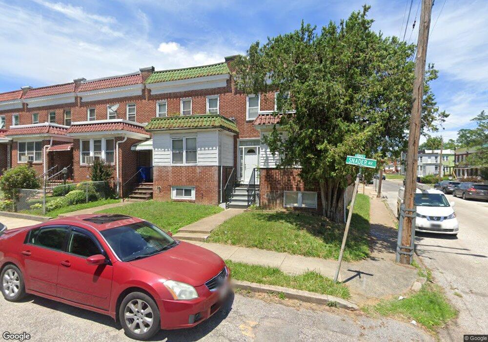
4803 Snader Ave Baltimore, MD 21215
Lucille Park NeighborhoodEstimated Value: $113,000 - $137,975
Studio
1
Bath
1,352
Sq Ft
$93/Sq Ft
Est. Value
About This Home
This home is located at 4803 Snader Ave, Baltimore, MD 21215 and is currently estimated at $125,488, approximately $92 per square foot. 4803 Snader Ave is a home located in Baltimore City with nearby schools including Pimlico Elementary School, Booker T. Washington Middle School, and Forest Park High School.
Ownership History
Date
Name
Owned For
Owner Type
Purchase Details
Closed on
Jul 27, 1999
Sold by
H & L Enterprises Inc
Bought by
Jennings Rico
Current Estimated Value
Purchase Details
Closed on
Oct 27, 1997
Sold by
Newman Toia E
Bought by
H & L Enterprises Inc
Purchase Details
Closed on
Jan 31, 1997
Sold by
Johnson Jo Etta
Bought by
Secretary Of Housing and Urban Development
Purchase Details
Closed on
Jan 11, 1995
Sold by
Becker Allen
Bought by
Johnson Jo E
Home Financials for this Owner
Home Financials are based on the most recent Mortgage that was taken out on this home.
Original Mortgage
$42,000
Interest Rate
9.23%
Create a Home Valuation Report for This Property
The Home Valuation Report is an in-depth analysis detailing your home's value as well as a comparison with similar homes in the area
Home Values in the Area
Average Home Value in this Area
Purchase History
| Date | Buyer | Sale Price | Title Company |
|---|---|---|---|
| Jennings Rico | $19,900 | -- | |
| H & L Enterprises Inc | -- | -- | |
| Secretary Of Housing | $48,900 | -- | |
| Newman Toia E | $48,900 | -- | |
| Johnson Jo E | $40,800 | -- |
Source: Public Records
Mortgage History
| Date | Status | Borrower | Loan Amount |
|---|---|---|---|
| Previous Owner | Johnson Jo E | $42,000 |
Source: Public Records
Tax History
| Year | Tax Paid | Tax Assessment Tax Assessment Total Assessment is a certain percentage of the fair market value that is determined by local assessors to be the total taxable value of land and additions on the property. | Land | Improvement |
|---|---|---|---|---|
| 2025 | $2,844 | $127,667 | -- | -- |
| 2024 | $2,844 | $121,100 | $46,000 | $75,100 |
| 2023 | $2,819 | $119,433 | $0 | $0 |
| 2022 | $2,779 | $117,767 | $0 | $0 |
| 2021 | $2,740 | $116,100 | $46,000 | $70,100 |
| 2020 | $2,720 | $115,267 | $0 | $0 |
| 2019 | $2,688 | $114,433 | $0 | $0 |
| 2018 | $2,681 | $113,600 | $46,000 | $67,600 |
| 2017 | $2,406 | $101,933 | $0 | $0 |
| 2016 | $1,951 | $90,267 | $0 | $0 |
| 2015 | $1,951 | $78,600 | $0 | $0 |
| 2014 | $1,951 | $78,600 | $0 | $0 |
Source: Public Records
Map
Nearby Homes
- 3824 Beehler Ave
- 4811 Reisterstown Rd
- 3728 Beehler Ave
- 4900 Reisterstown Rd
- 3729 Beehler Ave
- 3716 Beehler Ave
- 3721 Manchester Ave
- 4801 Cordelia Ave
- 4803 Cordelia Ave
- 3710 Oakmont Ave
- 4807 Cordelia Ave
- 3625 Oakmont Ave
- 4831 Cordelia Ave
- 3617 Manchester Ave
- 4908 Cordelia Ave
- 4826 Beaufort Ave
- 3702 Arcadia Ave
- 4911 Cordelia Ave
- 3716 Columbus Dr
- 4909 Litchfield Ave
- 4805 Snader Ave
- 4801 Snader Ave
- 4807 Snader Ave
- 4809 Snader Ave
- 4811 Snader Ave
- 3820 Lewin Ave
- 4813 Snader Ave
- 4815 Snader Ave
- 3821 Lewin Ave
- 3823 Lewin Ave
- 3819 Lewin Ave
- 3825 Lewin Ave
- 3817 Lewin Ave
- 3815 Lewin Ave
- 3827 Lewin Ave
- 3813 Lewin Ave
- 3829 Lewin Ave
- 3811 Lewin Ave
- 3831 Lewin Ave
- 3809 Lewin Ave
Your Personal Tour Guide
Ask me questions while you tour the home.