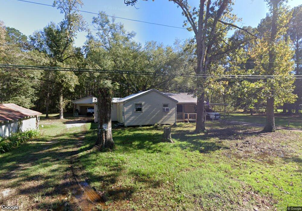
48092 Robertson Rd Tickfaw, LA 70466
Estimated Value: $149,000 - $245,000
--
Bed
--
Bath
612
Sq Ft
$309/Sq Ft
Est. Value
About This Home
This home is located at 48092 Robertson Rd, Tickfaw, LA 70466 and is currently estimated at $189,333, approximately $309 per square foot. 48092 Robertson Rd is a home located in Tangipahoa Parish with nearby schools including Midway Elementary School, Natalbany Middle School, and Hammond High Magnet School.
Ownership History
Date
Name
Owned For
Owner Type
Purchase Details
Closed on
Sep 26, 2025
Sold by
Tall Tines Properties Llc
Bought by
Maligo Clara Andrea Duag
Current Estimated Value
Home Financials for this Owner
Home Financials are based on the most recent Mortgage that was taken out on this home.
Original Mortgage
$234,671
Outstanding Balance
$234,671
Interest Rate
6.58%
Mortgage Type
FHA
Estimated Equity
-$45,338
Create a Home Valuation Report for This Property
The Home Valuation Report is an in-depth analysis detailing your home's value as well as a comparison with similar homes in the area
Home Values in the Area
Average Home Value in this Area
Purchase History
| Date | Buyer | Sale Price | Title Company |
|---|---|---|---|
| Maligo Clara Andrea Duag | $239,000 | None Listed On Document |
Source: Public Records
Mortgage History
| Date | Status | Borrower | Loan Amount |
|---|---|---|---|
| Open | Maligo Clara Andrea Duag | $234,671 |
Source: Public Records
Tax History Compared to Growth
Tax History
| Year | Tax Paid | Tax Assessment Tax Assessment Total Assessment is a certain percentage of the fair market value that is determined by local assessors to be the total taxable value of land and additions on the property. | Land | Improvement |
|---|---|---|---|---|
| 2024 | $788 | $9,135 | $4,342 | $4,793 |
| 2023 | $766 | $8,793 | $4,000 | $4,793 |
| 2022 | $310 | $3,559 | $1,700 | $1,859 |
| 2021 | $310 | $3,559 | $1,700 | $1,859 |
| 2020 | $310 | $3,559 | $1,700 | $1,859 |
| 2019 | $309 | $3,559 | $1,700 | $1,859 |
| 2018 | $310 | $3,559 | $1,700 | $1,859 |
| 2017 | $310 | $3,559 | $1,700 | $1,859 |
| 2016 | $310 | $3,559 | $1,700 | $1,859 |
| 2015 | -- | $3,559 | $1,700 | $1,859 |
| 2014 | -- | $3,559 | $1,700 | $1,859 |
Source: Public Records
Map
Nearby Homes
- LOT 34 Ewing Ln
- 12217 Northwood Dr
- 0 Northwood Dr
- 13055 Tammy Dr
- 11169 Griffin Ln
- 46450 Milton Rd
- 46376 Milton Rd
- 11081 Martin Ln
- 49090 Stafford Rd
- 48351 Woodhaven Rd
- 39 Acres Randall Rd
- 13290 New Gennessee Rd
- 10204 Crystal Ln
- 10215 Crystal Ln
- 10205 Pearl Ln
- 46286 Laurie Dr
- 46204 Rufus Bankston Rd
- 10172 Pearl Ln
- 10199 Crystal Ln
- 48121 Robertson Rd
- 48058 Robertson Rd
- 11621 Louisiana 1064
- 12063 Highway 1064
- 48144 Robertson Rd
- 12117 Robertson Rd Extension
- 12117 Robertson Rd Extension
- 48037 Robertson Rd
- 48160 Robertson Rd
- 12019 La Hwy 1064
- 12101 Robertson Rd Extension
- 12019 Highway 1064
- 12085 Robertson Extension Rd
- 12085 Robertson Rd Extension
- 12085 Robertson Rd Extension
- 12085 Robertson Rd
- 48176 Robertson Rd
- 12139 Hwy 1064
- 12085 Robertson Rd Ext Rd
- 11621 Highway 1064