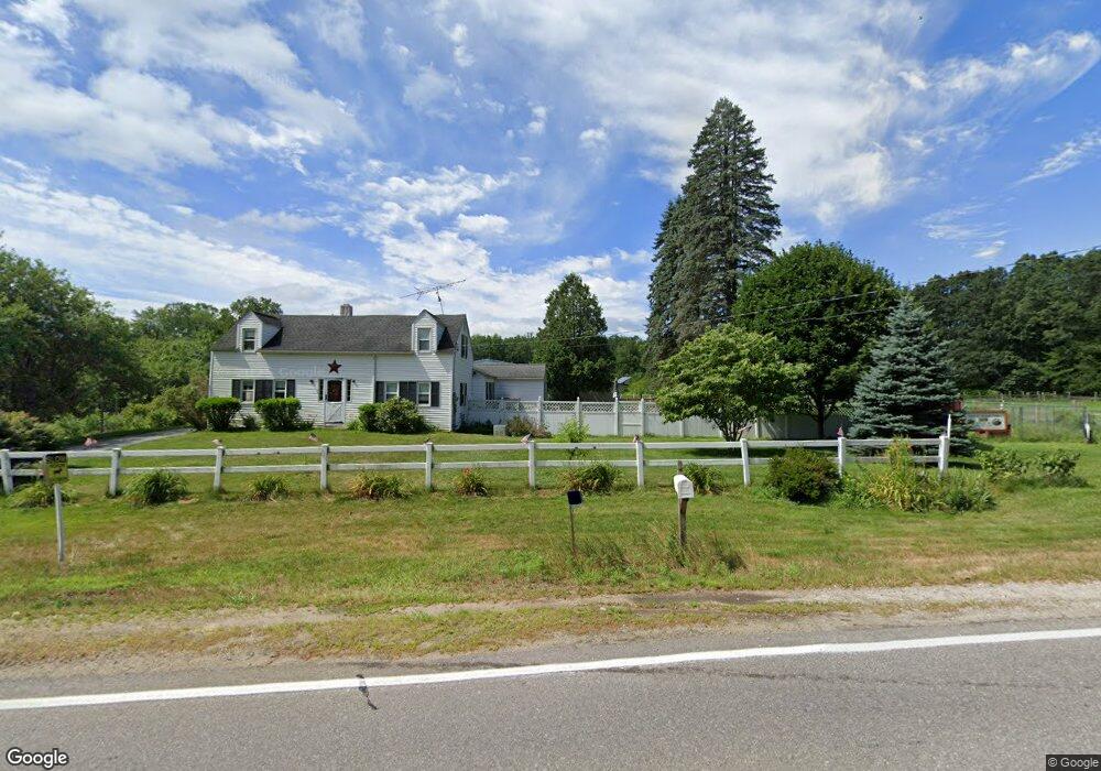
481 Boston Post Rd Amherst, NH 03031
Estimated Value: $589,000 - $727,000
3
Beds
1
Bath
1,298
Sq Ft
$507/Sq Ft
Est. Value
About This Home
This home is located at 481 Boston Post Rd, Amherst, NH 03031 and is currently estimated at $657,465, approximately $506 per square foot. 481 Boston Post Rd is a home located in Hillsborough County with nearby schools including Wilkins Elementary School, Amherst Middle School, and Souhegan Cooperative High School.
Ownership History
Date
Name
Owned For
Owner Type
Purchase Details
Closed on
Nov 21, 2011
Sold by
Ducal Dev Llc
Bought by
Gutro James P and Gutro Patricia A
Current Estimated Value
Purchase Details
Closed on
Sep 30, 2010
Sold by
Yunggebauer Carla M
Bought by
Ducal Development Llc
Create a Home Valuation Report for This Property
The Home Valuation Report is an in-depth analysis detailing your home's value as well as a comparison with similar homes in the area
Home Values in the Area
Average Home Value in this Area
Purchase History
| Date | Buyer | Sale Price | Title Company |
|---|---|---|---|
| Gutro James P | $360,000 | -- | |
| Ducal Development Llc | $335,000 | -- |
Source: Public Records
Mortgage History
| Date | Status | Borrower | Loan Amount |
|---|---|---|---|
| Open | Ducal Development Llc | $284,500 |
Source: Public Records
Tax History Compared to Growth
Tax History
| Year | Tax Paid | Tax Assessment Tax Assessment Total Assessment is a certain percentage of the fair market value that is determined by local assessors to be the total taxable value of land and additions on the property. | Land | Improvement |
|---|---|---|---|---|
| 2024 | $9,564 | $417,100 | $136,200 | $280,900 |
| 2023 | $9,126 | $417,100 | $136,200 | $280,900 |
| 2022 | $8,659 | $409,800 | $136,100 | $273,700 |
| 2021 | $8,735 | $409,900 | $136,200 | $273,700 |
| 2020 | $8,339 | $292,800 | $109,000 | $183,800 |
| 2019 | $7,549 | $280,000 | $109,000 | $171,000 |
| 2018 | $7,630 | $280,200 | $109,200 | $171,000 |
| 2017 | $7,288 | $280,200 | $109,200 | $171,000 |
| 2016 | $7,086 | $282,300 | $111,300 | $171,000 |
| 2015 | $8,087 | $305,400 | $141,200 | $164,200 |
| 2014 | $8,142 | $305,400 | $141,200 | $164,200 |
| 2013 | $7,610 | $287,700 | $141,200 | $146,500 |
Source: Public Records
Map
Nearby Homes
- 25 Eastern Ave
- 15 Four Winds Rd
- 101-2 Seaverns Bridge Rd
- 103 Seaverns Bridge Rd
- 105 Seaverns Bridge Rd
- 80 Peaslee Rd
- 1 County Rd
- 6 Veterans Rd Unit 15
- 206 S Merrimack Rd
- 16 Captain Danforth Ln
- 11 Queens Way
- 24 Deerwood Dr
- 77 Mooar Hill Rd
- 3 Roedean Dr Unit C-207
- 201 Millwright Dr
- 218 Millwright Dr Unit 218
- 6 Mason Rd
- 148 County Rd
- 150 County Rd Unit 4-142-8
- 150 County Rd
- 485 Boston Post Rd
- 477 Boston Post Rd
- 487 Boston Post Rd
- 484 Boston Post Rd
- 20 Hickory Dr
- 474 Boston Post Rd
- 482 Boston Post Rd
- 482 Boston Post Rd
- 475 Boston Post Rd
- 482 B Boston Post Rd
- 18 Hickory Dr
- 489 Boston Post Rd
- 22A & B Hickory Dr
- 16 Hickory Dr
- 5 Meadow Ln
- 22 Hickory Dr
- 22 Hickory Dr Unit 22A
- 22 Hickory Dr Unit A
- 22 Hickory Dr Unit B
- 486 Boston Post Rd