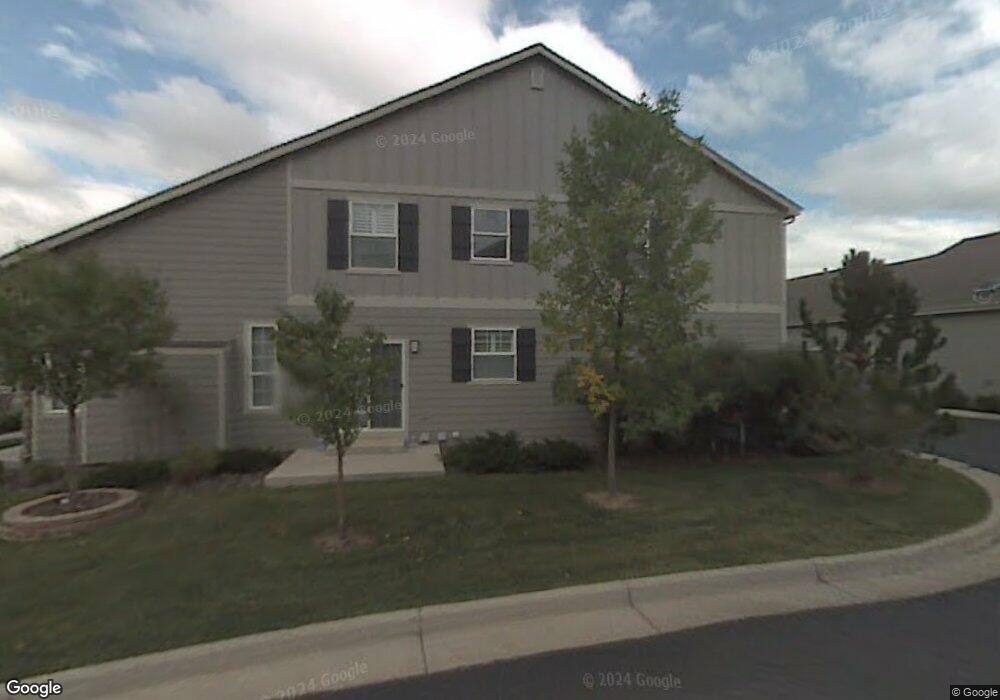
481 Clarendon Loop Castle Pines, CO 80108
Estimated Value: $530,595 - $620,000
2
Beds
3
Baths
1,849
Sq Ft
$309/Sq Ft
Est. Value
About This Home
This home is located at 481 Clarendon Loop, Castle Pines, CO 80108 and is currently estimated at $571,149, approximately $308 per square foot. 481 Clarendon Loop is a home located in Douglas County with nearby schools including Buffalo Ridge Elementary School, Rocky Heights Middle School, and Rock Canyon High School.
Ownership History
Date
Name
Owned For
Owner Type
Purchase Details
Closed on
Mar 12, 2008
Sold by
Orwick Jean M
Bought by
Fling Wendi L
Current Estimated Value
Home Financials for this Owner
Home Financials are based on the most recent Mortgage that was taken out on this home.
Original Mortgage
$226,689
Outstanding Balance
$139,124
Interest Rate
5.72%
Mortgage Type
Unknown
Estimated Equity
$432,025
Purchase Details
Closed on
Oct 29, 1999
Sold by
The Writer Corporation
Bought by
Orwick Jean M
Purchase Details
Closed on
Nov 24, 1997
Sold by
Brown Lisa E and Wright Lisa E
Bought by
Dilley Darrell D and Andree Michelle D
Home Financials for this Owner
Home Financials are based on the most recent Mortgage that was taken out on this home.
Original Mortgage
$140,593
Interest Rate
7.31%
Mortgage Type
FHA
Create a Home Valuation Report for This Property
The Home Valuation Report is an in-depth analysis detailing your home's value as well as a comparison with similar homes in the area
Home Values in the Area
Average Home Value in this Area
Purchase History
| Date | Buyer | Sale Price | Title Company |
|---|---|---|---|
| Fling Wendi L | $238,620 | Commonwealth Title | |
| Orwick Jean M | $204,396 | Land Title | |
| Dilley Darrell D | $142,900 | -- |
Source: Public Records
Mortgage History
| Date | Status | Borrower | Loan Amount |
|---|---|---|---|
| Open | Fling Wendi L | $226,689 | |
| Previous Owner | Dilley Darrell D | $140,593 |
Source: Public Records
Tax History
| Year | Tax Paid | Tax Assessment Tax Assessment Total Assessment is a certain percentage of the fair market value that is determined by local assessors to be the total taxable value of land and additions on the property. | Land | Improvement |
|---|---|---|---|---|
| 2025 | $3,195 | $32,850 | $6,060 | $26,790 |
| 2024 | $3,195 | $35,970 | $5,780 | $30,190 |
| 2023 | $3,225 | $35,970 | $5,780 | $30,190 |
| 2022 | $2,512 | $26,050 | $1,650 | $24,400 |
| 2021 | $2,612 | $26,050 | $1,650 | $24,400 |
| 2020 | $2,622 | $25,960 | $1,700 | $24,260 |
| 2019 | $2,631 | $25,960 | $1,700 | $24,260 |
| 2018 | $2,418 | $23,530 | $1,800 | $21,730 |
| 2017 | $2,272 | $23,530 | $1,800 | $21,730 |
| 2016 | $2,456 | $22,350 | $1,990 | $20,360 |
| 2015 | $2,730 | $22,350 | $1,990 | $20,360 |
| 2014 | $2,271 | $17,730 | $1,990 | $15,740 |
Source: Public Records
Map
Nearby Homes
- 7387 Norfolk Place
- 7243 Somerset Ct
- 7463 Norfolk Place
- 7177 Turweston Ln
- 7412 Pembroke Ct
- 7350 Brixham Cir
- 268 Woodstock Ln
- 906 Greenridge Ln
- 6879 Ingleton Dr
- 581 Stonemont Dr
- 369 Shoreham Cir
- 1033 Buffalo Ridge Rd
- 990 Glen Oaks Ave
- 7133 Hyland Hills St
- 8114 Briar Ridge Dr
- 6299 Ellingwood Point Place
- 1255 Forest Trails Dr
- 976 Country Club Pkwy
- 6297 Ellingwood Point Way
- 1277 Forest Trails Dr
- 473 Clarendon Loop
- 489 Clarendon Loop
- 457 Clarendon Loop
- 465 Clarendon Loop
- 505 Clarendon Loop
- 505 Clarendon Loop Unit 505
- 505 Clarendon Loop Unit 4505
- 513 Clarendon Loop
- 497 Clarendon Loop
- 521 Clarendon Loop
- 562 Clarendon Loop
- 448 Clarendon Loop
- 578 Clarendon Loop
- 537 Clarendon Loop
- 545 Clarendon Loop
- 529 Clarendon Loop
- 561 Clarendon Loop
- 553 Clarendon Loop
- 456 Clarendon Loop
- 586 Clarendon Loop
Your Personal Tour Guide
Ask me questions while you tour the home.