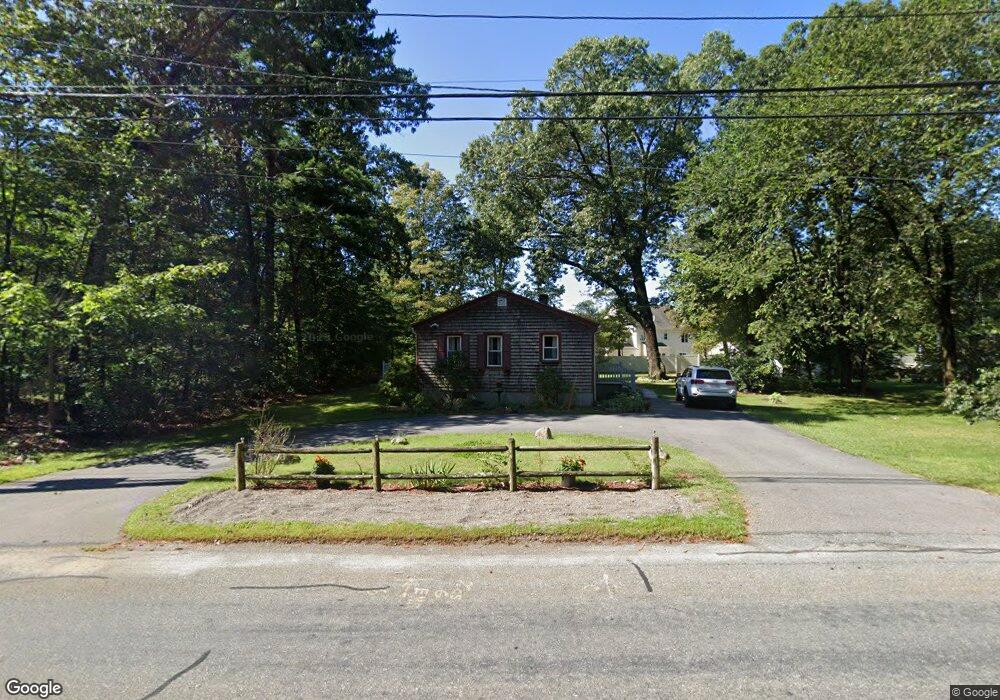
481 Creek St Wrentham, MA 02093
Estimated Value: $457,000 - $539,000
2
Beds
2
Baths
850
Sq Ft
$585/Sq Ft
Est. Value
About This Home
This home is located at 481 Creek St, Wrentham, MA 02093 and is currently estimated at $497,272, approximately $585 per square foot. 481 Creek St is a home located in Norfolk County with nearby schools including Delaney Elementary School and Charles E Roderick.
Ownership History
Date
Name
Owned For
Owner Type
Purchase Details
Closed on
Dec 30, 2021
Sold by
Mccarthy Timothy L and Mccarthy Lisa L
Bought by
T & L Mccarthy Irt
Current Estimated Value
Create a Home Valuation Report for This Property
The Home Valuation Report is an in-depth analysis detailing your home's value as well as a comparison with similar homes in the area
Purchase History
| Date | Buyer | Sale Price | Title Company |
|---|---|---|---|
| T & L Mccarthy Irt | -- | None Available |
Source: Public Records
Tax History
| Year | Tax Paid | Tax Assessment Tax Assessment Total Assessment is a certain percentage of the fair market value that is determined by local assessors to be the total taxable value of land and additions on the property. | Land | Improvement |
|---|---|---|---|---|
| 2025 | $5,301 | $457,400 | $290,700 | $166,700 |
| 2024 | $4,951 | $412,600 | $290,700 | $121,900 |
| 2023 | $4,620 | $366,100 | $264,300 | $101,800 |
| 2022 | $4,080 | $298,500 | $203,500 | $95,000 |
| 2021 | $4,272 | $303,600 | $213,200 | $90,400 |
| 2020 | $4,023 | $282,300 | $192,300 | $90,000 |
| 2019 | $3,756 | $266,000 | $177,500 | $88,500 |
| 2018 | $3,964 | $278,400 | $177,500 | $100,900 |
| 2017 | $3,769 | $264,500 | $174,100 | $90,400 |
| 2016 | $3,494 | $244,700 | $154,900 | $89,800 |
| 2015 | $3,134 | $209,200 | $135,400 | $73,800 |
| 2014 | $3,082 | $201,300 | $130,200 | $71,100 |
Source: Public Records
Map
Nearby Homes
- 500 Franklin St
- 287 Park St
- 50 Reed Fulton Ave Unit Lot 61
- 10 Nature View Dr
- 15 Nature View Dr
- 11 Earle Stewart Ln
- 12 Earle Stewart Ln
- Loty 3-14 Earle Stewart Ln
- Lot 1 - Blueberry 2 Car Plan at King Philip Estates
- Lot 8 - Blueberry 2 Car Plan at King Philip Estates
- Lot 5 - Hughes 2 car Plan at King Philip Estates
- Lot 6 - Blueberry 3 Car Plan at King Philip Estates
- 10 Earle Stewart Ln Unit Lot 5
- Lot 2 - Camden 2 Car Plan at King Philip Estates
- Lot 7 - Cedar Plan at King Philip Estates
- Lot 4 - Hemingway 2 Car Plan at King Philip Estates
- Lot 3 - Blueberry 2 Car Plan at King Philip Estates
- 45 Joshua Rd
- 246 Forest Grove Ave
- 319 Taunton St
- 4 Christina Dr
- 485 Creek St
- 4 Christina Dr
- 75 Hayden Woods
- 415 Creek St
- 85 Hayden Woods
- 5 Christina Dr
- 5 Christina Dr
- 55 Hayden Woods
- 529 Franklin St
- 45 Hayden Woods
- 80 Hayden Woods
- 520 Franklin St
- 405 Creek St
- 540 Franklin St
- 7 Christina Dr
- 7 Christina Dr
- 530 Franklin St
- 35 Hayden Woods
- LOT 2 Franklin St
Your Personal Tour Guide
Ask me questions while you tour the home.