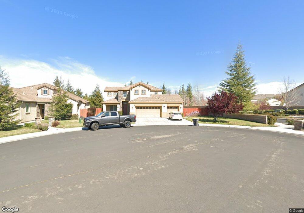
481 Munter Ct Manteca, CA 95337
Estimated Value: $680,000 - $725,000
4
Beds
4
Baths
2,652
Sq Ft
$263/Sq Ft
Est. Value
About This Home
This home is located at 481 Munter Ct, Manteca, CA 95337 and is currently estimated at $697,945, approximately $263 per square foot. 481 Munter Ct is a home located in San Joaquin County with nearby schools including Walter Woodward Elementary School, Manteca High School, and St. Anthony's Catholic School.
Ownership History
Date
Name
Owned For
Owner Type
Purchase Details
Closed on
Oct 28, 2021
Sold by
Truong Tuan Ke and Tuong Tuan K
Bought by
Truong Tuan Ke and Yu Xueyi
Current Estimated Value
Purchase Details
Closed on
Aug 24, 2007
Sold by
Campos Jesus
Bought by
Suntrust Bank
Purchase Details
Closed on
May 18, 2007
Sold by
Atherton Boyce Development Co Llc
Bought by
Loi David and Tuong Tuan K
Home Financials for this Owner
Home Financials are based on the most recent Mortgage that was taken out on this home.
Original Mortgage
$360,000
Interest Rate
6.18%
Mortgage Type
Purchase Money Mortgage
Create a Home Valuation Report for This Property
The Home Valuation Report is an in-depth analysis detailing your home's value as well as a comparison with similar homes in the area
Purchase History
| Date | Buyer | Sale Price | Title Company |
|---|---|---|---|
| Truong Tuan Ke | -- | None Available | |
| Suntrust Bank | $586,894 | None Available | |
| Loi David | $450,000 | Placer Title Company |
Source: Public Records
Mortgage History
| Date | Status | Borrower | Loan Amount |
|---|---|---|---|
| Previous Owner | Loi David | $360,000 |
Source: Public Records
Tax History
| Year | Tax Paid | Tax Assessment Tax Assessment Total Assessment is a certain percentage of the fair market value that is determined by local assessors to be the total taxable value of land and additions on the property. | Land | Improvement |
|---|---|---|---|---|
| 2025 | $7,093 | $602,871 | $241,147 | $361,724 |
| 2024 | $6,905 | $591,051 | $236,419 | $354,632 |
| 2023 | $6,826 | $579,463 | $231,784 | $347,679 |
| 2022 | $6,730 | $568,102 | $227,240 | $340,862 |
| 2021 | $6,661 | $556,964 | $222,785 | $334,179 |
| 2020 | $6,395 | $551,254 | $220,501 | $330,753 |
| 2019 | $6,306 | $540,446 | $216,178 | $324,268 |
| 2018 | $6,206 | $529,850 | $211,940 | $317,910 |
| 2017 | $5,299 | $449,000 | $180,000 | $269,000 |
| 2016 | $4,781 | $403,000 | $161,000 | $242,000 |
| 2014 | $4,282 | $380,000 | $152,000 | $228,000 |
Source: Public Records
Map
Nearby Homes
- 390 Munter St
- 1471 Tanoak St
- 1709 Queensland Ave
- 1502 Churcher Dr
- 837 Grafton St
- 1773 Lana Way
- 277 Fragrance St
- 475 Quintal Rd
- 2446 Paramount Ln
- 2043 Derrick Ave
- 250 Fragrance St
- 1047 Lindo Ct
- 1076 Balzo St
- 1051 Heartland Dr
- 1175 Miel St
- 1091 Alba St
- 2317 Mathar Dr
- 607 Mono St
- 2377 Beardsley Ave
- 6796 E Woodward Ave
- 463 Munter Ct
- 445 Munter Ct
- 1755 Buena Vista Dr
- 525 Cistus Ct
- 482 Munter Ct
- 464 Munter Ct
- 1754 Buena Vista Dr
- 442 Catmint St
- 450 Munter Ct
- 1766 Fleabane Ln
- 1774 Fleabane Ln
- 1754 Fleabane Ln
- 524 Cistus Ct
- 436 Munter Ct
- 1746 Buena Vista Dr
- 420 Catmint St
- 565 Cistus Ct
- 542 Cistus Ct
- 422 Munter Ct
- 552 Catmint St
Your Personal Tour Guide
Ask me questions while you tour the home.