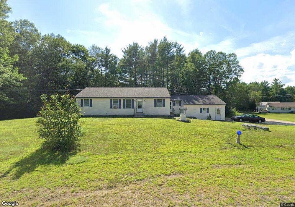
481 Nh Route 175 Campton, NH 03223
Estimated Value: $410,033 - $465,000
3
Beds
2
Baths
1,889
Sq Ft
$228/Sq Ft
Est. Value
About This Home
This home is located at 481 Nh Route 175, Campton, NH 03223 and is currently estimated at $430,508, approximately $227 per square foot. 481 Nh Route 175 is a home located in Grafton County with nearby schools including Campton Elementary School and Plymouth Regional High School.
Ownership History
Date
Name
Owned For
Owner Type
Purchase Details
Closed on
Oct 7, 2020
Sold by
Strong Sarah S
Bought by
Strong Kenneth R and Strong Michelle
Current Estimated Value
Home Financials for this Owner
Home Financials are based on the most recent Mortgage that was taken out on this home.
Original Mortgage
$172,000
Outstanding Balance
$152,985
Interest Rate
2.9%
Mortgage Type
New Conventional
Estimated Equity
$277,523
Purchase Details
Closed on
Oct 21, 1994
Bought by
Strong Ft
Create a Home Valuation Report for This Property
The Home Valuation Report is an in-depth analysis detailing your home's value as well as a comparison with similar homes in the area
Home Values in the Area
Average Home Value in this Area
Purchase History
| Date | Buyer | Sale Price | Title Company |
|---|---|---|---|
| Strong Kenneth R | $215,000 | None Available | |
| Strong Ft | -- | -- |
Source: Public Records
Mortgage History
| Date | Status | Borrower | Loan Amount |
|---|---|---|---|
| Open | Strong Kenneth R | $172,000 |
Source: Public Records
Tax History Compared to Growth
Tax History
| Year | Tax Paid | Tax Assessment Tax Assessment Total Assessment is a certain percentage of the fair market value that is determined by local assessors to be the total taxable value of land and additions on the property. | Land | Improvement |
|---|---|---|---|---|
| 2024 | $6,158 | $357,600 | $141,500 | $216,100 |
| 2023 | $5,901 | $205,100 | $67,600 | $137,500 |
| 2022 | $5,183 | $205,100 | $67,600 | $137,500 |
| 2021 | $5,121 | $205,100 | $67,600 | $137,500 |
| 2020 | $4,978 | $205,100 | $67,600 | $137,500 |
| 2019 | $4,760 | $205,100 | $67,600 | $137,500 |
| 2018 | $4,646 | $182,000 | $53,600 | $128,400 |
| 2017 | $4,514 | $182,000 | $53,600 | $128,400 |
| 2016 | $4,348 | $182,000 | $53,600 | $128,400 |
| 2015 | $4,170 | $182,000 | $53,600 | $128,400 |
| 2014 | $4,270 | $182,000 | $53,600 | $128,400 |
| 2013 | $4,060 | $203,100 | $55,700 | $147,400 |
Source: Public Records
Map
Nearby Homes
- NH New Hampshire Route 175
- Lot 15 Kelly Way
- 5 Wildwood Dr
- 10-6 Page Rd
- 18 Panaway Dr
- 8 Avery Rd
- 71 Carla Ct
- 172 Merrill Rd
- 90 Sunset Cir
- 73 Ellsworth Hill Rd
- 51 Turkey Jim Rd
- 32 Merrill Rd
- 20 Merrill Rd
- 12 Streamside Rd Unit 9
- 12 Streamside Rd Unit 7
- 8 Streamside Rd Unit 3
- 4 Seven Sisters Cir
- 0 Myrtle St Unit 2 5029940
- 99 Pinnacle Rd
- 399 Nh Route 49
- 482 Nh Route 175
- 13 Strong Rd
- 14 Strong Rd
- 4 Red Stone Rd
- 13 Red Stone Rd Unit 13
- Lot 13 Redstone Rd
- Lot 13 Redstone Rd Unit 13
- 522 Nh Route 175
- 522 Nh Route 175
- 432 New Hampshire Route 175
- 432 Nh Route 175
- 432 New Hampshire 175
- 26 Saddleback Cir
- 32 Saddle Back Cir
- 16 Saddle Back Cir
- 16 Saddleback Cir
- 10 Saddle Back Cir
- 29 Saddleback Cir
- 29 Saddle Back Cir
- 0 Saddleback Cir Unit 4689593