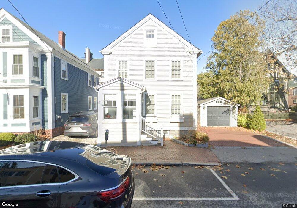
481 State St Portsmouth, NH 03801
West End NeighborhoodEstimated Value: $1,008,000 - $1,332,000
3
Beds
2
Baths
1,628
Sq Ft
$690/Sq Ft
Est. Value
About This Home
This home is located at 481 State St, Portsmouth, NH 03801 and is currently estimated at $1,123,144, approximately $689 per square foot. 481 State St is a home located in Rockingham County with nearby schools including Little Harbour School, Portsmouth Middle School, and Portsmouth High School.
Ownership History
Date
Name
Owned For
Owner Type
Purchase Details
Closed on
Dec 2, 2020
Sold by
Nelson Robert B
Bought by
Nelson Robert B and Guthrie Elizabeth
Current Estimated Value
Home Financials for this Owner
Home Financials are based on the most recent Mortgage that was taken out on this home.
Original Mortgage
$507,000
Interest Rate
2.7%
Mortgage Type
Stand Alone Refi Refinance Of Original Loan
Create a Home Valuation Report for This Property
The Home Valuation Report is an in-depth analysis detailing your home's value as well as a comparison with similar homes in the area
Home Values in the Area
Average Home Value in this Area
Purchase History
| Date | Buyer | Sale Price | Title Company |
|---|---|---|---|
| Nelson Robert B | -- | None Available | |
| Nelson Robert B | -- | None Available | |
| Nelson Robert B | -- | None Available |
Source: Public Records
Mortgage History
| Date | Status | Borrower | Loan Amount |
|---|---|---|---|
| Previous Owner | Nelson Robert B | $507,000 |
Source: Public Records
Tax History Compared to Growth
Tax History
| Year | Tax Paid | Tax Assessment Tax Assessment Total Assessment is a certain percentage of the fair market value that is determined by local assessors to be the total taxable value of land and additions on the property. | Land | Improvement |
|---|---|---|---|---|
| 2024 | $11,253 | $1,006,500 | $447,900 | $558,600 |
| 2023 | $9,304 | $576,800 | $259,600 | $317,200 |
| 2022 | $8,767 | $576,800 | $259,600 | $317,200 |
| 2021 | $8,669 | $576,800 | $259,600 | $317,200 |
| 2020 | $8,479 | $576,800 | $259,600 | $317,200 |
| 2019 | $8,571 | $576,800 | $259,600 | $317,200 |
| 2018 | $8,504 | $536,900 | $253,700 | $283,200 |
| 2017 | $7,622 | $495,600 | $212,400 | $283,200 |
| 2016 | $7,044 | $413,400 | $161,800 | $251,600 |
| 2015 | $6,941 | $413,400 | $161,800 | $251,600 |
| 2014 | $6,632 | $366,400 | $167,500 | $198,900 |
| 2013 | $6,568 | $366,700 | $167,500 | $199,200 |
| 2012 | $6,436 | $366,700 | $167,500 | $199,200 |
Source: Public Records
Map
Nearby Homes
- 51 Islington St Unit 406
- 4 Rock St Unit B
- 332 Hanover St
- 115 Court St
- 70 Maplewood Ave Unit 305
- 70 Maplewood Ave Unit 202
- 70 Maplewood Ave Unit 204
- 70 Maplewood Ave Unit 303
- 70 Maplewood Ave Unit 302
- 70 Maplewood Ave Unit 205
- 70 Maplewood Ave Unit 206
- 70 Maplewood Ave Unit 304
- 70 Maplewood Ave Unit 403
- 198 Islington St Unit 6
- 90 Fleet St Unit 4-5
- 99 Foundry Place Unit 106
- 99 Foundry Place Unit 408
- 99 Foundry Place Unit 102
- 99 Foundry Place Unit 310
- 99 Foundry Place Unit 109
- 487 State St Unit 2
- 56 Middle St Unit A
- 56 Middle St Unit B
- 56 Middle St Unit A
- 56 Middle St
- 495 State St
- State Stre Portsmouth
- 503 State St Unit 3
- 503 State St Unit 1
- 480 State St Unit 3
- 480 State St Unit 2
- 480 State St
- 6004 State St
- 3793 State St
- 37989 State St
- 7282 State St
- 507 State St Unit 2
- 507 State St Unit 1
- 116 U S Highway 1 Unit 301
- 116 U S Highway 1 Unit 206