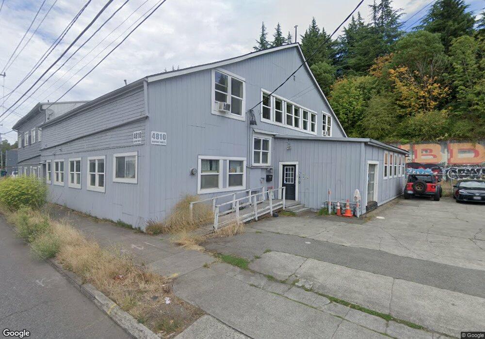
4810 Airport Way S Seattle, WA 98108
Estimated Value: $1,271,247
--
Bed
--
Bath
7,421
Sq Ft
$171/Sq Ft
Est. Value
About This Home
This home is located at 4810 Airport Way S, Seattle, WA 98108 and is currently estimated at $1,271,247, approximately $171 per square foot. 4810 Airport Way S is a home located in King County with nearby schools including Maple Elementary School, Mercer International Middle School, and Franklin High School.
Ownership History
Date
Name
Owned For
Owner Type
Purchase Details
Closed on
Mar 17, 2016
Sold by
Englesby Properties Llc
Bought by
4810 Building Llc
Current Estimated Value
Home Financials for this Owner
Home Financials are based on the most recent Mortgage that was taken out on this home.
Original Mortgage
$588,750
Outstanding Balance
$467,074
Interest Rate
3.72%
Estimated Equity
$804,173
Purchase Details
Closed on
Oct 24, 2006
Sold by
Englesby Frank and Englesby Liza
Bought by
Englesby Properties Llc
Home Financials for this Owner
Home Financials are based on the most recent Mortgage that was taken out on this home.
Original Mortgage
$500,000
Interest Rate
6.36%
Purchase Details
Closed on
Jun 25, 2001
Sold by
Pinkerton Holdings Inc
Bought by
Englesby Frank and Englesby Liza
Home Financials for this Owner
Home Financials are based on the most recent Mortgage that was taken out on this home.
Original Mortgage
$384,782
Interest Rate
7.14%
Create a Home Valuation Report for This Property
The Home Valuation Report is an in-depth analysis detailing your home's value as well as a comparison with similar homes in the area
Home Values in the Area
Average Home Value in this Area
Purchase History
| Date | Buyer | Sale Price | Title Company |
|---|---|---|---|
| 4810 Building Llc | $785,000 | Chicago Title | |
| Englesby Properties Llc | -- | Chicago Title | |
| Englesby Frank | $184,500 | First American |
Source: Public Records
Mortgage History
| Date | Status | Borrower | Loan Amount |
|---|---|---|---|
| Open | 4810 Building Llc | $588,750 | |
| Previous Owner | Englesby Properties Llc | $500,000 | |
| Previous Owner | Englesby Frank | $384,782 |
Source: Public Records
Tax History Compared to Growth
Tax History
| Year | Tax Paid | Tax Assessment Tax Assessment Total Assessment is a certain percentage of the fair market value that is determined by local assessors to be the total taxable value of land and additions on the property. | Land | Improvement |
|---|---|---|---|---|
| 2024 | $11,993 | $1,142,300 | $374,500 | $767,800 |
| 2023 | $8,350 | $1,001,900 | $374,500 | $627,400 |
| 2022 | $9,804 | $868,300 | $306,400 | $561,900 |
| 2021 | $10,551 | $971,200 | $306,400 | $664,800 |
| 2020 | $9,393 | $1,010,000 | $306,400 | $703,600 |
| 2018 | $8,048 | $764,400 | $224,700 | $539,700 |
| 2017 | $7,733 | $744,300 | $204,300 | $540,000 |
| 2016 | $7,252 | $744,300 | $190,600 | $553,700 |
| 2015 | $7,028 | $682,500 | $177,000 | $505,500 |
| 2014 | -- | $682,500 | $177,000 | $505,500 |
| 2013 | -- | $682,500 | $163,400 | $519,100 |
Source: Public Records
Map
Nearby Homes
- 4524 12th Ave S
- 5403 Maynard Ave S
- 1556 S Pearl St
- 1729 S Columbian Way
- 809 S Orcas St
- 813 S Orcas St
- 4852 19th Ave S
- 2928 S Bradford St
- 2010 S Bradford St
- 1614 S Juneau St
- 1616 S Juneau St
- 3628 14th Ave S
- 1709 S Juneau St
- 6245 Airport Way S Unit B
- 6247 Airport Way S Unit A
- 6249 Airport Way S Unit B
- 5903 19th Ave S
- 5928 18th Ave S
- 60 xx 21st Ave S
- 6310 Ellis Ave S Unit 1
- 4800 Airport Way S
- 4111 Bizops
- 707 S Snoqualmie St Unit 1D
- 707 S Snoqualmie St Unit 5a
- 707 S Snoqualmie St Unit 5D
- 707 S Snoqualmie St Unit 4-E
- 707 S Snoqualmie St Unit 4B
- 707 S Snoqualmie St Unit 2C
- 707 S Snoqualmie St Unit 3A
- 707 S Snoqualmie St Unit 2A
- 707 S Snoqualmie St Unit 2B
- 1804 Swift Ave S
- 1001 S Snoqualmie St
- 633 S Snoqualmie St
- 1005 S Snoqualmie St
- 1011 S Snoqualmie St
- 1017 S Snoqualmie St
- 1023 S Snoqualmie St
- 1000 S Snoqualmie St
- 1014 S Snoqualmie St