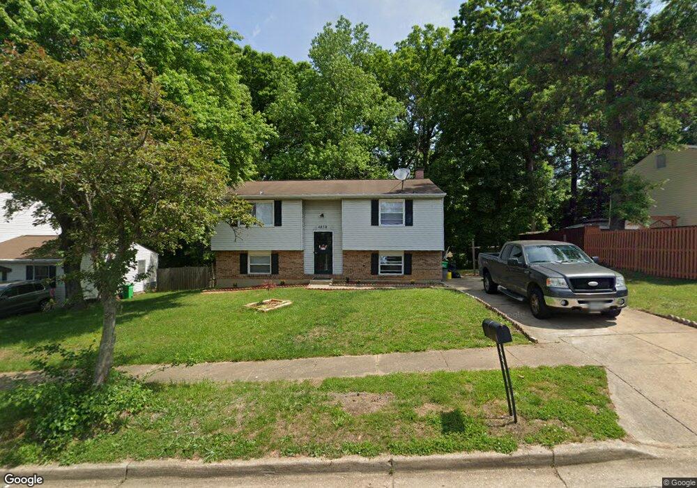
4810 Megan Dr Clinton, MD 20735
Estimated Value: $374,000 - $403,000
3
Beds
2
Baths
924
Sq Ft
$417/Sq Ft
Est. Value
About This Home
This home is located at 4810 Megan Dr, Clinton, MD 20735 and is currently estimated at $385,524, approximately $417 per square foot. 4810 Megan Dr is a home located in Prince George's County with nearby schools including Clinton Grove Elementary School, Stephen Decatur Middle School, and Surrattsville High School.
Ownership History
Date
Name
Owned For
Owner Type
Purchase Details
Closed on
Nov 1, 2005
Sold by
Alagoa Sally
Bought by
Oguara Albert R
Current Estimated Value
Home Financials for this Owner
Home Financials are based on the most recent Mortgage that was taken out on this home.
Original Mortgage
$260,000
Outstanding Balance
$163,274
Interest Rate
8.65%
Mortgage Type
Adjustable Rate Mortgage/ARM
Estimated Equity
$222,250
Purchase Details
Closed on
Jul 14, 2004
Sold by
Amoky Steven
Bought by
Alagoa Sally
Purchase Details
Closed on
Oct 19, 1999
Sold by
Proctor Joseph T and Proctor Frances M
Bought by
Secretary Of Veterans Affairs
Create a Home Valuation Report for This Property
The Home Valuation Report is an in-depth analysis detailing your home's value as well as a comparison with similar homes in the area
Home Values in the Area
Average Home Value in this Area
Purchase History
| Date | Buyer | Sale Price | Title Company |
|---|---|---|---|
| Oguara Albert R | $325,000 | -- | |
| Alagoa Sally | $200,000 | -- | |
| Secretary Of Veterans Affairs | $113,984 | -- |
Source: Public Records
Mortgage History
| Date | Status | Borrower | Loan Amount |
|---|---|---|---|
| Open | Alagoa Sally | $260,000 |
Source: Public Records
Tax History Compared to Growth
Tax History
| Year | Tax Paid | Tax Assessment Tax Assessment Total Assessment is a certain percentage of the fair market value that is determined by local assessors to be the total taxable value of land and additions on the property. | Land | Improvement |
|---|---|---|---|---|
| 2025 | $4,760 | $318,200 | $101,100 | $217,100 |
| 2024 | $4,760 | $293,500 | $0 | $0 |
| 2023 | $4,392 | $268,800 | $0 | $0 |
| 2022 | $4,025 | $244,100 | $101,100 | $143,000 |
| 2021 | $3,956 | $239,467 | $0 | $0 |
| 2020 | $3,887 | $234,833 | $0 | $0 |
| 2019 | $3,819 | $230,200 | $100,500 | $129,700 |
| 2018 | $3,604 | $215,733 | $0 | $0 |
| 2017 | $3,389 | $201,267 | $0 | $0 |
| 2016 | -- | $186,800 | $0 | $0 |
| 2015 | $3,426 | $186,800 | $0 | $0 |
| 2014 | $3,426 | $186,800 | $0 | $0 |
Source: Public Records
Map
Nearby Homes
- 8601 Temple Hill Rd Unit 5
- 8600 Sumter Ln
- 8806 Junaluska Terrace
- 5209 Sumter Ct
- 9009 Susan Ln
- 5413 Trent St
- 8600 Sapienza Dr
- 8210 Birdsong Dr
- 5506 San Juan Dr
- 5513 Tinkers Creek Place
- 4405 Natahala Dr
- 4549 Natahala Dr
- 5604 Chris Mar Ave
- 4811 Oahu St
- 7904 Birdsong Dr
- 3910 Oaklawn Rd
- 9515 Piscataway Rd
- 8910 Hardesty Dr
- 8406 Cinema Ct
- 8005 Pats Place