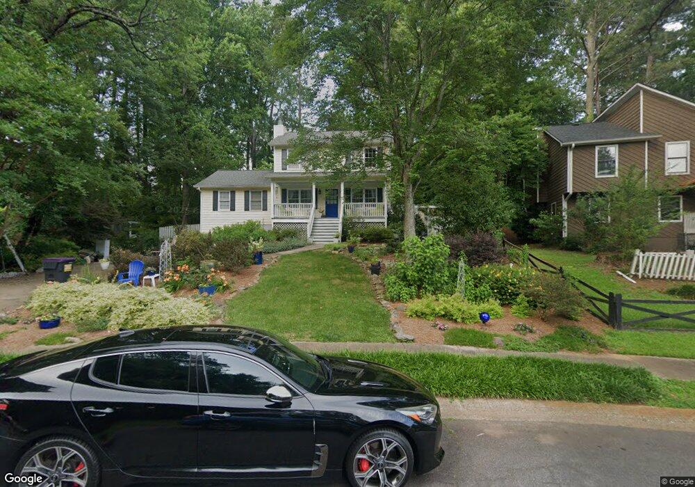
4810 N Hames Ct NE Unit 2 Marietta, GA 30066
Sandy Plains NeighborhoodEstimated Value: $377,000 - $444,000
3
Beds
2
Baths
1,664
Sq Ft
$249/Sq Ft
Est. Value
About This Home
This home is located at 4810 N Hames Ct NE Unit 2, Marietta, GA 30066 and is currently estimated at $414,437, approximately $249 per square foot. 4810 N Hames Ct NE Unit 2 is a home located in Cobb County with nearby schools including Davis Elementary School, Mabry Middle School, and Lassiter High School.
Ownership History
Date
Name
Owned For
Owner Type
Purchase Details
Closed on
Apr 19, 2004
Sold by
Wingspread Ents Llc
Bought by
Grain Walter D and Grain Tracy
Current Estimated Value
Home Financials for this Owner
Home Financials are based on the most recent Mortgage that was taken out on this home.
Original Mortgage
$153,500
Outstanding Balance
$70,128
Interest Rate
5.35%
Mortgage Type
New Conventional
Estimated Equity
$344,309
Purchase Details
Closed on
Dec 2, 2003
Sold by
Wiggins Elizabeth H and Wiggins Thomas W
Bought by
Wingspread Ents Llc
Create a Home Valuation Report for This Property
The Home Valuation Report is an in-depth analysis detailing your home's value as well as a comparison with similar homes in the area
Home Values in the Area
Average Home Value in this Area
Purchase History
| Date | Buyer | Sale Price | Title Company |
|---|---|---|---|
| Grain Walter D | $177,500 | -- | |
| Wingspread Ents Llc | $126,000 | -- |
Source: Public Records
Mortgage History
| Date | Status | Borrower | Loan Amount |
|---|---|---|---|
| Open | Grain Walter D | $153,500 |
Source: Public Records
Tax History Compared to Growth
Tax History
| Year | Tax Paid | Tax Assessment Tax Assessment Total Assessment is a certain percentage of the fair market value that is determined by local assessors to be the total taxable value of land and additions on the property. | Land | Improvement |
|---|---|---|---|---|
| 2025 | $3,775 | $163,104 | $36,000 | $127,104 |
| 2024 | $3,214 | $137,080 | $34,000 | $103,080 |
| 2023 | $2,671 | $137,080 | $34,000 | $103,080 |
| 2022 | $2,903 | $121,716 | $32,000 | $89,716 |
| 2021 | $2,428 | $100,016 | $24,000 | $76,016 |
| 2020 | $2,428 | $100,016 | $24,000 | $76,016 |
| 2019 | $2,195 | $89,404 | $22,000 | $67,404 |
| 2018 | $2,195 | $89,404 | $22,000 | $67,404 |
| 2017 | $1,806 | $75,200 | $18,000 | $57,200 |
| 2016 | $1,809 | $75,200 | $18,000 | $57,200 |
| 2015 | $1,407 | $56,580 | $18,000 | $38,580 |
| 2014 | $1,419 | $56,580 | $0 | $0 |
Source: Public Records
Map
Nearby Homes
- 4887 Raven Way NE
- 2958 Forest Chase Terrace NE
- The Arlington Plan at Tanglewood
- The Alston A Plan at Tanglewood
- 2256 Turtle Club Dr NE Unit 1
- 2423 Turtle Crossing NE
- 2842 Forest Chase Dr NE
- 2768 Hawk Trace Ct NE
- 4709 Trickum Rd NE
- 2874 S Cherokee Ln
- 4589 Wigley Estates Rd
- 255 Wild Ginger Bend
- 4499 Browning Ct NE
- 2697 S Cherokee Ln
- 235 Wild Ginger Bend
- 461 Maypop Ln
- 444 Maypop Ln
- 4464 Windsor Oaks Dr
- 4812 N Hames Ct NE
- 4808 N Hames Ct NE
- 0 Grants Way NE Unit 7177629
- 0 Grants Way NE
- N N Hames Ct NE
- 4797 Grants Way NE
- 4799 Grants Way NE
- 4807 N Hames Ct NE
- 2675 Forest Way NE
- 2675 Forest Way NE Unit 2
- 4811 N Hames Ct NE
- 4809 N Hames Ct NE
- 4801 Rushing Rock Way
- 4810 Rushing Rock Way
- 2669 Forest Way NE
- 4800 Grants Way NE
- 4795 Holmes Farm Ct
- 4798 Grants Way NE
- 2670 Forest Way NE Unit 2
- 2677 Forest Way NE