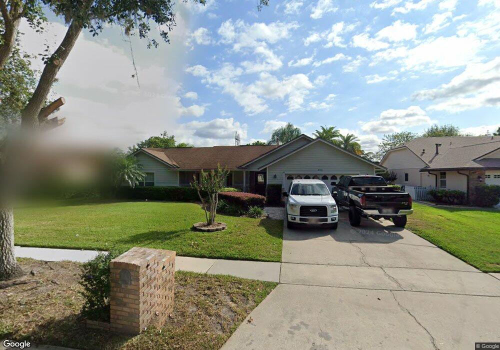
4811 Lonsdale Cir Orlando, FL 32817
Estimated Value: $434,000 - $492,768
3
Beds
2
Baths
2,069
Sq Ft
$229/Sq Ft
Est. Value
About This Home
This home is located at 4811 Lonsdale Cir, Orlando, FL 32817 and is currently estimated at $474,442, approximately $229 per square foot. 4811 Lonsdale Cir is a home located in Orange County with nearby schools including Lakemont Elementary, Maitland Middle School, and Winter Park High.
Ownership History
Date
Name
Owned For
Owner Type
Purchase Details
Closed on
Sep 10, 2001
Sold by
Adam D West M and Livie C West M
Bought by
Parsons Scott A and Parsons Kellie E
Current Estimated Value
Home Financials for this Owner
Home Financials are based on the most recent Mortgage that was taken out on this home.
Original Mortgage
$133,980
Interest Rate
7.02%
Mortgage Type
FHA
Create a Home Valuation Report for This Property
The Home Valuation Report is an in-depth analysis detailing your home's value as well as a comparison with similar homes in the area
Home Values in the Area
Average Home Value in this Area
Purchase History
| Date | Buyer | Sale Price | Title Company |
|---|---|---|---|
| Parsons Scott A | $157,000 | -- |
Source: Public Records
Mortgage History
| Date | Status | Borrower | Loan Amount |
|---|---|---|---|
| Open | Parsons Scott A | $138,200 | |
| Closed | Parsons Scott A | $37,574 | |
| Closed | Parsons Scott A | $133,980 |
Source: Public Records
Tax History Compared to Growth
Tax History
| Year | Tax Paid | Tax Assessment Tax Assessment Total Assessment is a certain percentage of the fair market value that is determined by local assessors to be the total taxable value of land and additions on the property. | Land | Improvement |
|---|---|---|---|---|
| 2025 | $2,867 | $178,419 | -- | -- |
| 2024 | $2,674 | $178,419 | -- | -- |
| 2023 | $2,674 | $168,341 | $0 | $0 |
| 2022 | $2,553 | $163,438 | $0 | $0 |
| 2021 | $2,480 | $158,678 | $0 | $0 |
| 2020 | $2,352 | $156,487 | $0 | $0 |
| 2019 | $2,406 | $152,969 | $0 | $0 |
| 2018 | $2,374 | $150,117 | $0 | $0 |
| 2017 | $2,332 | $222,993 | $48,600 | $174,393 |
| 2016 | $2,301 | $215,006 | $45,000 | $170,006 |
| 2015 | $2,333 | $204,206 | $45,000 | $159,206 |
| 2014 | $2,374 | $198,257 | $50,000 | $148,257 |
Source: Public Records
Map
Nearby Homes
- 4865 Gorham Ave
- 4445 Bridgewater Dr
- 9405 Holbrook Dr
- 8815 Atwater Loop
- 8912 Vickroy Terrace
- 9050 Stockton Ct
- 8608 Falstaff Place
- 8719 Larwin Ln
- 3153 Jade Tree Point
- 8602 Larwin Ln
- 8720 Larwin Ln
- 9017 Littleton Ct
- 2901 Ashford Park Place
- 8537 Buckley Ct
- 8518 Buckley Ct
- 9825 Lake Georgia Dr
- 5325 Cypress Reserve Place
- 3137 Riverboat Way
- 0 Seafarer Way Unit MFRS5137175
- 4674 Hall Rd
- 4817 Lonsdale Cir
- 4805 Lonsdale Cir
- 4748 Lake Sharp Dr
- 4742 Lake Sharp Dr
- 4802 Lake Sharp Dr
- 4823 Lonsdale Cir
- 4777 Lonsdale Cir
- 4812 Lonsdale Cir
- 4736 Lake Sharp Dr
- 4806 Lonsdale Cir
- 4818 Lonsdale Cir
- 4808 Lake Sharp Dr
- 4824 Lonsdale Cir
- 4829 Lonsdale Cir
- 4771 Lonsdale Cir
- 4730 Lake Sharp Dr
- 4749 Lake Sharp Dr
- 4830 Lonsdale Cir
- 4814 Lake Sharp Dr
- 4803 Lake Sharp Dr