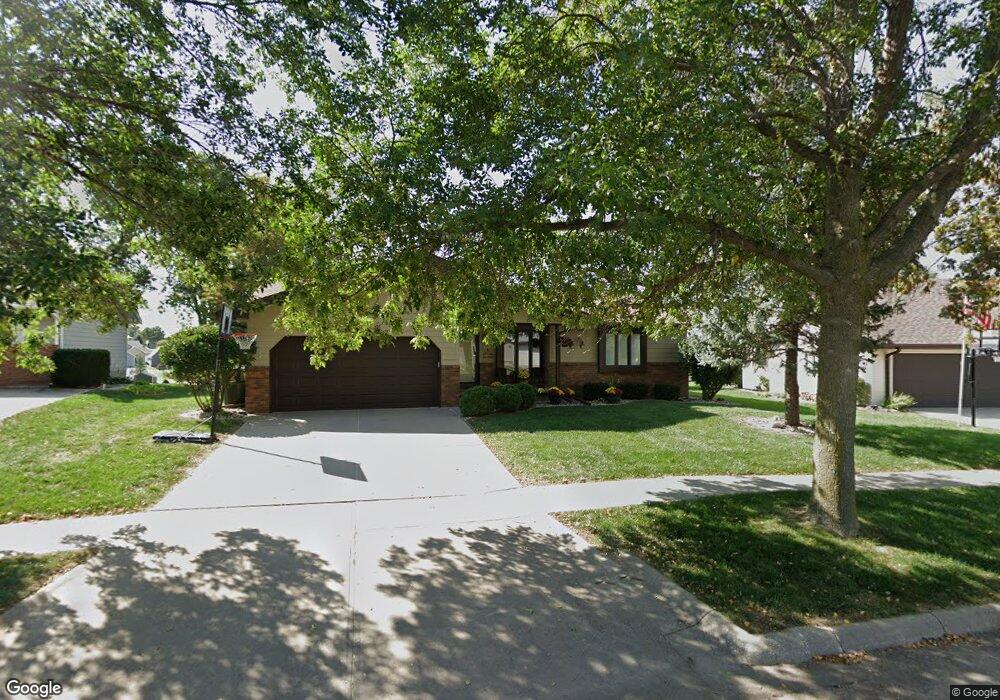
4811 Robin Ln Sioux City, IA 51106
Estimated Value: $330,095 - $402,000
4
Beds
3
Baths
1,324
Sq Ft
$282/Sq Ft
Est. Value
About This Home
This home is located at 4811 Robin Ln, Sioux City, IA 51106 and is currently estimated at $372,774, approximately $281 per square foot. 4811 Robin Ln is a home located in Woodbury County with nearby schools including Nodland Elementary School, East Middle School, and East High School.
Ownership History
Date
Name
Owned For
Owner Type
Purchase Details
Closed on
Jul 12, 2009
Sold by
Divis Matthew G and Divis Marie A
Bought by
Thomsen Matthew T and Thomsen Julie L
Current Estimated Value
Home Financials for this Owner
Home Financials are based on the most recent Mortgage that was taken out on this home.
Original Mortgage
$184,594
Outstanding Balance
$121,210
Interest Rate
5.43%
Mortgage Type
FHA
Estimated Equity
$251,564
Purchase Details
Closed on
Jul 28, 2005
Sold by
Us Bank Na
Bought by
Divis Matthew G and Divis Marie A
Home Financials for this Owner
Home Financials are based on the most recent Mortgage that was taken out on this home.
Original Mortgage
$130,625
Interest Rate
5.82%
Mortgage Type
New Conventional
Purchase Details
Closed on
Feb 8, 2005
Sold by
Perera Kenneth M and Perera Joni R
Bought by
Us Bank Na
Create a Home Valuation Report for This Property
The Home Valuation Report is an in-depth analysis detailing your home's value as well as a comparison with similar homes in the area
Home Values in the Area
Average Home Value in this Area
Purchase History
| Date | Buyer | Sale Price | Title Company |
|---|---|---|---|
| Thomsen Matthew T | $188,000 | None Available | |
| Divis Matthew G | $137,500 | None Available | |
| Us Bank Na | $171,730 | None Available |
Source: Public Records
Mortgage History
| Date | Status | Borrower | Loan Amount |
|---|---|---|---|
| Open | Thomsen Matthew T | $184,594 | |
| Previous Owner | Divis Matthew G | $130,625 |
Source: Public Records
Tax History Compared to Growth
Tax History
| Year | Tax Paid | Tax Assessment Tax Assessment Total Assessment is a certain percentage of the fair market value that is determined by local assessors to be the total taxable value of land and additions on the property. | Land | Improvement |
|---|---|---|---|---|
| 2025 | $5,020 | $317,800 | $57,000 | $260,800 |
| 2024 | $5,020 | $299,500 | $45,600 | $253,900 |
| 2023 | $4,884 | $299,500 | $45,600 | $253,900 |
| 2022 | $4,602 | $252,400 | $41,700 | $210,700 |
| 2021 | $4,602 | $242,400 | $41,700 | $200,700 |
| 2020 | $4,404 | $222,200 | $31,900 | $190,300 |
| 2019 | $4,554 | $0 | $0 | $0 |
| 2018 | $4,492 | $210,200 | $0 | $0 |
| 2017 | $4,492 | $194,100 | $0 | $0 |
| 2016 | $4,156 | $194,100 | $0 | $0 |
| 2015 | $4,071 | $194,100 | $28,500 | $165,600 |
| 2014 | $3,872 | $178,900 | $37,200 | $141,700 |
Source: Public Records
Map
Nearby Homes
- 4619 S Lakeport St
- 4712 Birch Way
- 4901 Singing Hills Blvd
- 4724 Grayhawk Ridge Dr
- 4859 Bradford Ln
- 4508 Stoneridge Point
- 4501-03-05 Whitetail Dr
- 5208-10-12 Singing Hills Blvd
- 5109 Singing Hills Blvd
- 4546 Whitetail Ct
- 4564 Badger Ct
- 4586 Badger Ct
- 5209 Lynx Ct
- 4546 Badger Ct
- 5227 Lynx Ct
- 4525 Elk Creek Rd
- 3840 Stadium Dr
- Overlook 1 Plan at The Overlook at Sunnybrook
- Overlook 4 Plan at The Overlook at Sunnybrook
- Overlook 2 Plan at The Overlook at Sunnybrook
- 4815 Robin Ln
- 4807 Robin Ln
- 4718 Red Rock Ct
- 4803 Robin Ln
- 4816 Robin Ln
- 4819 Robin Ln
- 4812 Robin Ln
- 4719 Meadowlark Ln
- 4712 Red Rock Ct
- 4820 Robin Ln
- 4835 Meadowlark Ln
- 4821 Robin Ln
- 4713 Red Rock Ct
- 4713 Meadowlark Ln
- 4824 Robin Ln
- 4706 Red Rock Ct
- 4839 Meadowlark Ln
- 4707 Meadowlark Ln
- 4822 Meadowlark Ln
- 4707 Red Rock Ct