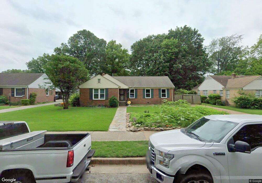
4813 Kaye Rd Memphis, TN 38117
Colonial Acres NeighborhoodEstimated Value: $277,000 - $293,000
3
Beds
2
Baths
1,657
Sq Ft
$171/Sq Ft
Est. Value
About This Home
This home is located at 4813 Kaye Rd, Memphis, TN 38117 and is currently estimated at $283,423, approximately $171 per square foot. 4813 Kaye Rd is a home located in Shelby County with nearby schools including Sea Isle Elementary School, Colonial Middle, and Overton High.
Ownership History
Date
Name
Owned For
Owner Type
Purchase Details
Closed on
Apr 3, 2025
Sold by
Murphy Stephen and Murphy Margaret A
Bought by
Murphy Revocable Living Trust and Murphy
Current Estimated Value
Purchase Details
Closed on
Jun 18, 2009
Sold by
Lopez Severo A and Lopez Irene G
Bought by
Murphy Stephen and Murphy Margaret A
Home Financials for this Owner
Home Financials are based on the most recent Mortgage that was taken out on this home.
Original Mortgage
$80,000
Interest Rate
4.77%
Mortgage Type
Purchase Money Mortgage
Purchase Details
Closed on
Aug 20, 2004
Sold by
Dougherty Patricia A
Bought by
Lopez Severo A and Lopez Irene G
Home Financials for this Owner
Home Financials are based on the most recent Mortgage that was taken out on this home.
Original Mortgage
$116,720
Interest Rate
5.25%
Mortgage Type
New Conventional
Create a Home Valuation Report for This Property
The Home Valuation Report is an in-depth analysis detailing your home's value as well as a comparison with similar homes in the area
Home Values in the Area
Average Home Value in this Area
Purchase History
| Date | Buyer | Sale Price | Title Company |
|---|---|---|---|
| Murphy Revocable Living Trust | -- | None Listed On Document | |
| Murphy Stephen | $150,000 | None Available | |
| Lopez Severo A | $145,900 | -- |
Source: Public Records
Mortgage History
| Date | Status | Borrower | Loan Amount |
|---|---|---|---|
| Previous Owner | Murphy Stephen | $80,000 | |
| Previous Owner | Lopez Severo A | $116,720 |
Source: Public Records
Tax History
| Year | Tax Paid | Tax Assessment Tax Assessment Total Assessment is a certain percentage of the fair market value that is determined by local assessors to be the total taxable value of land and additions on the property. | Land | Improvement |
|---|---|---|---|---|
| 2025 | $1,954 | $73,525 | $11,250 | $62,275 |
| 2024 | $1,954 | $57,650 | $9,050 | $48,600 |
| 2023 | $3,512 | $57,650 | $9,050 | $48,600 |
| 2022 | $3,512 | $57,650 | $9,050 | $48,600 |
| 2021 | $3,553 | $57,650 | $9,050 | $48,600 |
| 2020 | $2,862 | $39,500 | $9,050 | $30,450 |
| 2019 | $2,862 | $39,500 | $9,050 | $30,450 |
| 2018 | $2,862 | $39,500 | $9,050 | $30,450 |
| 2017 | $1,623 | $39,500 | $9,050 | $30,450 |
| 2016 | $1,768 | $40,450 | $0 | $0 |
| 2014 | $1,768 | $40,450 | $0 | $0 |
Source: Public Records
Map
Nearby Homes
- 1027 Colonial Rd
- 4856 Kaye Rd
- 866 Colonial Rd
- 4921 Alrose Ave
- 4853 Marion Ave
- 4927 Hampshire Ave
- 826 Thistledown Dr Unit 1202
- 4949 Welchshire Ave
- 4958 Welchshire Ave
- 4613 Crossover Ln
- 748 Hedgegrove Dr Unit 4803
- 812 Creekside Dr Unit 2
- 4764 Eagle Crest Dr Unit 4002
- 1168 S Perkins Rd
- 4786 Audubon View #2 Cir Unit 3807
- 1181 S Perkins Rd
- 901 S Perkins Rd
- 1044 Kings Park Rd
- 4780 Audubon View Cir Unit 3804
- 4777 Audubon View Cir Unit 1
- 4805 Kaye Rd
- 4821 Kaye Rd
- 4816 Welchshire Ave
- 4797 Kaye Rd
- 4829 Kaye Rd
- 4808 Welchshire Ave
- 4824 Welchshire Ave
- 4800 Welchshire Ave
- 4814 Kaye Rd
- 4806 Kaye Rd
- 4837 Kaye Rd
- 4789 Kaye Rd
- 4822 Kaye Rd
- 4792 Welchshire Ave
- 4798 Kaye Rd
- 4830 Kaye Rd
- 4838 Welchshire Ave
- 4784 Welchshire Ave
- 4790 Kaye Rd
- 4847 Kaye Rd
Your Personal Tour Guide
Ask me questions while you tour the home.