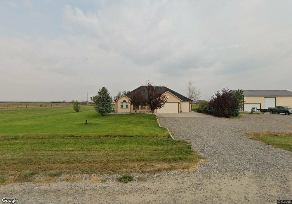
4815 Maribrooke Rd Shepherd, MT 59079
Estimated Value: $430,000 - $545,000
2
Beds
2
Baths
1,675
Sq Ft
$288/Sq Ft
Est. Value
About This Home
This home is located at 4815 Maribrooke Rd, Shepherd, MT 59079 and is currently estimated at $481,714, approximately $287 per square foot. 4815 Maribrooke Rd is a home located in Yellowstone County with nearby schools including Shepherd Elementary School, Shepherd Middle School, and Shepherd High School.
Ownership History
Date
Name
Owned For
Owner Type
Purchase Details
Closed on
Nov 3, 2010
Sold by
Simpson Dolores Christine
Bought by
Carter Danny R and Carter Stacey
Current Estimated Value
Home Financials for this Owner
Home Financials are based on the most recent Mortgage that was taken out on this home.
Original Mortgage
$179,910
Outstanding Balance
$119,064
Interest Rate
4.33%
Mortgage Type
New Conventional
Estimated Equity
$362,650
Create a Home Valuation Report for This Property
The Home Valuation Report is an in-depth analysis detailing your home's value as well as a comparison with similar homes in the area
Home Values in the Area
Average Home Value in this Area
Purchase History
| Date | Buyer | Sale Price | Title Company |
|---|---|---|---|
| Carter Danny R | -- | Ctic |
Source: Public Records
Mortgage History
| Date | Status | Borrower | Loan Amount |
|---|---|---|---|
| Open | Carter Danny R | $179,910 |
Source: Public Records
Tax History Compared to Growth
Tax History
| Year | Tax Paid | Tax Assessment Tax Assessment Total Assessment is a certain percentage of the fair market value that is determined by local assessors to be the total taxable value of land and additions on the property. | Land | Improvement |
|---|---|---|---|---|
| 2025 | $3,993 | $478,100 | $104,897 | $373,203 |
| 2024 | $3,993 | $449,100 | $78,454 | $370,646 |
| 2023 | $4,059 | $449,100 | $78,454 | $370,646 |
| 2022 | $3,727 | $366,400 | $61,987 | $304,413 |
| 2021 | $3,718 | $366,400 | $0 | $0 |
| 2020 | $3,548 | $336,700 | $0 | $0 |
| 2019 | $2,964 | $336,700 | $0 | $0 |
| 2018 | $2,867 | $305,500 | $0 | $0 |
| 2017 | $2,817 | $305,500 | $0 | $0 |
| 2016 | $2,664 | $306,600 | $0 | $0 |
| 2015 | $2,648 | $306,600 | $0 | $0 |
| 2014 | $2,135 | $130,380 | $0 | $0 |
Source: Public Records
Map
Nearby Homes
- 4820 Maribrooke Rd
- 4935 Lewies Way
- 7133 Mustang Rd
- 5358 Yeoman Rd
- 6447 US Highway 312
- 5510 Powmer Rd
- 6634 Killdeer Ln
- L5B4 Trumbo Cir
- L11B3 High Noon Dr
- L3B4 Trumbo Cir
- L13B2 High Noon Dr
- 7306 Kendra Lynn Dr
- L12B3 Molly Dr
- L11B2 Rio Lobo Cir
- L4B4 Trumbo Cir
- L2B4 True Grit St
- L12B2 High Noon Dr
- L10B3 High Noon Dr
- 5840,5850,5904 Lunder Ln
- L13B3 Molly Dr
- 4830 Maribrooke Rd
- 6625 Hofferber Rd
- 4835 Maribrooke Rd
- 6685 Hofferber Rd
- 4850 Maribrooke Rd
- 6701 Hofferber Rd
- 4860 Maribrooke Rd
- 4945 Maribrooke Rd
- 4845 Homer Davis Rd
- 6425 Hofferber Rd
- 6715 Hofferber Rd
- 4840 Maribrooke Rd Unit 19
- 4910 Maribrooke Rd
- 2B 1A Hofferber Rd
- 1A2B Hofferber Rd
- 6727 Hofferber Rd
- 4925 Homer Davis Rd
- 5015 Maribrooke Rd
- 6335 Hofferber Rd
- 0 Lewies Way