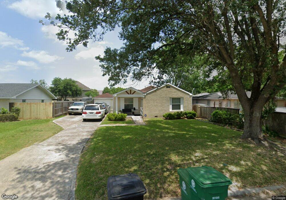
4817 Briscoe St Houston, TX 77033
Sunnyside NeighborhoodEstimated Value: $166,471 - $192,000
3
Beds
1
Bath
1,357
Sq Ft
$129/Sq Ft
Est. Value
About This Home
This home is located at 4817 Briscoe St, Houston, TX 77033 and is currently estimated at $174,868, approximately $128 per square foot. 4817 Briscoe St is a home located in Harris County with nearby schools including Bastian Elementary School, Attucks Middle School, and Worthing High School.
Ownership History
Date
Name
Owned For
Owner Type
Purchase Details
Closed on
Oct 12, 2011
Sold by
Tibbs Norman J and Tibbs Cynthia S
Bought by
Byrd Martha C
Current Estimated Value
Purchase Details
Closed on
Mar 15, 2007
Sold by
Hinton Mary and Hinton Mary H
Bought by
Tibbs Norman J and Tibbs Cynthia S
Home Financials for this Owner
Home Financials are based on the most recent Mortgage that was taken out on this home.
Original Mortgage
$47,000
Interest Rate
6.32%
Mortgage Type
Seller Take Back
Create a Home Valuation Report for This Property
The Home Valuation Report is an in-depth analysis detailing your home's value as well as a comparison with similar homes in the area
Home Values in the Area
Average Home Value in this Area
Purchase History
| Date | Buyer | Sale Price | Title Company |
|---|---|---|---|
| Byrd Martha C | -- | Startex Title | |
| Tibbs Norman J | -- | Fidelity National Title Co |
Source: Public Records
Mortgage History
| Date | Status | Borrower | Loan Amount |
|---|---|---|---|
| Previous Owner | Tibbs Norman J | $47,000 |
Source: Public Records
Tax History Compared to Growth
Tax History
| Year | Tax Paid | Tax Assessment Tax Assessment Total Assessment is a certain percentage of the fair market value that is determined by local assessors to be the total taxable value of land and additions on the property. | Land | Improvement |
|---|---|---|---|---|
| 2025 | $2,431 | $116,161 | $58,850 | $57,311 |
| 2024 | $2,431 | $116,161 | $58,850 | $57,311 |
| 2023 | $2,431 | $126,937 | $58,850 | $68,087 |
| 2022 | $2,293 | $104,124 | $47,080 | $57,044 |
| 2021 | $2,023 | $86,820 | $25,011 | $61,809 |
| 2020 | $2,102 | $86,820 | $25,011 | $61,809 |
| 2019 | $1,518 | $59,997 | $14,713 | $45,284 |
| 2018 | $1,274 | $50,346 | $5,885 | $44,461 |
| 2017 | $1,273 | $50,346 | $5,885 | $44,461 |
| 2016 | $1,075 | $42,505 | $5,885 | $36,620 |
| 2015 | $1,295 | $42,505 | $5,885 | $36,620 |
| 2014 | $1,295 | $50,378 | $5,885 | $44,493 |
Source: Public Records
Map
Nearby Homes
- 8107 Calhoun Rd
- 4843 Bricker St
- 4741 Bricker St
- 8201 Calhoun Rd Unit A/B
- 4830 Teton St
- 4614 Redbud St
- 4718 Teton St
- 4607 Bricker St
- 7905 Rock Rose St
- 4930 Teton St
- 4608 White Rock St
- 4638 Sunflower St Unit 9
- 4548 Briscoe St
- 4911 Edfield St
- 4545 Bricker St
- 4555 Newberry St
- 4903 Mayflower St
- 4624 Mayflower St Unit A/B
- 5007 Edfield St
- 5115 Briscoe St Unit A/B
- 4821 Briscoe St
- 4813 Briscoe St
- 4824 Bricker St
- 4824 Bricker St
- 4814 Bricker St
- 4829 Briscoe St
- 4807 Briscoe St
- 4818 Briscoe St
- 4820 Briscoe St
- 4830 Bricker St
- 4830 Briscoe St
- 4810 Briscoe St
- 4803 Briscoe St
- 4810 Bricker St
- 4806 Bricker St
- 4833 Briscoe St
- 8107 Calhoun Rd Unit B
- 8107 Calhoun Rd Unit A
- 4802 Bricker St
- 4836 Briscoe St