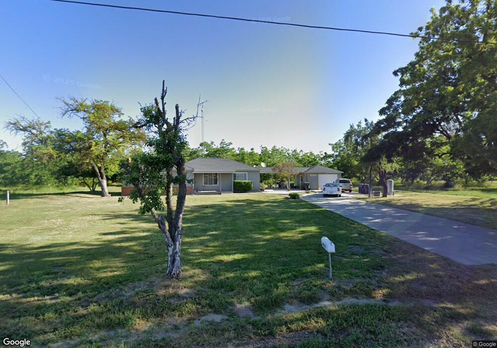
4819 Underhill Rd Turlock, CA 95380
Estimated Value: $486,000 - $667,000
2
Beds
1
Bath
1,378
Sq Ft
$408/Sq Ft
Est. Value
About This Home
This home is located at 4819 Underhill Rd, Turlock, CA 95380 and is currently estimated at $562,124, approximately $407 per square foot. 4819 Underhill Rd is a home located in Stanislaus County with nearby schools including Denair Elementary School, Denair Middle School, and Denair High School.
Ownership History
Date
Name
Owned For
Owner Type
Purchase Details
Closed on
Feb 17, 2000
Sold by
Redmon Robert L and Redmon Family T
Bought by
Ness Theodore D and Ness Janet T
Current Estimated Value
Purchase Details
Closed on
Jan 25, 1999
Sold by
Redmon Robert L and Redmon Family T
Bought by
Ness Theodore D and Ness Janet T
Purchase Details
Closed on
Jan 26, 1998
Sold by
Redmon Robert L and Redmon Family T
Bought by
Ness Theodore D and Ness Janet T
Purchase Details
Closed on
Oct 1, 1997
Sold by
Lowe Redmon Robert
Bought by
Ness Theodore D and Ness Janet T
Purchase Details
Closed on
May 1, 1996
Sold by
Redmon Robert Lowe and Redmon Leona Joyce
Bought by
Ness Theodore D and Ness Janet T
Purchase Details
Closed on
Apr 19, 1996
Sold by
Redmon Robert Lowe and Redmon Leona Joyce
Bought by
Redmon Robert Lowe and Redmon Leona Joyce
Create a Home Valuation Report for This Property
The Home Valuation Report is an in-depth analysis detailing your home's value as well as a comparison with similar homes in the area
Purchase History
| Date | Buyer | Sale Price | Title Company |
|---|---|---|---|
| Ness Theodore D | -- | -- | |
| Ness Theodore D | -- | -- | |
| Ness Theodore D | -- | -- | |
| Ness Theodore D | -- | -- | |
| Redmon Robert Lowe | -- | -- | |
| Ness Theodore D | -- | Stewart Title | |
| Redmon Robert Lowe | -- | -- |
Source: Public Records
Tax History
| Year | Tax Paid | Tax Assessment Tax Assessment Total Assessment is a certain percentage of the fair market value that is determined by local assessors to be the total taxable value of land and additions on the property. | Land | Improvement |
|---|---|---|---|---|
| 2025 | $915 | $74,004 | $30,174 | $43,830 |
| 2024 | $894 | $72,554 | $29,583 | $42,971 |
| 2023 | $869 | $71,132 | $29,003 | $42,129 |
| 2022 | $851 | $69,738 | $28,435 | $41,303 |
| 2021 | $847 | $68,372 | $27,878 | $40,494 |
| 2020 | $839 | $67,672 | $27,593 | $40,079 |
| 2019 | $797 | $66,346 | $27,052 | $39,294 |
| 2018 | $801 | $65,046 | $26,522 | $38,524 |
| 2017 | $779 | $63,771 | $26,002 | $37,769 |
| 2016 | $774 | $62,522 | $25,493 | $37,029 |
| 2015 | $738 | $61,584 | $25,111 | $36,473 |
| 2014 | $739 | $60,379 | $24,620 | $35,759 |
Source: Public Records
Map
Nearby Homes
- 4513 E Tuolumne Rd
- 3600 E Hawkeye Ave
- 2912 Marazan St
- 1980 Wyndfair Dr
- 716 N Daubenberger Rd
- 2970 E Tuolumne Rd
- 2943 Castleview Dr
- 2953 Castleview Dr
- 3416 N Gratton Rd
- 4115 Valkommen Dr
- 3620 E Monte Vista Ave
- 425 Corello St
- 2500 Mira Flores Dr
- 2787 Millstream Ln
- 1425 Forest Dr
- 2513 Feathermint Ln
- 2355 El Capitan Dr
- 2521 East Ave
- 3324 Dillion Way
- 3230 Dillion Way
- 4919 Underhill Rd
- 1024 N Gratton Rd
- 5025 Underhill Rd
- 1013 N Gratton Rd
- 5125 Underhill Rd
- 4780 E Hawkeye Ave
- 5200 Underhill Rd
- 1550 N Gratton Rd
- 901 N Gratton Rd
- 830 N Gratton Rd
- 1620 N Gratton Rd
- 4601 E Hawkeye Ave
- 4451 E Hawkeye Ave
- 4318 E Hawkeye Ave
- 1736 N Gratton Rd
- 1830 N Gratton Rd
- 1921 N Gratton Rd
- 1818 N Gratton Rd
- 5125 Moberg Rd
- 5315 Moberg Rd
Your Personal Tour Guide
Ask me questions while you tour the home.