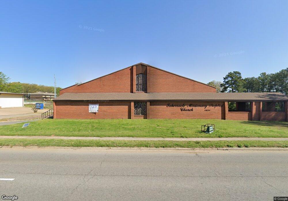
4820 W 65th St Little Rock, AR 72209
Wakefield NeighborhoodEstimated Value: $1,360,803
--
Bed
--
Bath
7,440
Sq Ft
$183/Sq Ft
Est. Value
About This Home
This home is located at 4820 W 65th St, Little Rock, AR 72209 and is currently priced at $1,360,803, approximately $182 per square foot. 4820 W 65th St is a home with nearby schools including Wakefield Elementary School, Cloverdale Middle School, and Little Rock Southwest High School.
Ownership History
Date
Name
Owned For
Owner Type
Purchase Details
Closed on
Jan 5, 2016
Sold by
Tabernacle Baptist Church
Bought by
Tabernacle Missionary Church
Current Estimated Value
Purchase Details
Closed on
Dec 11, 1997
Sold by
Wakefield Baptist Church
Bought by
Tabernacle Baptist Church
Home Financials for this Owner
Home Financials are based on the most recent Mortgage that was taken out on this home.
Original Mortgage
$250,000
Interest Rate
7.18%
Mortgage Type
Purchase Money Mortgage
Create a Home Valuation Report for This Property
The Home Valuation Report is an in-depth analysis detailing your home's value as well as a comparison with similar homes in the area
Home Values in the Area
Average Home Value in this Area
Purchase History
| Date | Buyer | Sale Price | Title Company |
|---|---|---|---|
| Tabernacle Missionary Church | -- | Attorney | |
| Tabernacle Baptist Church | $550,000 | First Security Title Company |
Source: Public Records
Mortgage History
| Date | Status | Borrower | Loan Amount |
|---|---|---|---|
| Previous Owner | Tabernacle Baptist Church | $250,000 |
Source: Public Records
Tax History Compared to Growth
Tax History
| Year | Tax Paid | Tax Assessment Tax Assessment Total Assessment is a certain percentage of the fair market value that is determined by local assessors to be the total taxable value of land and additions on the property. | Land | Improvement |
|---|---|---|---|---|
| 2025 | $2,415 | $34,500 | $34,500 | -- |
| 2024 | $2,415 | $34,500 | $34,500 | -- |
| 2023 | $2,415 | $34,500 | $34,500 | $0 |
| 2022 | $2,415 | $34,500 | $34,500 | $0 |
| 2021 | $2,415 | $34,500 | $34,500 | $0 |
| 2020 | $2,415 | $34,500 | $34,500 | $0 |
| 2019 | $2,415 | $34,500 | $34,500 | $0 |
| 2018 | $2,415 | $34,500 | $34,500 | $0 |
| 2017 | $2,415 | $34,500 | $34,500 | $0 |
| 2016 | $14,907 | $212,950 | $0 | $212,950 |
| 2015 | $14,928 | $212,950 | $0 | $212,950 |
| 2014 | $14,928 | $212,950 | $0 | $212,950 |
Source: Public Records
Map
Nearby Homes
- 22 Daven Ct
- 31 Allyson Cir
- 19 Daven Ct
- 29 Rugby Dr
- 37 Sheffield Dr
- 40 Wellford Dr
- 5303 W 57th St
- 14 Mansfield Dr
- 4905 Gum Springs Rd Unit 4907 Gum Springs Rd
- 5419 Western Ln
- 5900-5908 Geyer Springs
- 000 Young Rd
- 48 Rosemoor Dr
- 5215 Gum Springs Rd
- 7102 Geyer Springs Rd
- 24 Rosemoor Dr
- 5223 Mabelvale Pike
- 00 S University Ave
- 7 Linkay Ct
- 5424 W 51st St
- 6 Guardian Ct
- 0 Guardian Ct
- 10 Guardian Ct
- 8 Guardian Ct
- 4 Guardian Ct
- 6313 Butler Rd
- 6402 Butler Rd
- 6 Cambridge Cir
- 5 Cambridge Cir
- 0 Cambridge Cir
- 4 Cambridge Cir
- 3 Cambridge Cir
- 5001 W 65th St
- 5001 W 65th St
- 6320 Butler Rd
- 6700 W Wakefield Dr
- 6612 W Wakefield Dr
- 6608 W Wakefield Dr
- 6702 W Wakefield Dr
- 6310 Butler Rd