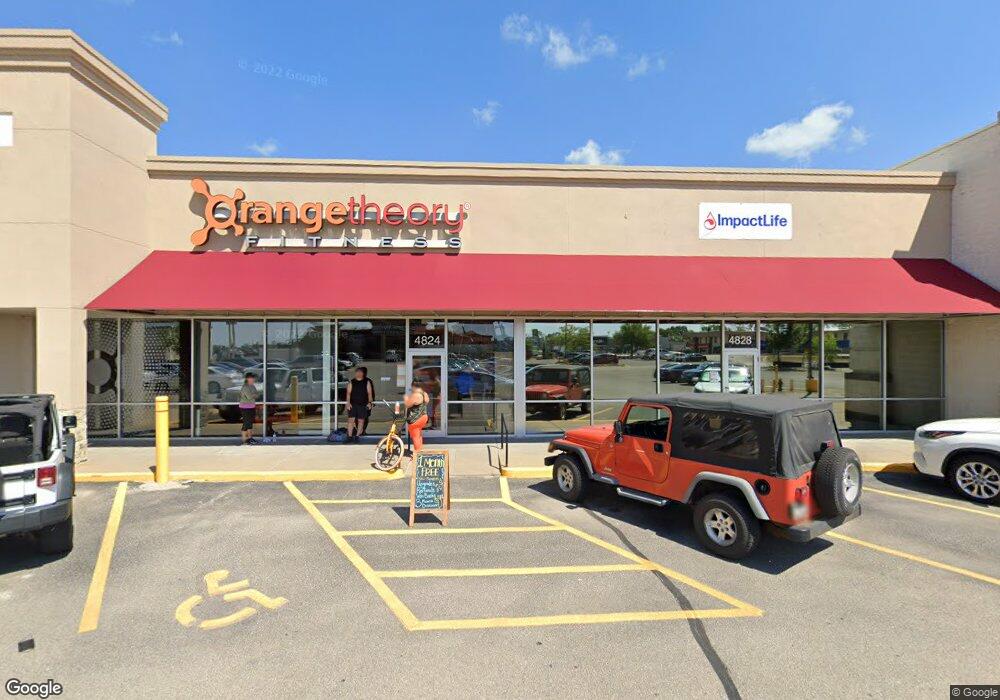
4824 1st Ave NE Cedar Rapids, IA 52402
Estimated Value: $16,602,487
--
Bed
--
Bath
2,850
Sq Ft
$5,825/Sq Ft
Est. Value
About This Home
This home is located at 4824 1st Ave NE, Cedar Rapids, IA 52402 and is currently estimated at $16,602,487, approximately $5,825 per square foot. 4824 1st Ave NE is a home located in Linn County with nearby schools including Novak Elementary School, Oak Ridge School, and Linn-Mar High School.
Ownership History
Date
Name
Owned For
Owner Type
Purchase Details
Closed on
Feb 9, 2006
Sold by
Lindale Crossing Associates Lp
Bought by
Lindale Holdings Ii Llc
Current Estimated Value
Home Financials for this Owner
Home Financials are based on the most recent Mortgage that was taken out on this home.
Original Mortgage
$7,060,000
Interest Rate
6.3%
Mortgage Type
Unknown
Purchase Details
Closed on
Sep 16, 2002
Sold by
Lindale Crossing Lc
Bought by
Lindale Crossing Associates Ltd Prtnrshp
Create a Home Valuation Report for This Property
The Home Valuation Report is an in-depth analysis detailing your home's value as well as a comparison with similar homes in the area
Home Values in the Area
Average Home Value in this Area
Purchase History
| Date | Buyer | Sale Price | Title Company |
|---|---|---|---|
| Lindale Holdings Ii Llc | $8,824,500 | Chicago Title Insurance Comp | |
| Lindale Crossing Associates Ltd Prtnrshp | $6,183,000 | -- |
Source: Public Records
Mortgage History
| Date | Status | Borrower | Loan Amount |
|---|---|---|---|
| Closed | Lindale Holdings Ii Llc | $7,060,000 |
Source: Public Records
Tax History Compared to Growth
Tax History
| Year | Tax Paid | Tax Assessment Tax Assessment Total Assessment is a certain percentage of the fair market value that is determined by local assessors to be the total taxable value of land and additions on the property. | Land | Improvement |
|---|---|---|---|---|
| 2025 | $162,878 | $4,957,600 | $1,365,000 | $3,592,600 |
| 2024 | $171,576 | $4,353,300 | $1,365,000 | $2,988,300 |
| 2023 | $171,576 | $4,353,300 | $1,365,000 | $2,988,300 |
| 2022 | $166,926 | $4,617,400 | $1,365,000 | $3,252,400 |
| 2021 | $170,628 | $7,869,800 | $1,365,000 | $6,504,800 |
| 2020 | $170,628 | $7,920,000 | $1,365,000 | $6,555,000 |
| 2019 | $167,132 | $4,642,500 | $1,365,000 | $3,277,500 |
| 2018 | $163,746 | $4,642,500 | $1,365,000 | $3,277,500 |
| 2017 | $134,360 | $3,807,200 | $1,092,000 | $2,715,200 |
| 2016 | $137,795 | $3,807,200 | $1,092,000 | $2,715,200 |
| 2015 | $141,992 | $3,926,808 | $1,092,000 | $2,834,808 |
| 2014 | $139,460 | $3,926,808 | $1,092,000 | $2,834,808 |
| 2013 | $147,500 | $3,926,808 | $1,092,000 | $2,834,808 |
Source: Public Records
Map
Nearby Homes
- 1013 Blairs Ferry R
- 4551 Maureen Dr SE Unit 33
- 4571 Maureen Dr SE Unit 43
- 1145 Blairs Ferry Rd
- 850 Kerry Ln SE Unit 23
- 955 Bridgit Ln SE
- 869 Kerry Ln SE Unit 46
- 809 Kerry Ln SE Unit 72
- 809 Kerry Ln SE Unit 66
- 849 Kerry Ln SE Unit 58
- 1005 Bridgit Ct SE Unit 7
- 1015 Woodland Heights Ct SE Unit 12
- 340 Cemar Ct
- 203 Cemar Ct
- 4410 Maureen Ct SE Unit 189
- 6030 Northridge Point SE
- 112 Merion Blvd
- 655 W 9th Ave
- 103 Merion Blvd
- 5030 Charter Oak Ln SE
- 4824 1st Ave NE Unit 100
- 4824 1st Ave NE Unit 200
- 4828 1st Ave NE
- 4828 1st Ave NE
- 4840 1st Ave NE
- 4850 1st Ave NE
- 1020 Twixt Town Rd
- 4854 1st Ave NE
- 0 Twixt Town Rd
- 4862 1st Ave NE
- 1170 Twixt Town Rd NE
- 1020 Twixt Town Rd
- 4870 1st Ave NE
- 115 Southview Dr
- 1190 Twixt Town Rd
- 1190 Twixt Town Rd NE
- 1190 Twixt Town Rd NE Unit 2
- 1190 Twixt Town Rd NE Unit 1
- 245 & 235 Delong Dr
- 640 Marion Blvd