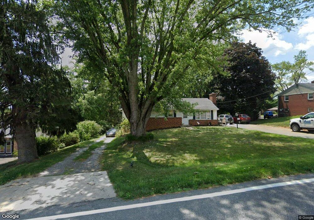
4825 Dave Rill Rd Hampstead, MD 21074
Estimated Value: $379,552 - $502,000
--
Bed
1
Bath
2,508
Sq Ft
$174/Sq Ft
Est. Value
About This Home
This home is located at 4825 Dave Rill Rd, Hampstead, MD 21074 and is currently estimated at $436,638, approximately $174 per square foot. 4825 Dave Rill Rd is a home located in Carroll County with nearby schools including Manchester Elementary School, North Carroll Middle School, and Manchester Valley High School.
Ownership History
Date
Name
Owned For
Owner Type
Purchase Details
Closed on
Jan 11, 2007
Sold by
Shaffer Janet A
Bought by
Shaffer Janet A and Shaffer Herbert E
Current Estimated Value
Home Financials for this Owner
Home Financials are based on the most recent Mortgage that was taken out on this home.
Original Mortgage
$170,000
Outstanding Balance
$102,381
Interest Rate
6.35%
Mortgage Type
Stand Alone Refi Refinance Of Original Loan
Estimated Equity
$334,257
Purchase Details
Closed on
Dec 5, 2006
Sold by
Shaffer Janet A
Bought by
Shaffer Janet A and Shaffer Herbert E
Home Financials for this Owner
Home Financials are based on the most recent Mortgage that was taken out on this home.
Original Mortgage
$170,000
Outstanding Balance
$102,381
Interest Rate
6.35%
Mortgage Type
Stand Alone Refi Refinance Of Original Loan
Estimated Equity
$334,257
Create a Home Valuation Report for This Property
The Home Valuation Report is an in-depth analysis detailing your home's value as well as a comparison with similar homes in the area
Home Values in the Area
Average Home Value in this Area
Purchase History
| Date | Buyer | Sale Price | Title Company |
|---|---|---|---|
| Shaffer Janet A | $170,000 | -- | |
| Shaffer Janet A | $170,000 | -- |
Source: Public Records
Mortgage History
| Date | Status | Borrower | Loan Amount |
|---|---|---|---|
| Open | Shaffer Janet A | $170,000 | |
| Closed | Shaffer Janet A | $170,000 |
Source: Public Records
Tax History Compared to Growth
Tax History
| Year | Tax Paid | Tax Assessment Tax Assessment Total Assessment is a certain percentage of the fair market value that is determined by local assessors to be the total taxable value of land and additions on the property. | Land | Improvement |
|---|---|---|---|---|
| 2025 | $3,424 | $322,900 | $90,000 | $232,900 |
| 2024 | $3,424 | $300,433 | $0 | $0 |
| 2023 | $3,173 | $277,967 | $0 | $0 |
| 2022 | $2,921 | $255,500 | $90,000 | $165,500 |
| 2021 | $5,575 | $236,067 | $0 | $0 |
| 2020 | $2,508 | $216,633 | $0 | $0 |
| 2019 | $2,288 | $197,200 | $90,000 | $107,200 |
| 2018 | $2,243 | $194,967 | $0 | $0 |
| 2017 | $2,218 | $192,733 | $0 | $0 |
| 2016 | -- | $190,500 | $0 | $0 |
| 2015 | -- | $190,500 | $0 | $0 |
| 2014 | -- | $190,500 | $0 | $0 |
Source: Public Records
Map
Nearby Homes
- 18310 Upper Beckleysville Rd
- 163 Gorsuch Rd
- 2439 Fairmount Rd Unit 35
- 0 Dave Rill Rd
- 2461 Fairmount Rd
- 18906 Falls Rd
- 4150 Sommerfield Dr
- 1208 Wynside Ln
- 4050 Wheatland Ct
- 4210 Upper Beckleysville Rd
- 4929 Millers Station Rd
- 4250 Flail Dr
- 4148 Sellman Dr
- 4112 Creswell Terrace
- 4131 Shanelle Ct
- 4138 Hillcrest Ave
- 4098 Janae Dr
- 1809 Hanover Pike
- 4843 Millers Station Rd
- 1909 Hanover Pike
- 4827 Dave Rill Rd
- 4823 Dave Rill Rd
- 4821 Dave Rill Rd
- 4824 Westfield Dr
- 4822 Westfield Dr
- 4822 Dave Rill Rd
- 4826 Westfield Dr
- 4829 Dave Rill Rd
- 4820 Westfield Dr
- 4819 Dave Rill Rd
- 4818 Westfield Dr
- 4817 Dave Rill Rd
- 4823 Westfield Dr
- 4816 Westfield Dr
- 4825 Westfield Dr
- 18324 Upper Beckleysville Rd
- 4821 Westfield Dr
- 18328 Upper Beckleysville Rd
- 4814 Westfield Dr
- 4829 Westfield Dr