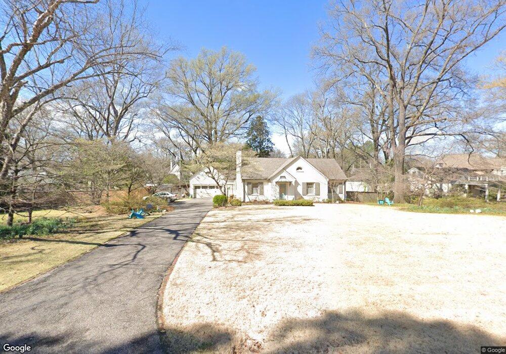
4828 Shady Grove Rd Memphis, TN 38117
Audubon Park NeighborhoodEstimated Value: $446,000 - $567,000
5
Beds
4
Baths
3,086
Sq Ft
$167/Sq Ft
Est. Value
About This Home
This home is located at 4828 Shady Grove Rd, Memphis, TN 38117 and is currently estimated at $514,544, approximately $166 per square foot. 4828 Shady Grove Rd is a home located in Shelby County with nearby schools including White Station Elementary School, White Station High, and White Station Middle.
Ownership History
Date
Name
Owned For
Owner Type
Purchase Details
Closed on
Sep 30, 1999
Sold by
Burr Griffith C and Burr Rebecca B
Bought by
Link Thomas E and Link Angela B
Current Estimated Value
Home Financials for this Owner
Home Financials are based on the most recent Mortgage that was taken out on this home.
Original Mortgage
$228,000
Outstanding Balance
$67,739
Interest Rate
7.62%
Estimated Equity
$446,805
Create a Home Valuation Report for This Property
The Home Valuation Report is an in-depth analysis detailing your home's value as well as a comparison with similar homes in the area
Home Values in the Area
Average Home Value in this Area
Purchase History
| Date | Buyer | Sale Price | Title Company |
|---|---|---|---|
| Link Thomas E | $285,000 | -- |
Source: Public Records
Mortgage History
| Date | Status | Borrower | Loan Amount |
|---|---|---|---|
| Open | Link Thomas E | $228,000 |
Source: Public Records
Tax History Compared to Growth
Tax History
| Year | Tax Paid | Tax Assessment Tax Assessment Total Assessment is a certain percentage of the fair market value that is determined by local assessors to be the total taxable value of land and additions on the property. | Land | Improvement |
|---|---|---|---|---|
| 2025 | $3,322 | $134,800 | $52,125 | $82,675 |
| 2024 | $3,322 | $98,000 | $38,250 | $59,750 |
| 2023 | $5,970 | $98,000 | $38,250 | $59,750 |
| 2022 | $5,970 | $98,000 | $38,250 | $59,750 |
| 2021 | $6,040 | $98,000 | $38,250 | $59,750 |
| 2020 | $6,424 | $88,650 | $38,250 | $50,400 |
| 2019 | $6,424 | $88,650 | $38,250 | $50,400 |
| 2018 | $6,424 | $88,650 | $38,250 | $50,400 |
| 2017 | $3,200 | $77,850 | $38,250 | $39,600 |
| 2016 | $2,993 | $68,500 | $0 | $0 |
| 2014 | $2,993 | $68,500 | $0 | $0 |
Source: Public Records
Map
Nearby Homes
- 4859 Gwynne Rd
- 4772 Gwynne Rd
- 356 Clove Dr
- 4736 All Spice Dr Unit 71E
- 427 S Perkins Rd Unit 427-2
- 4916 Greenway Ave
- 4654 Hemlock Ln
- 4926 Greenway Ave
- 4903 Greenway Ave
- 378 Caraway Cove Unit 10A
- 435 Fairfield Cir
- 5071 Anchor Cove
- 154 Perkins Extension
- 405 S Perkins Rd Unit 430
- 5055 Greenway Rd
- 4679 Walnut Grove Rd
- 4948 Fairfield Cir
- 137 Perkins Extension
- 455 S Perkins Rd Unit 3
- 5094 Cole Rd
- 4842 Shady Grove Rd
- 218 Colonial Rd
- 4810 Shady Grove Rd
- 4858 Shady Grove Rd
- 4837 Shady Grove Rd
- 208 Colonial Rd
- 4821 Shady Grove Rd
- 4861 Shady Grove Rd
- 4809 Shady Grove Rd
- 196 Colonial Rd
- 4862 Shady Grove Rd
- 4855 Roane Rd
- 241 Colonial Rd
- 4795 Shady Grove Rd
- 207 Colonial Rd
- 217 Colonial Rd
- 4872 Shady Grove Rd
- 4871 Shady Grove Rd
- 184 Colonial Rd
- 229 Colonial Rd