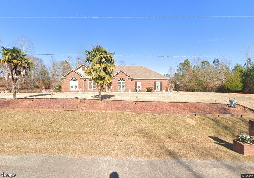
483 Boyd Branch Dr Upatoi, GA 31829
Estimated Value: $467,000 - $504,000
4
Beds
5
Baths
3,340
Sq Ft
$145/Sq Ft
Est. Value
About This Home
This home is located at 483 Boyd Branch Dr, Upatoi, GA 31829 and is currently estimated at $485,644, approximately $145 per square foot. 483 Boyd Branch Dr is a home with nearby schools including Pine Ridge Elementary School, Cogburn Woods Elementary School, and Harris County Carver Middle School.
Ownership History
Date
Name
Owned For
Owner Type
Purchase Details
Closed on
Oct 27, 2006
Sold by
Wright Building Co Llc
Bought by
Sheridan Kelvin G
Current Estimated Value
Home Financials for this Owner
Home Financials are based on the most recent Mortgage that was taken out on this home.
Original Mortgage
$265,275
Outstanding Balance
$157,440
Interest Rate
6.27%
Mortgage Type
New Conventional
Estimated Equity
$328,204
Purchase Details
Closed on
Jun 14, 2006
Sold by
Moon Family Corp
Bought by
Wright Building Company Llc
Home Financials for this Owner
Home Financials are based on the most recent Mortgage that was taken out on this home.
Original Mortgage
$200,000
Interest Rate
6.57%
Mortgage Type
New Conventional
Purchase Details
Closed on
Sep 29, 2003
Bought by
Moon Family Corp
Create a Home Valuation Report for This Property
The Home Valuation Report is an in-depth analysis detailing your home's value as well as a comparison with similar homes in the area
Home Values in the Area
Average Home Value in this Area
Purchase History
| Date | Buyer | Sale Price | Title Company |
|---|---|---|---|
| Sheridan Kelvin G | $354,000 | -- | |
| Wright Building Company Llc | $60,000 | -- | |
| Moon Family Corp | $135,000 | -- |
Source: Public Records
Mortgage History
| Date | Status | Borrower | Loan Amount |
|---|---|---|---|
| Open | Sheridan Kelvin G | $265,275 | |
| Closed | Sheridan Kelvin G | $88,400 | |
| Previous Owner | Wright Building Company Llc | $200,000 |
Source: Public Records
Tax History Compared to Growth
Tax History
| Year | Tax Paid | Tax Assessment Tax Assessment Total Assessment is a certain percentage of the fair market value that is determined by local assessors to be the total taxable value of land and additions on the property. | Land | Improvement |
|---|---|---|---|---|
| 2024 | $1,504 | $167,907 | $17,600 | $150,307 |
| 2023 | $468 | $139,303 | $15,400 | $123,903 |
| 2022 | $1,149 | $139,303 | $15,400 | $123,903 |
| 2021 | $828 | $125,461 | $15,400 | $110,061 |
| 2020 | $1,119 | $125,461 | $15,400 | $110,061 |
| 2019 | $1,192 | $124,799 | $15,400 | $109,399 |
| 2018 | $1,338 | $124,799 | $15,400 | $109,399 |
| 2017 | $1,441 | $124,799 | $15,400 | $109,399 |
| 2016 | $1,358 | $122,713 | $15,400 | $107,313 |
| 2015 | $1,014 | $105,432 | $15,400 | $90,032 |
| 2014 | $1,197 | $109,809 | $15,400 | $94,409 |
| 2013 | -- | $115,827 | $26,400 | $89,427 |
Source: Public Records
Map
Nearby Homes
- 0 Boyd Ct
- 8585 Mckee Rd
- 7019 Kendall Creek Dr
- 8701 Mckee Rd
- 8715 Mckee Rd
- 8711 Mckee Rd
- 8695 Mckee Rd
- 8705 Mckee Rd
- 57 Old Chimney Ct
- Cypress Plan at Bowers Creek
- Cannaberra Plan at Bowers Creek
- Belmont Plan at Bowers Creek
- Jackson Plan at Bowers Creek
- Alder Plan at Bowers Creek
- Oakwood Plan at Bowers Creek
- Magnolia Plan at Bowers Creek
- Ash II Plan at Bowers Creek
- Harrison Plan at Bowers Creek
- 7524 Hedgestone Dr
- 7901 Shallowford Rd
- 553 Boyd Branch Dr
- 485 Boyd Branch Dr
- 613 Boyd Branch Dr
- 20 Kendall Ct
- 61 Wood Duck Ct
- 663 Boyd Branch Dr
- 664 Boyd Branch Dr
- 473 Boyd Branch Dr
- 31 Hearld Ct
- 66 Wood Duck Ct
- 437 Boyd Branch Dr
- 0 Wood Duck Ct Unit 7572174
- 81 Kendall Ct
- 113 Hearld Ct
- 681 Boyd Branch Dr
- 74 Kendall Ct
- 670 Boyd Branch Dr
- 73 Wood Duck Ct
- 60 Wood Duck Ct
- 409 Boyd Branch Dr