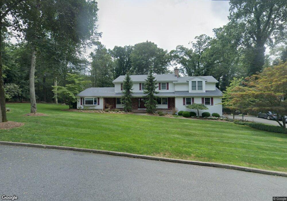
483 Mark Rd Allendale, NJ 07401
Estimated Value: $1,479,828 - $1,589,000
Studio
--
Bath
3,649
Sq Ft
$419/Sq Ft
Est. Value
About This Home
This home is located at 483 Mark Rd, Allendale, NJ 07401 and is currently estimated at $1,528,457, approximately $418 per square foot. 483 Mark Rd is a home located in Bergen County with nearby schools including Hillside Elementary School, Brookside Elementary School, and Northern Highlands Reg High School.
Ownership History
Date
Name
Owned For
Owner Type
Purchase Details
Closed on
Jul 2, 2003
Sold by
Magrath Paul
Bought by
Hitt Lyle and Hitt Susan
Current Estimated Value
Home Financials for this Owner
Home Financials are based on the most recent Mortgage that was taken out on this home.
Original Mortgage
$525,000
Outstanding Balance
$223,372
Interest Rate
5.27%
Estimated Equity
$1,305,085
Create a Home Valuation Report for This Property
The Home Valuation Report is an in-depth analysis detailing your home's value as well as a comparison with similar homes in the area
Home Values in the Area
Average Home Value in this Area
Purchase History
| Date | Buyer | Sale Price | Title Company |
|---|---|---|---|
| Hitt Lyle | $860,000 | -- |
Source: Public Records
Mortgage History
| Date | Status | Borrower | Loan Amount |
|---|---|---|---|
| Open | Hitt Lyle | $525,000 |
Source: Public Records
Tax History
| Year | Tax Paid | Tax Assessment Tax Assessment Total Assessment is a certain percentage of the fair market value that is determined by local assessors to be the total taxable value of land and additions on the property. | Land | Improvement |
|---|---|---|---|---|
| 2025 | $24,770 | $1,241,000 | $628,200 | $612,800 |
| 2024 | $23,268 | $1,174,500 | $595,700 | $578,800 |
| 2023 | $22,902 | $1,058,100 | $490,500 | $567,600 |
| 2022 | $22,784 | $1,000,600 | $465,500 | $535,100 |
| 2021 | $22,182 | $944,300 | $430,500 | $513,800 |
| 2020 | $21,604 | $895,300 | $420,500 | $474,800 |
| 2019 | $21,031 | $895,300 | $420,500 | $474,800 |
| 2018 | $18,629 | $811,000 | $420,500 | $390,500 |
| 2017 | $18,556 | $811,000 | $420,500 | $390,500 |
| 2016 | $18,580 | $811,000 | $420,500 | $390,500 |
| 2015 | $18,207 | $811,000 | $420,500 | $390,500 |
| 2014 | $18,587 | $780,000 | $420,500 | $359,500 |
Source: Public Records
Map
Nearby Homes
- 314 Meadowbrook Rd
- 89 Barrett Ln
- 12 Sandburg Ct
- 16 Sandburg Ct Unit 16
- 37-1 Tamaron Dr
- 53 Lockwood Dr
- 8 Masterson Ct
- 8 Edgewood Ave
- 257 Franklin Ave
- 754 Wyckoff Ave
- 290 Wyckoff Ave
- 373 W Crescent Ave
- 260 W Allendale Ave
- 4 Mill Brook Ln
- 15 Old Oak Dr
- 4 Lee Ct
- 8 Crestwood Mews
- 444B Bromley Place Unit B
- 444B Bromley Place
- 77 Myrtle Ave
Your Personal Tour Guide
Ask me questions while you tour the home.