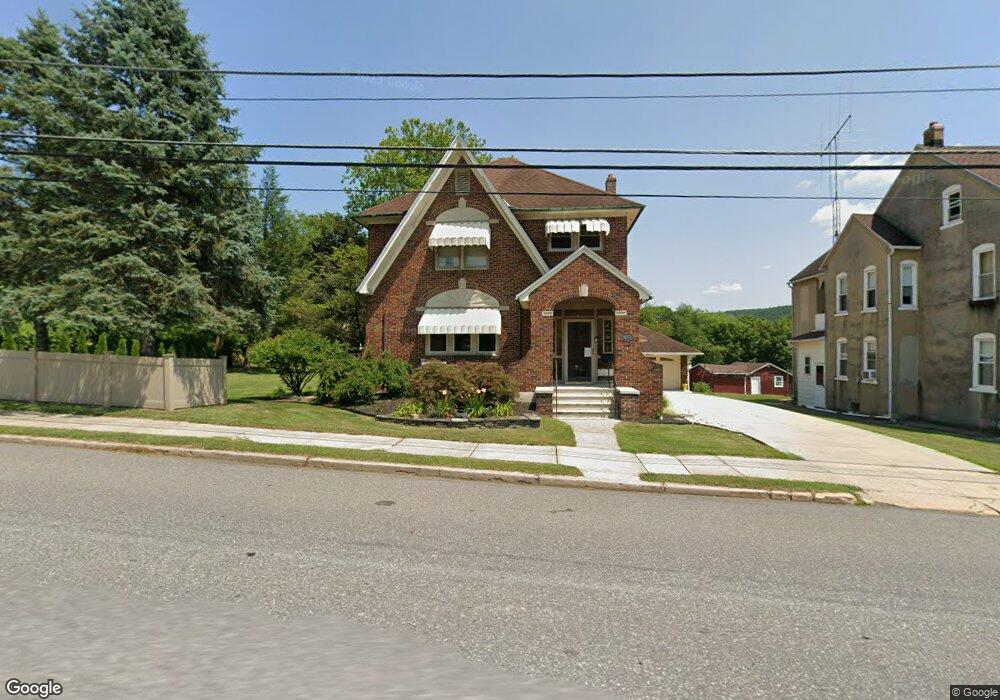
483 S 9th St Lehighton, PA 18235
Estimated Value: $292,514 - $396,000
3
Beds
1
Bath
2,182
Sq Ft
$150/Sq Ft
Est. Value
About This Home
This home is located at 483 S 9th St, Lehighton, PA 18235 and is currently estimated at $328,379, approximately $150 per square foot. 483 S 9th St is a home located in Carbon County with nearby schools including Lehighton Area High School, Sts. Peter & Paul School, and Valley Ridge Academy.
Ownership History
Date
Name
Owned For
Owner Type
Purchase Details
Closed on
Oct 29, 2004
Bought by
Andrew Vaughn A and Andrew Lisa A
Current Estimated Value
Create a Home Valuation Report for This Property
The Home Valuation Report is an in-depth analysis detailing your home's value as well as a comparison with similar homes in the area
Home Values in the Area
Average Home Value in this Area
Purchase History
| Date | Buyer | Sale Price | Title Company |
|---|---|---|---|
| Andrew Vaughn A | $180,500 | -- |
Source: Public Records
Tax History Compared to Growth
Tax History
| Year | Tax Paid | Tax Assessment Tax Assessment Total Assessment is a certain percentage of the fair market value that is determined by local assessors to be the total taxable value of land and additions on the property. | Land | Improvement |
|---|---|---|---|---|
| 2025 | $4,132 | $51,800 | $5,500 | $46,300 |
| 2024 | $3,531 | $46,600 | $5,500 | $41,100 |
| 2023 | $3,496 | $46,600 | $5,500 | $41,100 |
| 2022 | $3,496 | $46,600 | $5,500 | $41,100 |
| 2021 | $3,373 | $46,600 | $5,500 | $41,100 |
| 2020 | $3,291 | $46,600 | $5,500 | $41,100 |
| 2019 | $3,152 | $46,600 | $5,500 | $41,100 |
| 2018 | $3,082 | $46,600 | $5,500 | $41,100 |
| 2017 | $3,058 | $46,600 | $5,500 | $41,100 |
| 2016 | -- | $46,600 | $5,500 | $41,100 |
| 2015 | -- | $46,600 | $5,500 | $41,100 |
| 2014 | -- | $46,600 | $5,500 | $41,100 |
Source: Public Records
Map
Nearby Homes
- 410 S 8th St
- 639 Iron St
- 17 Mahoning Dr E
- 522 Iron St
- 0 Emily Plan at Summit Point Unit PACC2005480
- 0 Copper Beech Plan at Summit Ridge Unit PACC2005478
- 0 Black Cherry Plan at Summit Ridge Unit PACC2005474
- 0 Ridge
- 193 S 4th St
- 193 S 4th St Unit 191-193
- 196 S 3rd St
- 12 2nd Ave
- 236 S 2nd St
- 230 S 2nd St
- 117 N 4th St
- 142 Bankway St
- 215 N 4th St
- 470 N 8th St
- 70 W Highland Ln
- 231 Coal St