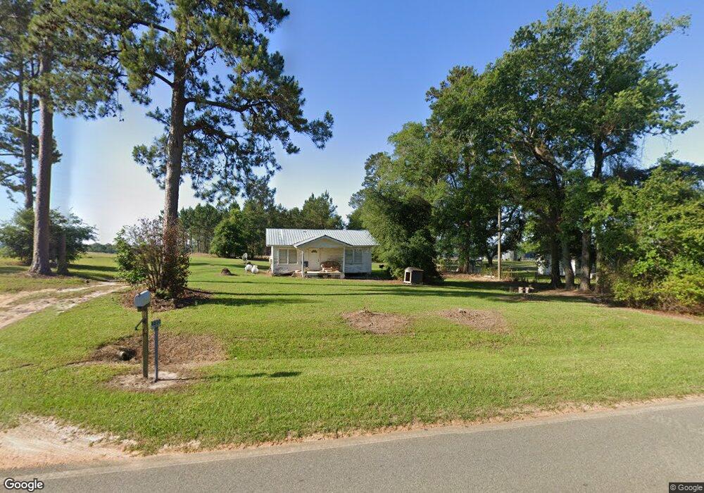
4830 Coffee Rd Quitman, GA 31643
Estimated Value: $86,000 - $1,537,111
--
Bed
1
Bath
780
Sq Ft
$1,040/Sq Ft
Est. Value
About This Home
This home is located at 4830 Coffee Rd, Quitman, GA 31643 and is currently estimated at $811,556, approximately $1,040 per square foot. 4830 Coffee Rd is a home located in Brooks County with nearby schools including North Brooks Elementary School.
Ownership History
Date
Name
Owned For
Owner Type
Purchase Details
Closed on
May 14, 2010
Sold by
Price Roger T
Bought by
Release Of Conservation Use Covenant
Current Estimated Value
Purchase Details
Closed on
Dec 10, 2009
Sold by
Price Roger T
Bought by
Conservation Easement
Purchase Details
Closed on
Mar 21, 2008
Bought by
Conservation Use Covenant Recording
Purchase Details
Closed on
May 3, 2007
Sold by
Price Herbert T
Bought by
Price Roger T
Purchase Details
Closed on
Sep 8, 1986
Sold by
Hiers Mrs H B
Bought by
Porter Hazel H
Create a Home Valuation Report for This Property
The Home Valuation Report is an in-depth analysis detailing your home's value as well as a comparison with similar homes in the area
Home Values in the Area
Average Home Value in this Area
Purchase History
| Date | Buyer | Sale Price | Title Company |
|---|---|---|---|
| Release Of Conservation Use Covenant | -- | -- | |
| Conservation Easement | -- | -- | |
| Conservation Use Covenant Recording | -- | -- | |
| Price Roger T | -- | -- | |
| Porter Hazel H | -- | -- |
Source: Public Records
Tax History Compared to Growth
Tax History
| Year | Tax Paid | Tax Assessment Tax Assessment Total Assessment is a certain percentage of the fair market value that is determined by local assessors to be the total taxable value of land and additions on the property. | Land | Improvement |
|---|---|---|---|---|
| 2025 | $7,855 | $649,680 | $128,760 | $520,920 |
| 2024 | $7,855 | $391,400 | $128,080 | $263,320 |
| 2023 | $1,263 | $126,400 | $112,680 | $13,720 |
| 2022 | $1,226 | $117,240 | $107,320 | $9,920 |
| 2021 | $1,135 | $98,720 | $89,560 | $9,160 |
| 2020 | $2,658 | $95,720 | $86,640 | $9,080 |
| 2019 | $1,044 | $85,800 | $77,160 | $8,640 |
| 2018 | $2,465 | $84,400 | $75,760 | $8,640 |
| 2017 | $980 | $84,080 | $75,760 | $8,320 |
| 2016 | $1,005 | $84,280 | $75,760 | $8,520 |
| 2015 | -- | $84,360 | $75,760 | $8,600 |
| 2014 | -- | $84,680 | $75,760 | $8,920 |
| 2013 | -- | $84,680 | $75,760 | $8,920 |
Source: Public Records
Map
Nearby Homes
- 9283 Tallokas Rd Unit 54/13
- 9283 Tallokas Rd
- 11439 Adel Hwy
- 85 Hitch St
- 165 Fletcher St
- 1136 Nesbitt Rd
- 237 Turkey Ridge Ln
- 1440 Peach Rd
- 2818 Dry Lake Rd
- 0 Spencer Rd
- 1038-BA Church St
- 302 Waterside Dr
- 431 Dry Lake Rd
- 2055 S Roberts St
- 714 Morris Ave
- 2275 Old Coffee Rd
- 1002 N Madison St
- 2051 W Pear St
- 304 W Rountree St
- 602 N Webster St