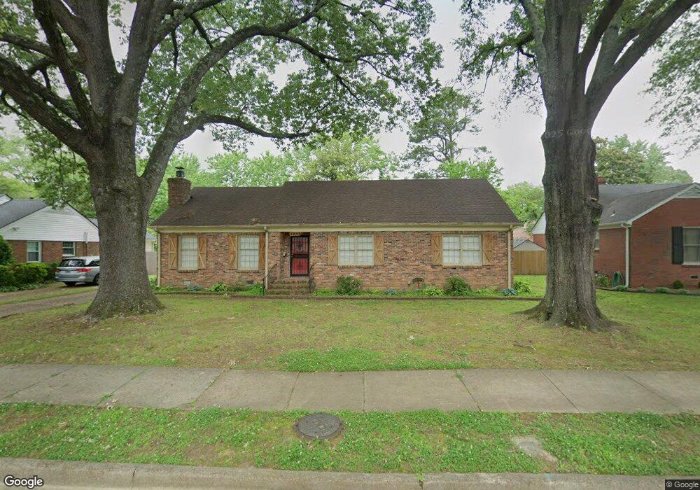
4830 Kaye Rd Memphis, TN 38117
Colonial Acres NeighborhoodEstimated Value: $270,324 - $301,000
4
Beds
2
Baths
1,806
Sq Ft
$156/Sq Ft
Est. Value
About This Home
This home is located at 4830 Kaye Rd, Memphis, TN 38117 and is currently estimated at $281,831, approximately $156 per square foot. 4830 Kaye Rd is a home located in Shelby County with nearby schools including Sea Isle Elementary School, Colonial Middle, and Overton High.
Ownership History
Date
Name
Owned For
Owner Type
Purchase Details
Closed on
Jan 9, 2015
Sold by
Mcneil Frederick L and Mcneil Leigh R
Bought by
Greer Madison
Current Estimated Value
Home Financials for this Owner
Home Financials are based on the most recent Mortgage that was taken out on this home.
Original Mortgage
$128,800
Outstanding Balance
$45,437
Interest Rate
4.01%
Mortgage Type
New Conventional
Estimated Equity
$236,394
Purchase Details
Closed on
Jun 26, 2008
Sold by
Klosky Jill and Klosky James
Bought by
Mcneil Frederick L and Mcneil Leigh R
Purchase Details
Closed on
Jul 29, 2004
Sold by
Galloway United Methodist Church
Bought by
Klosky James and Klosky Jill
Home Financials for this Owner
Home Financials are based on the most recent Mortgage that was taken out on this home.
Original Mortgage
$141,000
Interest Rate
6.22%
Mortgage Type
Purchase Money Mortgage
Create a Home Valuation Report for This Property
The Home Valuation Report is an in-depth analysis detailing your home's value as well as a comparison with similar homes in the area
Home Values in the Area
Average Home Value in this Area
Purchase History
| Date | Buyer | Sale Price | Title Company |
|---|---|---|---|
| Greer Madison | $163,800 | Realty Title & Escrow Co Inc | |
| Mcneil Frederick L | $169,500 | None Available | |
| Klosky James | $141,000 | -- |
Source: Public Records
Mortgage History
| Date | Status | Borrower | Loan Amount |
|---|---|---|---|
| Open | Greer Madison | $128,800 | |
| Previous Owner | Klosky James | $141,000 |
Source: Public Records
Tax History
| Year | Tax Paid | Tax Assessment Tax Assessment Total Assessment is a certain percentage of the fair market value that is determined by local assessors to be the total taxable value of land and additions on the property. | Land | Improvement |
|---|---|---|---|---|
| 2025 | $1,837 | $68,275 | $10,125 | $58,150 |
| 2024 | -- | $54,175 | $8,150 | $46,025 |
| 2023 | $3,300 | $54,175 | $8,150 | $46,025 |
| 2022 | $3,300 | $54,175 | $8,150 | $46,025 |
| 2021 | $3,644 | $63,025 | $8,150 | $54,875 |
| 2020 | $3,020 | $41,675 | $8,150 | $33,525 |
| 2019 | $3,020 | $41,675 | $8,150 | $33,525 |
| 2018 | $3,020 | $41,675 | $8,150 | $33,525 |
| 2017 | $1,713 | $41,675 | $8,150 | $33,525 |
| 2016 | $1,826 | $41,775 | $0 | $0 |
| 2014 | $1,826 | $41,775 | $0 | $0 |
Source: Public Records
Map
Nearby Homes
- 4856 Kaye Rd
- 1027 Colonial Rd
- 4921 Alrose Ave
- 866 Colonial Rd
- 4853 Marion Ave
- 4927 Hampshire Ave
- 4949 Welchshire Ave
- 4958 Welchshire Ave
- 826 Thistledown Dr Unit 1202
- 748 Hedgegrove Dr Unit 4803
- 812 Creekside Dr Unit 2
- 5010 Kaye Rd
- 4764 Eagle Crest Dr Unit 4002
- 4786 Audubon View #2 Cir Unit 3807
- 4977 Essexshire Ave
- 4780 Audubon View Cir Unit 3804
- 4777 Audubon View Cir Unit 1
- 777 Moss Rd
- 4613 Crossover Ln
- 5042 Alrose Ave
Your Personal Tour Guide
Ask me questions while you tour the home.