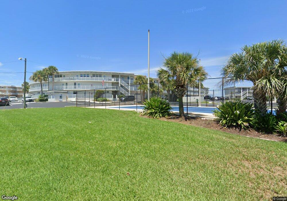
Surfside 4831 Saxon Dr Unit 218 New Smyrna Beach, FL 32169
New Smyrna Beachfront NeighborhoodEstimated Value: $481,353 - $568,000
2
Beds
2
Baths
1,200
Sq Ft
$445/Sq Ft
Est. Value
About This Home
This home is located at 4831 Saxon Dr Unit 218, New Smyrna Beach, FL 32169 and is currently estimated at $534,088, approximately $445 per square foot. 4831 Saxon Dr Unit 218 is a home located in Volusia County with nearby schools including Coronado Beach Elementary School, New Smyrna Beach Middle School, and New Smyrna Beach High School.
Ownership History
Date
Name
Owned For
Owner Type
Purchase Details
Closed on
Sep 17, 2010
Sold by
Bracken Laura
Bought by
Rishoi Pamela E
Current Estimated Value
Purchase Details
Closed on
Feb 28, 2006
Sold by
Picone James O and Picone Elizabeth M
Bought by
Bracken Laura
Home Financials for this Owner
Home Financials are based on the most recent Mortgage that was taken out on this home.
Original Mortgage
$366,400
Interest Rate
6.19%
Mortgage Type
Fannie Mae Freddie Mac
Purchase Details
Closed on
Mar 1, 2004
Sold by
Hegert Patricia A
Bought by
Hegert Thomas F and Thomas F Hegert Declaration Of Trust
Purchase Details
Closed on
Mar 15, 1970
Bought by
Rishoi Pamela E
Create a Home Valuation Report for This Property
The Home Valuation Report is an in-depth analysis detailing your home's value as well as a comparison with similar homes in the area
Home Values in the Area
Average Home Value in this Area
Purchase History
| Date | Buyer | Sale Price | Title Company |
|---|---|---|---|
| Rishoi Pamela E | $215,000 | Fidelity Natl Title Ins Co | |
| Bracken Laura | $458,000 | None Available | |
| Hegert Thomas F | -- | -- | |
| Rishoi Pamela E | $24,000 | -- |
Source: Public Records
Mortgage History
| Date | Status | Borrower | Loan Amount |
|---|---|---|---|
| Previous Owner | Bracken Laura | $366,400 |
Source: Public Records
Tax History Compared to Growth
Tax History
| Year | Tax Paid | Tax Assessment Tax Assessment Total Assessment is a certain percentage of the fair market value that is determined by local assessors to be the total taxable value of land and additions on the property. | Land | Improvement |
|---|---|---|---|---|
| 2025 | $5,997 | $444,210 | -- | $444,210 |
| 2024 | $5,997 | $444,210 | -- | $444,210 |
| 2023 | $5,997 | $394,262 | $0 | $394,262 |
| 2022 | $5,626 | $368,132 | $0 | $368,132 |
| 2021 | $5,274 | $301,500 | $0 | $301,500 |
| 2020 | $4,637 | $244,718 | $0 | $244,718 |
| 2019 | $4,344 | $207,030 | $0 | $207,030 |
| 2018 | $5,316 | $266,618 | $1 | $266,617 |
| 2017 | $4,948 | $233,261 | $58,315 | $174,946 |
| 2016 | $4,719 | $199,995 | $0 | $0 |
| 2015 | $4,953 | $206,025 | $0 | $0 |
| 2014 | $4,474 | $186,026 | $0 | $0 |
Source: Public Records
About Surfside
Map
Nearby Homes
- 4831 Saxon Dr Unit 212
- 4849 Saxon Dr Unit A204
- 4849 Saxon Dr Unit C202
- 4841 Saxon Dr Unit E206
- 4821 Saxon Dr Unit 201B
- 4811 Saxon Dr Unit C102
- 4811 Saxon Dr Unit A201
- 4860 S Atlantic Ave Unit 1030
- 4870 S Atlantic Ave Unit 2040
- 5201 S Atlantic Ave Unit 703A
- 5201 S Atlantic Ave Unit 401A
- 5201 S Atlantic Ave Unit 708A
- 5201 S Atlantic Ave Unit 809A
- 5203 S Atlantic Ave Unit 313B
- 5203 S Atlantic Ave Unit 416B
- 5203 S Atlantic Ave Unit 412B
- 5207 S Atlantic Ave Unit 424
- 5207 S Atlantic Ave Unit 126
- 5207 S Atlantic Ave Unit 626
- 5207 S Atlantic Ave Unit 1226
- 4831 Saxon Dr Unit 108
- 4831 Saxon Dr Unit 235
- 4831 Saxon Dr Unit 102
- 4831 Saxon Dr Unit 221
- 4831 Saxon Dr Unit 117a
- 4831 Saxon Dr Unit 213
- 4831 Saxon Dr Unit 2380
- 4831 Saxon Dr Unit 2370
- 4831 Saxon Dr Unit 2360
- 4831 Saxon Dr Unit 2350
- 4831 Saxon Dr Unit 2340
- 4831 Saxon Dr Unit 2330
- 4831 Saxon Dr Unit 2320
- 4831 Saxon Dr Unit 2310
- 4831 Saxon Dr Unit 2300
- 4831 Saxon Dr Unit 2290
- 4831 Saxon Dr Unit 2280
- 4831 Saxon Dr Unit 2270
- 4831 Saxon Dr Unit 2260
- 4831 Saxon Dr Unit 2250