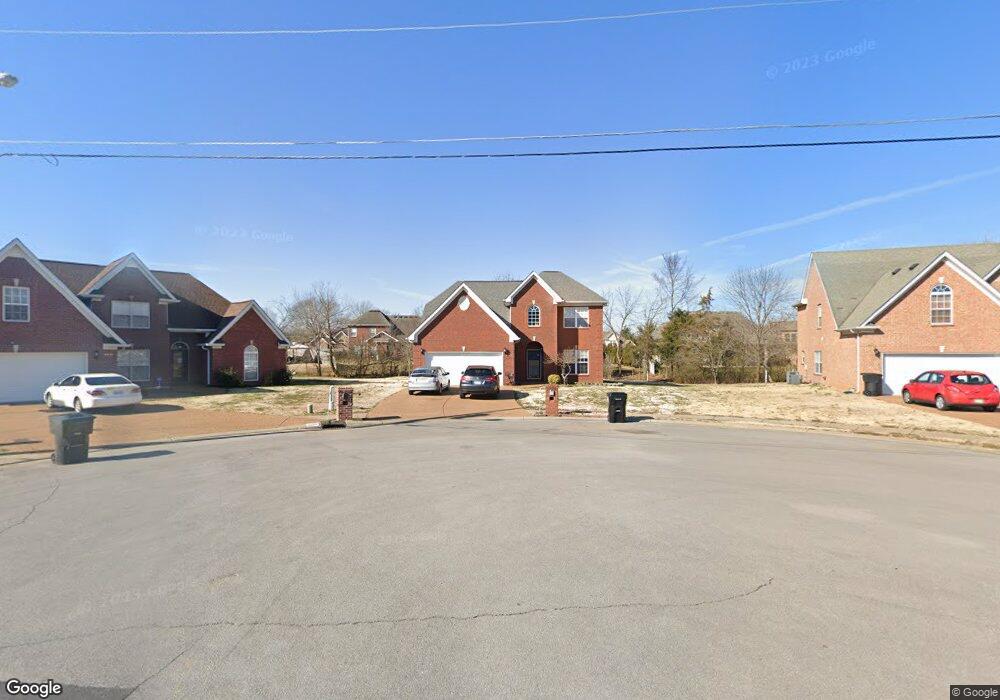
4832 Forsman Ct Murfreesboro, TN 37128
Estimated Value: $472,506 - $538,000
--
Bed
3
Baths
2,568
Sq Ft
$200/Sq Ft
Est. Value
About This Home
This home is located at 4832 Forsman Ct, Murfreesboro, TN 37128 and is currently estimated at $512,627, approximately $199 per square foot. 4832 Forsman Ct is a home located in Rutherford County with nearby schools including Blackman Elementary School, Overall Creek Elementary School, and Blackman Middle School.
Ownership History
Date
Name
Owned For
Owner Type
Purchase Details
Closed on
Mar 9, 2019
Sold by
Khounboribounsak Joey
Bought by
Khounboribounsak Phavan
Current Estimated Value
Purchase Details
Closed on
Jun 30, 2005
Sold by
Waldron David V and Waldron Betsy
Bought by
Khounboribounsak and Phavan
Home Financials for this Owner
Home Financials are based on the most recent Mortgage that was taken out on this home.
Original Mortgage
$172,000
Outstanding Balance
$89,089
Interest Rate
5.54%
Estimated Equity
$423,538
Create a Home Valuation Report for This Property
The Home Valuation Report is an in-depth analysis detailing your home's value as well as a comparison with similar homes in the area
Home Values in the Area
Average Home Value in this Area
Purchase History
| Date | Buyer | Sale Price | Title Company |
|---|---|---|---|
| Khounboribounsak Phavan | -- | None Available | |
| Khounboribounsak | $215,000 | -- |
Source: Public Records
Mortgage History
| Date | Status | Borrower | Loan Amount |
|---|---|---|---|
| Open | Khounboribounsak | $172,000 | |
| Closed | Khounboribounsak | $43,000 |
Source: Public Records
Tax History Compared to Growth
Tax History
| Year | Tax Paid | Tax Assessment Tax Assessment Total Assessment is a certain percentage of the fair market value that is determined by local assessors to be the total taxable value of land and additions on the property. | Land | Improvement |
|---|---|---|---|---|
| 2025 | $2,931 | $103,625 | $13,750 | $89,875 |
| 2024 | $2,931 | $103,625 | $13,750 | $89,875 |
| 2023 | $1,944 | $103,625 | $13,750 | $89,875 |
| 2022 | $1,675 | $103,625 | $13,750 | $89,875 |
| 2021 | $1,656 | $74,625 | $12,500 | $62,125 |
| 2020 | $1,656 | $74,625 | $12,500 | $62,125 |
| 2019 | $1,656 | $74,625 | $12,500 | $62,125 |
| 2018 | $2,275 | $74,625 | $0 | $0 |
| 2017 | $2,354 | $60,575 | $0 | $0 |
| 2016 | $2,354 | $60,575 | $0 | $0 |
| 2015 | $2,354 | $60,575 | $0 | $0 |
| 2014 | $1,506 | $60,575 | $0 | $0 |
| 2013 | -- | $60,750 | $0 | $0 |
Source: Public Records
Map
Nearby Homes
- 4826 Trevino Ct
- 802 Licinius Ln
- 814 Stovers Glen
- 827 Stovers Glen Dr
- 4670 Forsman Ct
- 835 Stovers Glen Dr
- 843 Stovers Glen Dr
- 5108 Saint Ives Dr
- 5008 Hannah Dr
- 1232 Stockwell Dr
- 548 Brinkley Rd
- 628 Evergreen Dr
- 4437 Sunday Silence Way
- 718 Sergio Ave
- 4419 Sunday Silence Way
- 5227 Starnes Dr
- 4414 Sunday Silence Way
- 4433 Prometheus Way
- 4814 Saint Ives Dr
- 400 Brinkley Rd
- 4836 Forsman Ct
- 4828 Forsman Ct
- 4842 Trevino Ct
- 4848 Trevino Ct
- 4837 Forsman Ct
- 4836 Trevino Ct
- 4824 Forsman Ct
- 4856 Trevino Ct
- 4831 Forsman Ct
- 4825 Forsman Ct
- 4818 Trevino Ct
- 4820 Forsman Ct
- 4819 Forsman Ct
- 4855 Trevino Ct
- 4823 Trevino Ct
- 4819 Trevino Ct
- 4816 Forsman Ct
- 4827 Trevino Ct
- 4814 Trevino Ct
- 4839 Trevino Ct