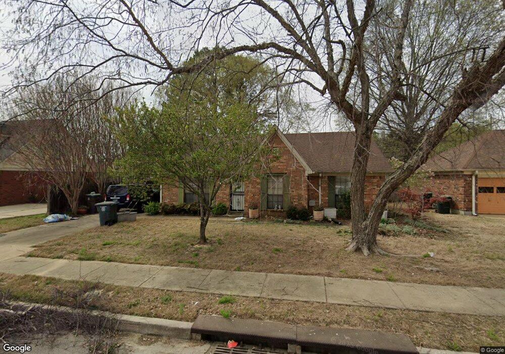
4837 Blue Wing St Memphis, TN 38141
Hickory Hill NeighborhoodEstimated Value: $169,000 - $204,000
3
Beds
2
Baths
1,368
Sq Ft
$135/Sq Ft
Est. Value
About This Home
This home is located at 4837 Blue Wing St, Memphis, TN 38141 and is currently estimated at $184,764, approximately $135 per square foot. 4837 Blue Wing St is a home located in Shelby County with nearby schools including Ross Elementary School, Kirby High School, and Memphis Business Academy Hickory Hill Middle School.
Ownership History
Date
Name
Owned For
Owner Type
Purchase Details
Closed on
Jul 19, 2000
Sold by
Fischer Kip H
Bought by
Richardson Levi M and Richardson Shenica M
Current Estimated Value
Home Financials for this Owner
Home Financials are based on the most recent Mortgage that was taken out on this home.
Original Mortgage
$74,320
Outstanding Balance
$30,343
Interest Rate
10.24%
Estimated Equity
$154,421
Create a Home Valuation Report for This Property
The Home Valuation Report is an in-depth analysis detailing your home's value as well as a comparison with similar homes in the area
Home Values in the Area
Average Home Value in this Area
Purchase History
| Date | Buyer | Sale Price | Title Company |
|---|---|---|---|
| Richardson Levi M | $92,900 | Mid America Title Agency Inc |
Source: Public Records
Mortgage History
| Date | Status | Borrower | Loan Amount |
|---|---|---|---|
| Open | Richardson Levi M | $74,320 | |
| Closed | Richardson Levi M | $18,580 |
Source: Public Records
Tax History Compared to Growth
Tax History
| Year | Tax Paid | Tax Assessment Tax Assessment Total Assessment is a certain percentage of the fair market value that is determined by local assessors to be the total taxable value of land and additions on the property. | Land | Improvement |
|---|---|---|---|---|
| 2025 | $941 | $47,400 | $10,600 | $36,800 |
| 2024 | $941 | $27,750 | $5,650 | $22,100 |
| 2023 | $1,690 | $27,750 | $5,650 | $22,100 |
| 2022 | $1,690 | $27,750 | $5,650 | $22,100 |
| 2021 | $1,710 | $27,750 | $5,650 | $22,100 |
| 2020 | $1,656 | $22,850 | $5,650 | $17,200 |
| 2019 | $1,656 | $22,850 | $5,650 | $17,200 |
| 2018 | $1,656 | $22,850 | $5,650 | $17,200 |
| 2017 | $939 | $22,850 | $5,650 | $17,200 |
| 2016 | $869 | $19,875 | $0 | $0 |
| 2014 | $869 | $19,875 | $0 | $0 |
Source: Public Records
Map
Nearby Homes
- 4821 Blue Wing St
- 4868 Water Fowl Ln
- 6732 Henredon Dr
- 6493 Summer Creek E
- 6788 Burlingame Dr
- 6623 Quail Covey Dr
- 4585 S Berrypick Ln
- 4529 Quail Ridge Trail
- 6543 Stockport Dr
- 6716 Shoreline Cir
- 4935 Woodberry Cove
- 6770 Seven Valley Dr
- 6395 Golden Park Dr
- 6744 Shoreline Cir
- 6842 Rockbrook Dr
- 6770 Shoreline Cir
- 4447 Ross Rd
- 6941 Bennington Cir
- 5265 Crystal Oak Dr
- 4463 Sandy Park Dr
- 4831 Blue Wing St
- 4845 Blue Wing St
- 4836 Gadwall Dr W
- 4844 Gadwall Dr W
- 4830 Gadwall Dr W
- 4853 Blue Wing St
- 4840 Blue Wing St
- 4848 Mallard Nest Dr
- 4850 Gadwall Dr W
- 4824 Gadwall Dr W
- 4850 Blue Wing St
- 4857 Blue Wing St
- 4815 Blue Wing St
- 4856 Gadwall Dr W
- 4847 Mallard Nest Dr
- 4818 Gadwall Dr W
- 4856 Blue Wing St
- 4837 Barkshire Dr
- 4861 Blue Wing St
- 4839 Gadwall Dr W