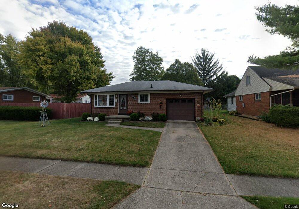
4838 Willowbrook Dr Springfield, OH 45503
Estimated Value: $173,650 - $202,000
3
Beds
2
Baths
1,125
Sq Ft
$165/Sq Ft
Est. Value
About This Home
This home is located at 4838 Willowbrook Dr, Springfield, OH 45503 and is currently estimated at $185,550, approximately $164 per square foot. 4838 Willowbrook Dr is a home located in Clark County with nearby schools including Northridge Elementary School, Kenton Ridge Middle & High School, and Emmanuel Christian Academy.
Ownership History
Date
Name
Owned For
Owner Type
Purchase Details
Closed on
May 16, 2002
Sold by
Hill Dwane J and Hill Sharon E
Bought by
Evans Mikel D and Evans Barbara J
Current Estimated Value
Home Financials for this Owner
Home Financials are based on the most recent Mortgage that was taken out on this home.
Original Mortgage
$84,400
Outstanding Balance
$34,784
Interest Rate
7.16%
Mortgage Type
Purchase Money Mortgage
Estimated Equity
$150,766
Purchase Details
Closed on
Dec 6, 1990
Create a Home Valuation Report for This Property
The Home Valuation Report is an in-depth analysis detailing your home's value as well as a comparison with similar homes in the area
Home Values in the Area
Average Home Value in this Area
Purchase History
| Date | Buyer | Sale Price | Title Company |
|---|---|---|---|
| Evans Mikel D | $92,000 | -- | |
| -- | $63,500 | -- |
Source: Public Records
Mortgage History
| Date | Status | Borrower | Loan Amount |
|---|---|---|---|
| Open | Evans Mikel D | $84,400 |
Source: Public Records
Tax History
| Year | Tax Paid | Tax Assessment Tax Assessment Total Assessment is a certain percentage of the fair market value that is determined by local assessors to be the total taxable value of land and additions on the property. | Land | Improvement |
|---|---|---|---|---|
| 2025 | $1,729 | $62,050 | $18,140 | $43,910 |
| 2024 | $1,672 | $39,540 | $10,560 | $28,980 |
| 2023 | $1,672 | $39,540 | $10,560 | $28,980 |
| 2022 | $1,678 | $39,540 | $10,560 | $28,980 |
| 2021 | $1,711 | $34,150 | $7,830 | $26,320 |
| 2020 | $1,712 | $34,150 | $7,830 | $26,320 |
| 2019 | $1,745 | $34,150 | $7,830 | $26,320 |
| 2018 | $1,885 | $35,290 | $9,970 | $25,320 |
| 2017 | $1,616 | $30,034 | $9,968 | $20,066 |
| 2016 | $1,605 | $30,034 | $9,968 | $20,066 |
| 2015 | $1,517 | $29,653 | $9,587 | $20,066 |
| 2014 | $1,517 | $29,653 | $9,587 | $20,066 |
| 2013 | $1,482 | $29,653 | $9,587 | $20,066 |
Source: Public Records
Map
Nearby Homes
- 4802 Willowbrook Dr
- 4741 Cullen Ave
- 4733 Curtis Dr
- 5235 W Ridgewood Rd
- 5033 Ridgewood Rd E
- 1521 Erika Dr
- 1341 Student Ave
- 4446 Ridgewood Rd E Unit 3
- 5300 Brookshire Ln
- 4577 Reno Ln Unit 2
- 4652 Reno Ln Unit 15
- 4322 Midfield St Unit 15
- 4732 Lehigh Dr
- 4256 Midfield St Unit 9
- 5564 Ridgewood Rd W
- 1495 Victorian Way
- 5564 Ridgewood Rd E Unit 7
- 4890 Brannan Dr W Unit 4890
- 1644 Delmar Dr
- 3942 Harris Ln
- 4832 Willowbrook Dr
- 1209 Stanway Ave
- 1219 Stanway Ave
- 4826 Willowbrook Dr
- 4841 Ridgewood Rd W
- 1223 Stanway Ave
- 4833 Ridgewood Rd W
- 4837 Willowbrook Dr
- 4820 Willowbrook Dr
- 4847 Willowbrook Dr
- 4831 Willowbrook Dr
- 4825 Willowbrook Dr
- 4827 Ridgewood Rd W
- 4827 W Ridgewood Rd
- 4814 Willowbrook Dr
- 1214 Ferndale Ln
- 1143 Stanway Ave
- 4819 Willowbrook Dr
- 1220 Stanway Ave
- 4909 Ridgewood Rd W
Your Personal Tour Guide
Ask me questions while you tour the home.