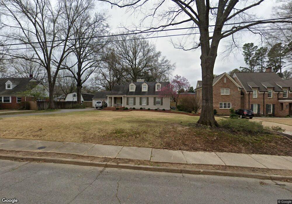
4839 Barfield Rd Memphis, TN 38117
East Memphis NeighborhoodEstimated Value: $565,000 - $647,000
4
Beds
4
Baths
3,851
Sq Ft
$154/Sq Ft
Est. Value
About This Home
This home is located at 4839 Barfield Rd, Memphis, TN 38117 and is currently estimated at $593,559, approximately $154 per square foot. 4839 Barfield Rd is a home located in Shelby County with nearby schools including White Station Elementary School, White Station Middle, and White Station High.
Ownership History
Date
Name
Owned For
Owner Type
Purchase Details
Closed on
Apr 21, 2023
Sold by
Burns Dan G and Burns Catherine S
Bought by
Zeiler Austin and Zeiler Hannah
Current Estimated Value
Home Financials for this Owner
Home Financials are based on the most recent Mortgage that was taken out on this home.
Original Mortgage
$500,001
Outstanding Balance
$481,271
Interest Rate
5.13%
Mortgage Type
New Conventional
Estimated Equity
$112,288
Purchase Details
Closed on
Feb 27, 2013
Sold by
Burns Dan G and Burns John D
Bought by
Burns Dan G and Burns Catherine S
Home Financials for this Owner
Home Financials are based on the most recent Mortgage that was taken out on this home.
Original Mortgage
$172,300
Interest Rate
3.43%
Mortgage Type
New Conventional
Purchase Details
Closed on
Apr 15, 2011
Sold by
Blanton Robert G and Blanton Shannon L
Bought by
Burns Dan G and Burns John D
Home Financials for this Owner
Home Financials are based on the most recent Mortgage that was taken out on this home.
Original Mortgage
$150,000
Interest Rate
4.85%
Mortgage Type
New Conventional
Purchase Details
Closed on
Dec 1, 2005
Sold by
Sirva Relocation Llc
Bought by
Blanton Robert G and Blanton Shannon L
Home Financials for this Owner
Home Financials are based on the most recent Mortgage that was taken out on this home.
Original Mortgage
$332,000
Interest Rate
6.23%
Mortgage Type
Fannie Mae Freddie Mac
Purchase Details
Closed on
May 28, 2004
Sold by
Baine Brown Burch and Baine Ashley F
Bought by
Temple Scott and Temple Carrie
Home Financials for this Owner
Home Financials are based on the most recent Mortgage that was taken out on this home.
Original Mortgage
$316,000
Interest Rate
5.98%
Mortgage Type
Purchase Money Mortgage
Purchase Details
Closed on
Feb 12, 1998
Sold by
Baine Brown B
Bought by
Baine Brown Burch and Baine Ashley F
Home Financials for this Owner
Home Financials are based on the most recent Mortgage that was taken out on this home.
Original Mortgage
$112,000
Interest Rate
7%
Purchase Details
Closed on
Mar 14, 1996
Bought by
Mcneill Phillip H and Mcneill Cat
Create a Home Valuation Report for This Property
The Home Valuation Report is an in-depth analysis detailing your home's value as well as a comparison with similar homes in the area
Home Values in the Area
Average Home Value in this Area
Purchase History
| Date | Buyer | Sale Price | Title Company |
|---|---|---|---|
| Zeiler Austin | $605,000 | Executive Title & Closing | |
| Burns Dan G | -- | None Available | |
| Burns Dan G | $372,250 | None Available | |
| Blanton Robert G | $415,000 | -- | |
| Sirva Relocation Llc | $415,000 | Cumberland Title | |
| Temple Scott | $395,000 | -- | |
| Baine Brown Burch | -- | -- | |
| Baine Brown Burch | -- | -- | |
| Mcneill Phillip H | $190,000 | -- |
Source: Public Records
Mortgage History
| Date | Status | Borrower | Loan Amount |
|---|---|---|---|
| Open | Zeiler Austin | $500,001 | |
| Previous Owner | Burns Dan G | $172,300 | |
| Previous Owner | Burns Dan G | $150,000 | |
| Previous Owner | Blanton Robert G | $332,000 | |
| Previous Owner | Temple Scott | $316,000 | |
| Previous Owner | Baine Brown Burch | $112,000 |
Source: Public Records
Tax History
| Year | Tax Paid | Tax Assessment Tax Assessment Total Assessment is a certain percentage of the fair market value that is determined by local assessors to be the total taxable value of land and additions on the property. | Land | Improvement |
|---|---|---|---|---|
| 2025 | $3,421 | $143,050 | $33,450 | $109,600 |
| 2024 | $3,421 | $100,900 | $33,450 | $67,450 |
| 2023 | $6,146 | $100,900 | $33,450 | $67,450 |
| 2022 | $6,146 | $100,900 | $33,450 | $67,450 |
| 2021 | $6,219 | $100,900 | $33,450 | $67,450 |
| 2020 | $6,766 | $93,375 | $33,450 | $59,925 |
| 2019 | $6,766 | $93,375 | $33,450 | $59,925 |
| 2018 | $6,766 | $93,375 | $33,450 | $59,925 |
| 2017 | $3,838 | $93,375 | $33,450 | $59,925 |
| 2016 | $3,705 | $84,775 | $0 | $0 |
| 2014 | $3,705 | $84,775 | $0 | $0 |
Source: Public Records
Map
Nearby Homes
- 4798 Normandy Ln
- 4723 Normandy Ln
- 354 Avon Rd
- 352 Avon Rd
- 4841 Fleetgrove Ave
- 371 N Mendenhall Rd
- 4640 Chickasaw Rd
- 416 Elwood Ln
- 4561 Minden Rd
- 91 N Grove Park Rd
- 455 Oma Cove
- 4974 Princeton Rd
- 4525 Sequoia Rd
- 154 Perkins Extension
- 5110 Sequoia Rd
- 5017 Henry Heights Dr
- 41 W Bendel Cir
- 65 Laverne Ln
- 35 W Bendel Cir
- 5045 Henry Heights Dr
- 4829 Barfield Rd
- 4849 Barfield Rd
- 4819 Barfield Rd
- 4859 Barfield Rd
- 4838 Normandy Ln
- 4828 Normandy Ln
- 4850 Normandy Ln
- 4850 Barfield Rd
- 4818 Normandy Ln
- 4867 Barfield Rd
- 4838 Barfield Rd
- 4858 Normandy Ln
- 4809 Barfield Rd
- 4860 Barfield Rd
- 4826 Barfield Rd
- 4820 Barfield Rd
- 4866 Barfield Rd
- 4808 Normandy Ln
- 4868 Normandy Ln
- 4810 Barfield Rd