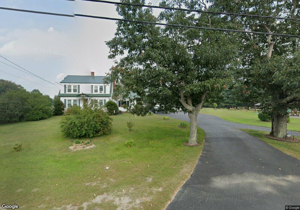
484 Durham Rd Brunswick, ME 04011
Estimated Value: $533,000 - $585,000
4
Beds
2
Baths
2,145
Sq Ft
$263/Sq Ft
Est. Value
About This Home
This home is located at 484 Durham Rd, Brunswick, ME 04011 and is currently estimated at $563,400, approximately $262 per square foot. 484 Durham Rd is a home located in Cumberland County with nearby schools including Kate Furbish Elementary School, Brunswick Jr High School, and Brunswick High School.
Ownership History
Date
Name
Owned For
Owner Type
Purchase Details
Closed on
Jan 8, 2013
Sold by
Stcyr Michael J and Stcyr Lisa A
Bought by
Maclean Mark S and Maclean Penny J
Current Estimated Value
Home Financials for this Owner
Home Financials are based on the most recent Mortgage that was taken out on this home.
Original Mortgage
$184,000
Outstanding Balance
$127,816
Interest Rate
3.35%
Mortgage Type
New Conventional
Estimated Equity
$435,584
Create a Home Valuation Report for This Property
The Home Valuation Report is an in-depth analysis detailing your home's value as well as a comparison with similar homes in the area
Home Values in the Area
Average Home Value in this Area
Purchase History
| Date | Buyer | Sale Price | Title Company |
|---|---|---|---|
| Maclean Mark S | -- | -- |
Source: Public Records
Mortgage History
| Date | Status | Borrower | Loan Amount |
|---|---|---|---|
| Open | Maclean Mark S | $184,000 |
Source: Public Records
Tax History
| Year | Tax Paid | Tax Assessment Tax Assessment Total Assessment is a certain percentage of the fair market value that is determined by local assessors to be the total taxable value of land and additions on the property. | Land | Improvement |
|---|---|---|---|---|
| 2024 | $5,466 | $229,200 | $60,000 | $169,200 |
| 2023 | $5,338 | $229,200 | $60,000 | $169,200 |
| 2022 | $4,874 | $224,700 | $60,000 | $164,700 |
| 2021 | $4,104 | $226,200 | $60,000 | $166,200 |
| 2020 | $4,008 | $226,200 | $60,000 | $166,200 |
| 2019 | $4,461 | $226,200 | $60,000 | $166,200 |
| 2018 | $4,280 | $226,200 | $60,000 | $166,200 |
| 2017 | $4,155 | $226,200 | $60,000 | $166,200 |
| 2016 | $22,782 | $141,200 | $31,300 | $109,900 |
| 2015 | $4,004 | $141,200 | $31,300 | $109,900 |
| 2014 | $3,869 | $141,200 | $31,300 | $109,900 |
| 2013 | -- | $141,200 | $31,300 | $109,900 |
Source: Public Records
Map
Nearby Homes
- Lot 9 Little Fawn Ln
- 0 Nyasa Ln
- 16 Piper Farm Rd
- 42 Greystone Ln
- 42 Greystone Ln
- 32 Grant Rd
- 1595 U S 1
- 481 River Rd
- 20 Sadler Dr
- 42A Wardtown Rd
- 6 Miranda St
- 12 Signature Dr Unit 12
- 21 Renee Rd
- 146 Shiloh Rd
- 0 Prout Rd
- 15 Edgefield Ln
- 3 Haskell Cir
- 10 Forest Terrace
- 307 Church Rd
- 152 Mckeen St Unit D17
Your Personal Tour Guide
Ask me questions while you tour the home.