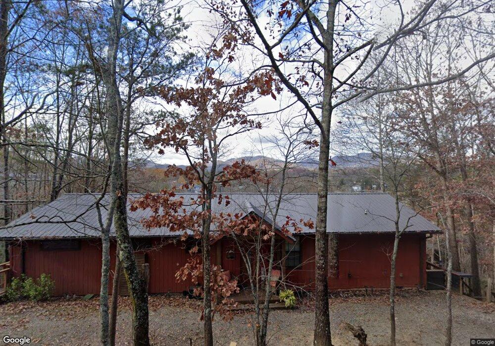
484 High St Young Harris, GA 30582
Estimated Value: $257,462 - $454,000
--
Bed
--
Bath
1,536
Sq Ft
$218/Sq Ft
Est. Value
About This Home
This home is located at 484 High St, Young Harris, GA 30582 and is currently estimated at $334,366, approximately $217 per square foot. 484 High St is a home with nearby schools including Towns County Elementary School, Towns County Middle School, and Towns County High School.
Ownership History
Date
Name
Owned For
Owner Type
Purchase Details
Closed on
Oct 27, 2014
Sold by
Law Catherine D
Bought by
Stephens Jenna L
Current Estimated Value
Purchase Details
Closed on
Sep 14, 2005
Sold by
Boyd Roger L
Bought by
Law Larry D and Law Catherine D
Purchase Details
Closed on
Apr 4, 2005
Sold by
Cole Joan and Cole Devaughn Emili
Bought by
Cole Joan and Macy Gwen
Purchase Details
Closed on
Feb 11, 2005
Sold by
Cole Joan
Bought by
Cole Joan Hungerford and Devaughn Emilie Michelle
Purchase Details
Closed on
Oct 27, 2003
Sold by
Hammond Larry A
Bought by
Boyd Roger L and Boyd Gwendolyn
Create a Home Valuation Report for This Property
The Home Valuation Report is an in-depth analysis detailing your home's value as well as a comparison with similar homes in the area
Home Values in the Area
Average Home Value in this Area
Purchase History
| Date | Buyer | Sale Price | Title Company |
|---|---|---|---|
| Stephens Jenna L | $130,000 | -- | |
| Law Larry D | $107,000 | -- | |
| Cole Joan | -- | -- | |
| Cole Joan Hungerford | -- | -- | |
| Boyd Roger L | $64,900 | -- |
Source: Public Records
Tax History Compared to Growth
Tax History
| Year | Tax Paid | Tax Assessment Tax Assessment Total Assessment is a certain percentage of the fair market value that is determined by local assessors to be the total taxable value of land and additions on the property. | Land | Improvement |
|---|---|---|---|---|
| 2024 | $1,220 | $93,300 | $7,500 | $85,800 |
| 2023 | $866 | $80,651 | $7,500 | $73,151 |
| 2022 | $837 | $71,405 | $7,500 | $63,905 |
| 2021 | $718 | $59,575 | $5,000 | $54,575 |
| 2020 | $704 | $54,938 | $5,000 | $49,938 |
| 2019 | $696 | $53,431 | $5,000 | $48,431 |
| 2018 | $710 | $53,168 | $5,000 | $48,168 |
| 2017 | $768 | $55,518 | $10,000 | $45,518 |
| 2016 | $768 | $55,518 | $10,000 | $45,518 |
| 2015 | $728 | $55,518 | $10,000 | $45,518 |
| 2014 | $784 | $55,518 | $10,000 | $45,518 |
| 2013 | -- | $55,517 | $10,000 | $45,517 |
Source: Public Records
Map
Nearby Homes
- 1 Thomas Town Rd
- 83 McTyeire Dr
- 92 McTyeire Dr
- 35 McTyeire Dr
- 162 Grandview Dr
- LOT 10 Asheland Cove
- #68 Summerwood Ln
- Lot 57 Asheland Overlook
- LOT 57 Asheland Cove Dr
- Lot 106 Asheland Cove Dr
- LT 95/97 Asheland Cove Dr Unit 95/97
- Lot 55 Asheland Cove Dr Unit 55
- LT 95/97 Asheland Cove Dr
- Lot 80 Asheland Cove Dr
- Lot 55 Asheland Cove Dr
- L93 - 95 Timberline Dr
- L93-95 Timberline Dr
- 486 High St
- #14 High St
- #12 High St
- #13 High St
- #15 High St
- 2206 High St Unit 9&12
- 0 High St Unit Lot 6
- 826 W Sunset Dr W
- 748 Sunset Dr W
- 407 Sunset Dr
- 480 High St
- 704 Sunset Dr W
- 584 Sunset Dr
- 99 Double Knobs Trail
- 4220 Thomas Town Rd
- 471 Sunset Dr E
- 478 High St
- 682 Sunset Dr
- 449 Bryson Rd
- 596 Sunset Dr