Estimated Value: $65,052 - $108,000
--
Bed
1
Bath
624
Sq Ft
$131/Sq Ft
Est. Value
About This Home
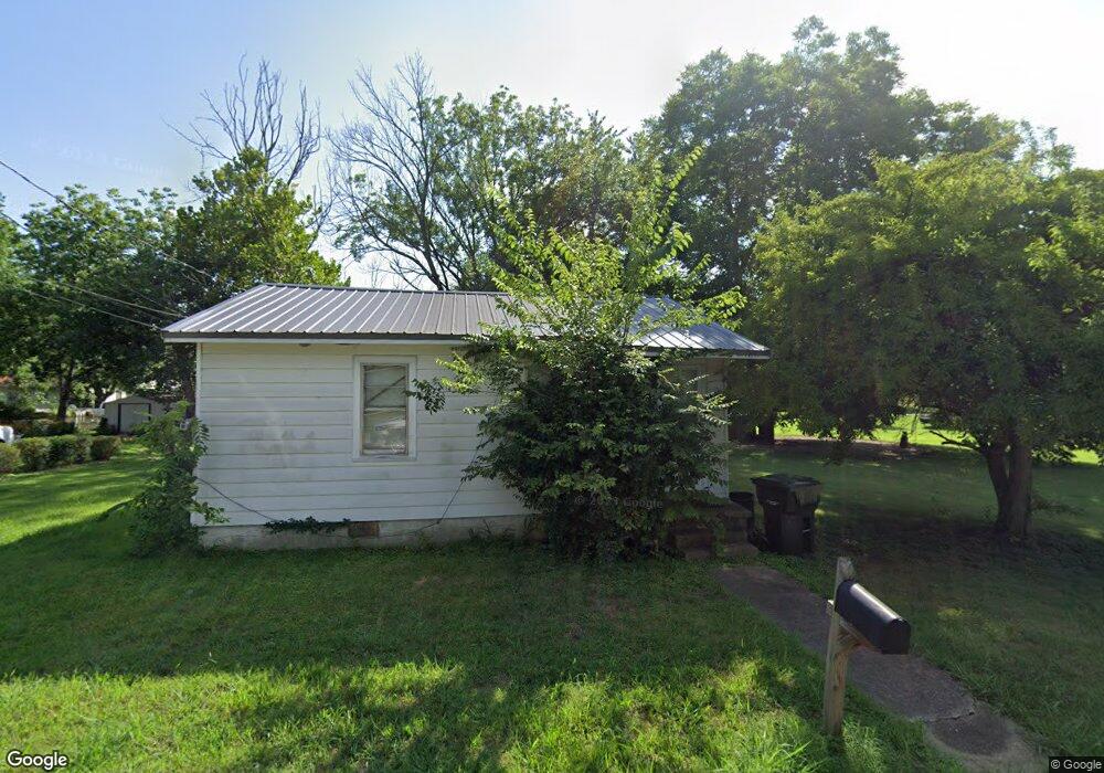
This home is located at 484 Mays St, Dyer, TN 38330 and is currently estimated at $82,013, approximately $131 per square foot. 484 Mays St is a home located in Gibson County with nearby schools including Dyer Elementary School and Gibson County High School.
Ownership History
Date
Name
Owned For
Owner Type
Purchase Details
Closed on
Nov 24, 2020
Sold by
Brooks Lavora and Brooks Jeremy
Bought by
Williams Kendall Patrick
Current Estimated Value
Home Financials for this Owner
Home Financials are based on the most recent Mortgage that was taken out on this home.
Original Mortgage
$66,375
Outstanding Balance
$59,199
Interest Rate
2.8%
Mortgage Type
FHA
Estimated Equity
$22,814
Purchase Details
Closed on
Feb 5, 2019
Sold by
Georgia Community Investments Llc
Bought by
Brooks Lavora and Brooks Jeremy
Purchase Details
Closed on
Nov 5, 1997
Sold by
Mays Mozelle and Mays Alvernia
Bought by
Larue Lonzo and Larue Gertrude
Create a Home Valuation Report for This Property
The Home Valuation Report is an in-depth analysis detailing your home's value as well as a comparison with similar homes in the area
Home Values in the Area
Average Home Value in this Area
Purchase History
| Date | Buyer | Sale Price | Title Company |
|---|---|---|---|
| Williams Kendall Patrick | $67,600 | None Available | |
| Brooks Lavora | $16,500 | -- | |
| Larue Lonzo | $15,000 | -- |
Source: Public Records
Mortgage History
| Date | Status | Borrower | Loan Amount |
|---|---|---|---|
| Open | Williams Kendall Patrick | $66,375 |
Source: Public Records
Tax History Compared to Growth
Tax History
| Year | Tax Paid | Tax Assessment Tax Assessment Total Assessment is a certain percentage of the fair market value that is determined by local assessors to be the total taxable value of land and additions on the property. | Land | Improvement |
|---|---|---|---|---|
| 2024 | $300 | $8,675 | $2,500 | $6,175 |
| 2023 | $138 | $4,450 | $1,050 | $3,400 |
| 2022 | $135 | $4,450 | $1,050 | $3,400 |
| 2021 | $135 | $4,450 | $1,050 | $3,400 |
| 2020 | $221 | $4,450 | $1,050 | $3,400 |
| 2019 | $221 | $4,450 | $1,050 | $3,400 |
| 2018 | $219 | $4,350 | $1,050 | $3,300 |
| 2017 | $211 | $4,350 | $1,050 | $3,300 |
| 2016 | $211 | $4,350 | $1,050 | $3,300 |
| 2015 | $192 | $4,350 | $1,050 | $3,300 |
| 2014 | $192 | $4,350 | $1,050 | $3,300 |
Source: Public Records
Map
Nearby Homes
- 117 Washington St
- 0 Royal St
- 208 & 210 Lee St
- 173 Orr Rd
- 288 W Broad St
- 205 Division St
- 142 S Poplar St
- 299 E Walnut St
- 137 W South St
- 354 E Maple St
- 139 Peach St
- 217 Central St
- 246 Thomas St
- 163 Monroe St
- 548 E College St
- 153 New Hope St
- 0 Reed Rd
- 23 Gravettes Crossing Rd W
- 106 Scattered Acres Dr
- 0 Ernest Paschall Rd Unit RRA45339