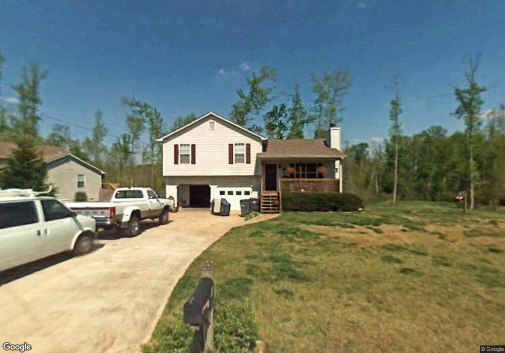
484 Rustin Dr Dallas, GA 30157
Estimated Value: $247,115 - $271,000
3
Beds
2
Baths
1,104
Sq Ft
$235/Sq Ft
Est. Value
About This Home
This home is located at 484 Rustin Dr, Dallas, GA 30157 and is currently estimated at $259,029, approximately $234 per square foot. 484 Rustin Dr is a home located in Paulding County with nearby schools including Union Elementary School, Carl Scoggins Sr. Middle School, and South Paulding High School.
Ownership History
Date
Name
Owned For
Owner Type
Purchase Details
Closed on
Oct 6, 2016
Sold by
Key Akc Llc
Bought by
Amin Vrajesh H
Current Estimated Value
Home Financials for this Owner
Home Financials are based on the most recent Mortgage that was taken out on this home.
Original Mortgage
$77,720
Outstanding Balance
$34,595
Interest Rate
3.44%
Mortgage Type
New Conventional
Estimated Equity
$224,434
Purchase Details
Closed on
Apr 7, 2015
Sold by
Mcdonald Timothy Shone
Bought by
Key Akc Llc
Purchase Details
Closed on
Jul 24, 2014
Sold by
Mcdonald Timothy Shone and Mcdonald Courtney R
Bought by
Bank Of America Na
Purchase Details
Closed on
Jan 27, 2001
Sold by
Mcdonald Timothy Shone
Purchase Details
Closed on
Jan 26, 2001
Sold by
Ted Constuction Co Inc
Create a Home Valuation Report for This Property
The Home Valuation Report is an in-depth analysis detailing your home's value as well as a comparison with similar homes in the area
Home Values in the Area
Average Home Value in this Area
Purchase History
| Date | Buyer | Sale Price | Title Company |
|---|---|---|---|
| Amin Vrajesh H | $97,150 | -- | |
| Amin Vrajesh H | $97,150 | -- | |
| Key Akc Llc | $63,000 | -- | |
| Key Akc Llc | $63,000 | -- | |
| Bank Of America Na | -- | -- | |
| Bank Of America Na | -- | -- | |
| -- | -- | -- | |
| -- | -- | -- | |
| -- | $85,400 | -- | |
| -- | $85,400 | -- |
Source: Public Records
Mortgage History
| Date | Status | Borrower | Loan Amount |
|---|---|---|---|
| Open | Amin Vrajesh H | $77,720 |
Source: Public Records
Tax History
| Year | Tax Paid | Tax Assessment Tax Assessment Total Assessment is a certain percentage of the fair market value that is determined by local assessors to be the total taxable value of land and additions on the property. | Land | Improvement |
|---|---|---|---|---|
| 2025 | $2,624 | $105,496 | $12,000 | $93,496 |
| 2024 | $2,445 | $98,304 | $12,000 | $86,304 |
| 2023 | $2,467 | $94,628 | $12,000 | $82,628 |
| 2022 | $2,246 | $86,148 | $12,000 | $74,148 |
| 2021 | $1,864 | $64,128 | $8,000 | $56,128 |
| 2020 | $1,759 | $59,216 | $8,000 | $51,216 |
| 2019 | $1,643 | $54,548 | $8,000 | $46,548 |
| 2018 | $1,408 | $46,720 | $8,000 | $38,720 |
| 2017 | $1,187 | $39,960 | $6,000 | $33,960 |
| 2016 | $762 | $34,960 | $6,000 | $28,960 |
| 2015 | $909 | $31,376 | $6,000 | $25,376 |
| 2014 | $508 | $17,964 | $6,000 | $11,964 |
| 2013 | -- | $14,280 | $6,000 | $8,280 |
Source: Public Records
Map
Nearby Homes
- 564 Rustin Dr
- 41 Canter Ln
- 177 Rustin Dr
- 0 Rustin Dr Unit 10617842
- 0 Rustin Dr Unit 7657021
- 128 Tanner Dr
- 393 Rc Thompson Rd
- 453 Mulberry Rock Rd
- 391 Mulberry Rock Rd
- 8277 Buchanan Hwy
- 320 Twin Oaks Ln
- 281 Harmony Woods Dr
- 0 Old Yorkville Rd Unit 10574003
- 232 Cynthia Ct
- 292 Harmony Woods Dr
- 42 Bryan Miller Rd
- 161 Rachel Dr
- 163 Rachel Dr
- 723 Mulberry Rock Rd
- 59 Mullberry Path
Your Personal Tour Guide
Ask me questions while you tour the home.