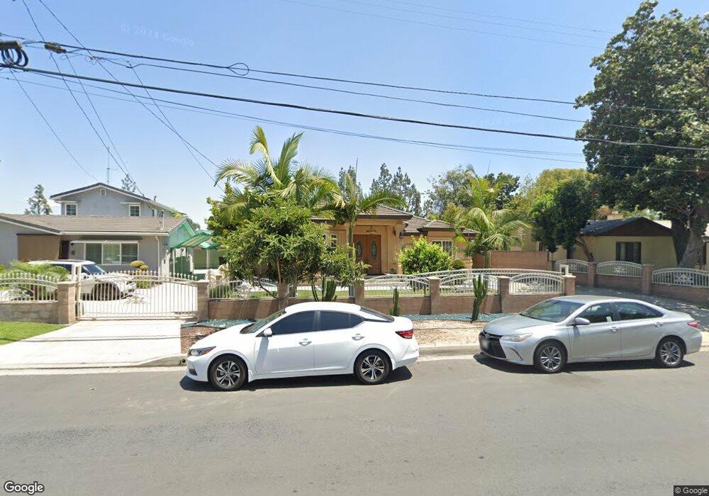
4842 Cedar Ave El Monte, CA 91732
Norwood Cherrylee NeighborhoodEstimated Value: $804,000 - $930,289
3
Beds
1
Bath
2,012
Sq Ft
$431/Sq Ft
Est. Value
About This Home
This home is located at 4842 Cedar Ave, El Monte, CA 91732 and is currently estimated at $867,072, approximately $430 per square foot. 4842 Cedar Ave is a home located in Los Angeles County with nearby schools including Rio Hondo School, Arroyo High School, and Shield of Faith Christian School.
Ownership History
Date
Name
Owned For
Owner Type
Purchase Details
Closed on
Aug 22, 2008
Sold by
Ho Ha Thanh and Ho Chanh Fong
Bought by
Ho Ha Thanh
Current Estimated Value
Purchase Details
Closed on
Jul 15, 2005
Sold by
Ho Kiu
Bought by
Ho Ha Thanh
Home Financials for this Owner
Home Financials are based on the most recent Mortgage that was taken out on this home.
Original Mortgage
$150,000
Interest Rate
5.56%
Mortgage Type
Fannie Mae Freddie Mac
Purchase Details
Closed on
May 20, 2003
Sold by
Lam Jason
Bought by
Lam Jason
Home Financials for this Owner
Home Financials are based on the most recent Mortgage that was taken out on this home.
Original Mortgage
$110,000
Interest Rate
5.77%
Purchase Details
Closed on
Dec 14, 2001
Sold by
Ho Quy H and Ho Chanh Jin
Bought by
Lam Jason
Create a Home Valuation Report for This Property
The Home Valuation Report is an in-depth analysis detailing your home's value as well as a comparison with similar homes in the area
Home Values in the Area
Average Home Value in this Area
Purchase History
| Date | Buyer | Sale Price | Title Company |
|---|---|---|---|
| Ho Ha Thanh | -- | None Available | |
| Ho Ha Thanh | $200,000 | Advantage Title Inc | |
| Ho Kiu | -- | Advantage Title Inc | |
| Lam Jason | -- | Southland Title | |
| Lam Jason | -- | -- |
Source: Public Records
Mortgage History
| Date | Status | Borrower | Loan Amount |
|---|---|---|---|
| Closed | Ho Ha Thanh | $150,000 | |
| Previous Owner | Lam Jason | $110,000 |
Source: Public Records
Tax History
| Year | Tax Paid | Tax Assessment Tax Assessment Total Assessment is a certain percentage of the fair market value that is determined by local assessors to be the total taxable value of land and additions on the property. | Land | Improvement |
|---|---|---|---|---|
| 2025 | $7,941 | $572,606 | $446,046 | $126,560 |
| 2024 | $7,941 | $561,379 | $437,300 | $124,079 |
| 2023 | $7,784 | $550,373 | $428,726 | $121,647 |
| 2022 | $7,497 | $539,582 | $420,320 | $119,262 |
| 2021 | $7,593 | $529,003 | $412,079 | $116,924 |
| 2019 | $7,743 | $513,314 | $399,857 | $113,457 |
| 2018 | $7,504 | $503,250 | $392,017 | $111,233 |
| 2016 | $7,192 | $483,710 | $376,796 | $106,914 |
| 2015 | $7,110 | $476,446 | $371,137 | $105,309 |
| 2014 | $6,828 | $467,114 | $363,867 | $103,247 |
Source: Public Records
Map
Nearby Homes
- 11216 Lower Azusa Rd Unit C
- 4720 Elrovia Ave
- 11326 Ranchito St
- 11547 Lower Azusa Rd Unit C
- 11537 Ranchito St
- 11433 Elmcrest St
- 4849 Peck Rd Unit 67
- 4849 Peck Rd Unit 48
- 4849 Peck Rd Unit 37
- 4849 Peck Rd Unit 36
- 4849 Peck Rd Unit 13
- 11052 W Hondo Pkwy
- 4612 Peck Rd Unit D
- 11654 Roseglen St
- 4501 Peck Rd Unit 63
- 4501 Peck Rd Unit 9
- 11211 Mcgirk Ave
- 11734 Lower Azusa Rd
- 11396 Mcgirk Ave
- 4800 Daleview Ave Unit 121
- 4846 Cedar Ave
- 4832 Cedar Ave
- 4854 Cedar Ave
- 11314 Fairview St
- 11318 Fairview St
- 11315 Lower Azusa Rd
- 4828 Cedar Ave
- 4906 Cedar Ave
- 11333 Lower Azusa Rd
- 4822 Cedar Ave
- 11323 Lower Azusa Rd
- 11331 Lower Azusa Rd
- 4818 Cedar Ave
- 11317 Lower Azusa Rd
- 11329 Lower Azusa Rd
- 11317 1/2 Lower Azusa Rd
- 11303 Fairview St
- 4821 Cedar Ave
- 11307 Fairview St
- 11327 Lower Azusa Rd
Your Personal Tour Guide
Ask me questions while you tour the home.