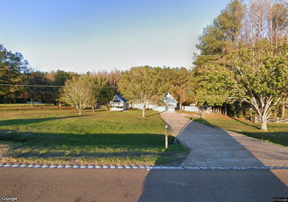
4843 Highway 18 Brandon, MS 39042
Estimated Value: $237,000 - $379,000
3
Beds
2
Baths
2,100
Sq Ft
$140/Sq Ft
Est. Value
About This Home
This home is located at 4843 Highway 18, Brandon, MS 39042 and is currently estimated at $293,832, approximately $139 per square foot. 4843 Highway 18 is a home located in Rankin County with nearby schools including Puckett Elementary School and Puckett High School.
Ownership History
Date
Name
Owned For
Owner Type
Purchase Details
Closed on
Sep 1, 2017
Sold by
Jeffrey M Burnham
Bought by
Philliip Murphy and Murphy Abbie
Current Estimated Value
Home Financials for this Owner
Home Financials are based on the most recent Mortgage that was taken out on this home.
Original Mortgage
$183,488
Interest Rate
3.82%
Purchase Details
Closed on
Aug 14, 2015
Sold by
Desper Dustin G and Desper Mistie H
Bought by
Murphy Phillip T and Murphy Abbie T
Home Financials for this Owner
Home Financials are based on the most recent Mortgage that was taken out on this home.
Original Mortgage
$199,323
Interest Rate
4.16%
Mortgage Type
FHA
Purchase Details
Closed on
Oct 22, 2008
Sold by
Desper Dustin G and Hays Mistie R
Bought by
Desper Dustin G and Desper Mistie H
Home Financials for this Owner
Home Financials are based on the most recent Mortgage that was taken out on this home.
Original Mortgage
$107,000
Interest Rate
6.11%
Create a Home Valuation Report for This Property
The Home Valuation Report is an in-depth analysis detailing your home's value as well as a comparison with similar homes in the area
Home Values in the Area
Average Home Value in this Area
Purchase History
| Date | Buyer | Sale Price | Title Company |
|---|---|---|---|
| Philliip Murphy | -- | -- | |
| Murphy Phillip T | -- | None Available | |
| Desper Dustin G | -- | -- |
Source: Public Records
Mortgage History
| Date | Status | Borrower | Loan Amount |
|---|---|---|---|
| Previous Owner | Philliip Murphy | $183,488 | |
| Previous Owner | Philliip Murphy | -- | |
| Previous Owner | Murphy Phillip T | $199,323 | |
| Previous Owner | Desper Dustin G | $107,000 |
Source: Public Records
Tax History Compared to Growth
Tax History
| Year | Tax Paid | Tax Assessment Tax Assessment Total Assessment is a certain percentage of the fair market value that is determined by local assessors to be the total taxable value of land and additions on the property. | Land | Improvement |
|---|---|---|---|---|
| 2024 | $982 | $12,989 | $0 | $0 |
| 2023 | $798 | $11,126 | $0 | $0 |
| 2022 | $781 | $11,126 | $0 | $0 |
| 2021 | $768 | $10,992 | $0 | $0 |
| 2020 | $768 | $10,992 | $0 | $0 |
| 2019 | $666 | $9,665 | $0 | $0 |
| 2018 | $647 | $9,665 | $0 | $0 |
| 2017 | $647 | $9,665 | $0 | $0 |
| 2016 | $611 | $9,797 | $0 | $0 |
| 2015 | $611 | $9,797 | $0 | $0 |
| 2014 | $590 | $9,797 | $0 | $0 |
| 2013 | -- | $9,797 | $0 | $0 |
Source: Public Records
Map
Nearby Homes
- 0 Tullos Cove
- Johns Shilow Rd
- 0 Easy St
- 1314 Ashley Rd
- 0 Ashley Rd Unit 25129785
- 0 Ashley Rd Unit 4128194
- 0 Ashley Rd Unit 4128192
- 0 Ashley Rd Unit 20288528
- 00 Ashley Rd
- 110 Hawks Nest Cove
- 00 Johns Shiloh Rd
- 4167 Highway 18
- J05 Red Light Rd
- J04 Red Light Rd
- 1185 Sanctuary Dr
- 1175 Sanctuary Dr
- 0 Bill Hubbard Rd
- 3826 Mississippi 18
- 0 Peter McAfee Dr
- 329 County Line Rd
- 4835 Highway 18 None
- 4835 Highway 18
- 4829 Highway 18 None
- 4863 Highway 18
- 4811 Highway 18
- 4814 Highway 18
- 4880 Highway 18
- 4885 Highway 18
- 468 Mount Zion Church Rd
- 150 Rockhaven Rd
- 4798 Highway 18
- 4882 Highway 18
- 428 Mount Zion Church Rd
- 420 Mount Zion Church Rd
- 492 Mount Zion Church Rd
- 125 Rockhaven Rd
- 4785 Highway 18
- 437 Mount Zion Church Rd
- 433 Mount Zion Church Rd
- 429 Mount Zion Church Rd