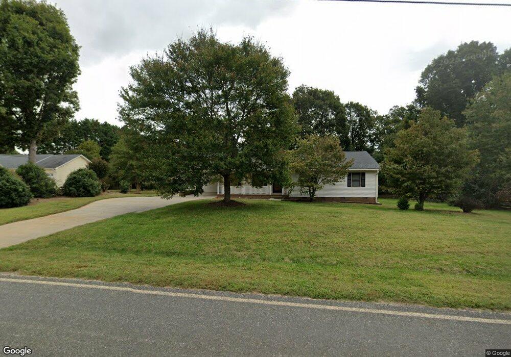
4847 Flay Rd Lincolnton, NC 28092
Estimated Value: $280,000 - $337,000
3
Beds
2
Baths
1,626
Sq Ft
$194/Sq Ft
Est. Value
About This Home
This home is located at 4847 Flay Rd, Lincolnton, NC 28092 and is currently estimated at $315,590, approximately $194 per square foot. 4847 Flay Rd is a home located in Lincoln County with nearby schools including Union Elementary School, West Lincoln Middle, and West Lincoln High School.
Ownership History
Date
Name
Owned For
Owner Type
Purchase Details
Closed on
Apr 7, 2008
Sold by
Gilbert Ruby B and Gilbert Berniece L
Bought by
Mckee Peggy J
Current Estimated Value
Home Financials for this Owner
Home Financials are based on the most recent Mortgage that was taken out on this home.
Original Mortgage
$126,000
Outstanding Balance
$78,632
Interest Rate
6.03%
Mortgage Type
New Conventional
Estimated Equity
$236,958
Purchase Details
Closed on
Sep 1, 2004
Bought by
Gilbert Larry E and Gilbert Bernice L
Purchase Details
Closed on
Sep 27, 1996
Bought by
Rhinehardt Harry E and Rhinehardt Alice H
Create a Home Valuation Report for This Property
The Home Valuation Report is an in-depth analysis detailing your home's value as well as a comparison with similar homes in the area
Purchase History
| Date | Buyer | Sale Price | Title Company |
|---|---|---|---|
| Mckee Peggy J | $126,000 | None Available | |
| Gilbert Larry E | $120,000 | -- | |
| Rhinehardt Harry E | $98,000 | -- |
Source: Public Records
Mortgage History
| Date | Status | Borrower | Loan Amount |
|---|---|---|---|
| Open | Mckee Peggy J | $126,000 |
Source: Public Records
Tax History
| Year | Tax Paid | Tax Assessment Tax Assessment Total Assessment is a certain percentage of the fair market value that is determined by local assessors to be the total taxable value of land and additions on the property. | Land | Improvement |
|---|---|---|---|---|
| 2025 | $1,621 | $233,447 | $26,332 | $207,115 |
| 2024 | $1,601 | $233,447 | $26,332 | $207,115 |
| 2023 | $1,596 | $233,447 | $26,332 | $207,115 |
| 2022 | $1,245 | $149,720 | $21,665 | $128,055 |
| 2021 | $1,245 | $149,720 | $21,665 | $128,055 |
| 2020 | $1,100 | $149,720 | $21,665 | $128,055 |
| 2019 | $1,100 | $149,720 | $21,665 | $128,055 |
| 2018 | $1,106 | $137,040 | $17,372 | $119,668 |
| 2017 | $1,005 | $137,040 | $17,372 | $119,668 |
| 2016 | $1,005 | $137,040 | $17,372 | $119,668 |
| 2015 | $1,068 | $137,040 | $17,372 | $119,668 |
| 2014 | $1,143 | $150,890 | $18,164 | $132,726 |
Source: Public Records
Map
Nearby Homes
- 4850 Gideon Dr
- 520 Shoal Rd
- 00 McCurry Farm Ln Unit F1, F2 & F3
- 00 McCurry Farm Ln Unit D
- 5159 Flay Rd
- 00 Westwinds Rd Unit F3
- 3987 W Highway 27
- 00 Wilson Ct Unit 12
- 00 Wilson Ct Unit 13
- 00 Wilson Ct Unit 15
- 00 Cat Square Rd Unit 1
- 00 Cat Square Rd
- 3243 Wilson Ct Unit 11
- 5790 Summer Ln
- 110 Alf Hoover Rd
- 5740 Crouse Rd
- 142 Alf Hoover Rd
- 6203 Flay Rd
- 00 Star Ln Unit 1
- 5958 Hoover Elmore Rd
Your Personal Tour Guide
Ask me questions while you tour the home.